It has been a quiet work week up to this point, and it will stay that way through Friday as well. However, beginning as early as Friday night, our tranquil conditions will take a leave of absence for the following seven days.
Late Friday night, we’ll be tracking a storm system over the southern gulf coast as it moves northeast into the mid-Atlantic coast on Saturday. The lower Ohio Valley will be positioned on the northern side of this system, which means the chance for accumulating snow is present.
However, deep cold air is lacking in this system. This spells a complicated forecast for snow potential. I can say for sure though, this would be a very wet snow.
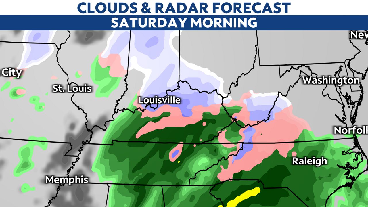
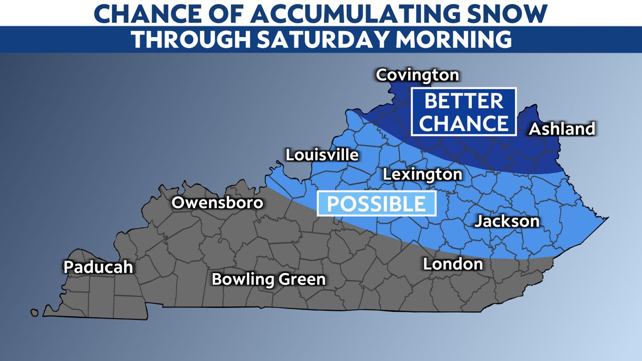
As of Wednesday afternoon, the area with the highest chance of accumulations will be from northeastern Kentucky into the Bluegrass. Chances fade farther west and south.
Following Saturday’s system, a weaker upper level disturbance looks to bring a chance for light showers to most of the region on Sunday. This would likely only make for a dreary second half of the weekend.
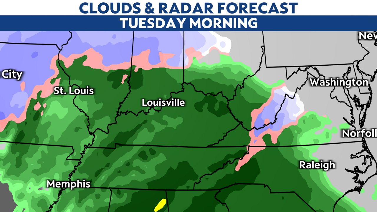
A break in the action is expected on Monday, but then a much more powerful storm system will be organizing in the center of the country by Monday night. This system will be centered much farther north of our area, which means we’re expecting mainly rain Monday night into Tuesday.
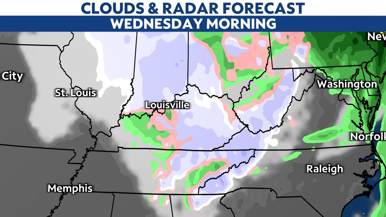
However, on the back side of this system, as the area of low pressure deepens, snow showers and windy conditions are possible in the Commonwealth and southern Indiana by Wednesday.
Our team of meteorologists dives deep into the science of weather and breaks down timely weather data and information. To view more weather and climate stories, check out our weather blogs section.


