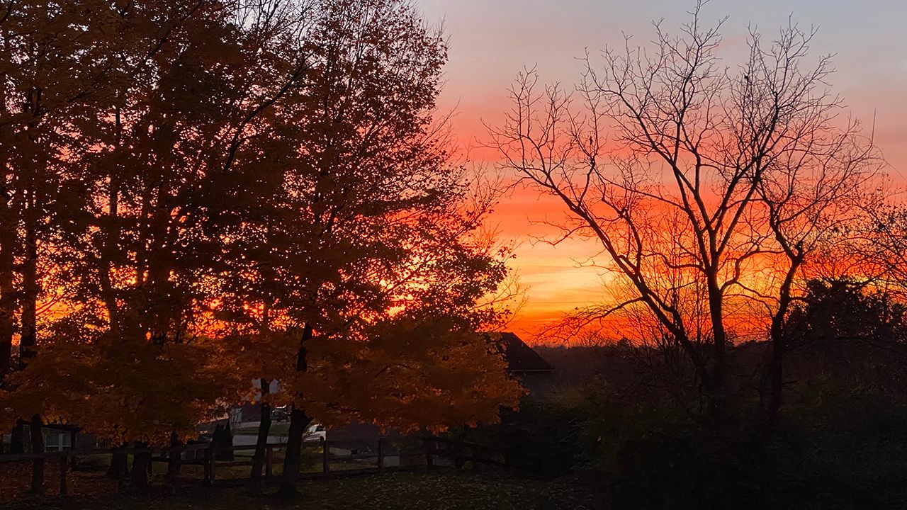
Temperatures are abnormally hot this week, but as the days continue to get shorter and the nights longer in the weeks ahead, you’ll notice a downward trend with the temperatures.
As the sun continues to set earlier in the evening and rise later in the morning, we don’t have as much time to warm up during the day, which leads to a sharp drop of our average temperatures in the months ahead.
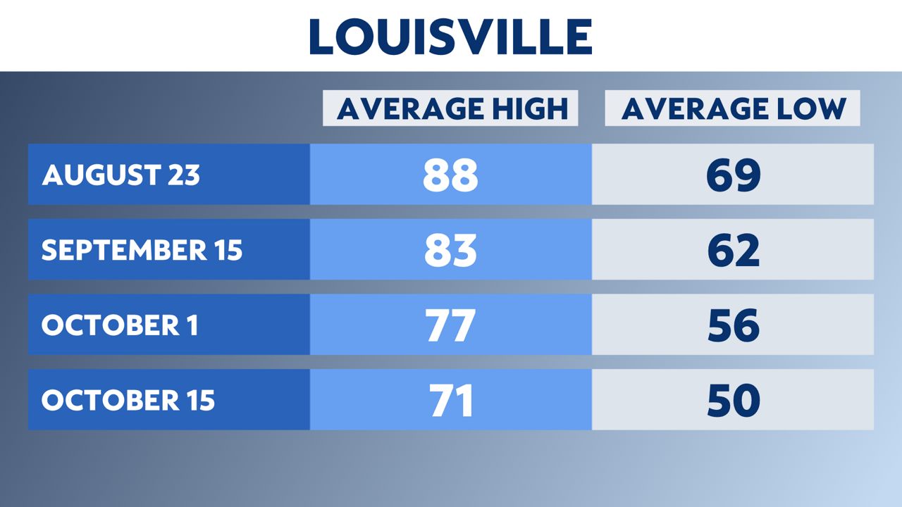
Let’s start with a look at Louisville. The average high as of writing this is still in the upper 80s with an average low of 69 degrees. You’ll notice that within just a few weeks, the average high will drop to 83 and the average low to 62. The drop is even more dramatic as we get into October.
While Lexington is typically a bit cooler than Louisville, you will notice a similar trend. Average highs will drop into the 70s within the next month and average lows will fall into the 50s. The average low in Lexington falls into the 40s by early to mid-October.

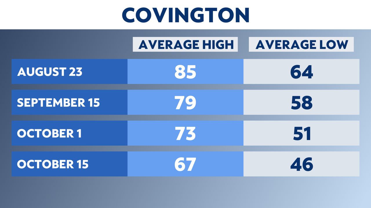
Covington is typically one of the coolest climate locations across the state. The average high right now is in the mid-80s, but falls all the way into the 60s by early to mid October.
Oppositely, Bowling Green is one of our warmer climate locations with an average high near 90 this time of the year. The average high will drop 16 degrees by mid-October, with an average high of only 73 by Oct. 15 and an average low of 48.

These are just our average numbers and we do sometimes hit extremes that take us up near record levels like we are seeing this week.
It can also get a lot cooler than average in the weeks and months ahead as well. This at least gives you an idea of the typical downward temperature trend that we often see this time of the year.
Our team of meteorologists dives deep into the science of weather and breaks down timely weather data and information. To view more weather and climate stories, check out our weather blogs section.


