

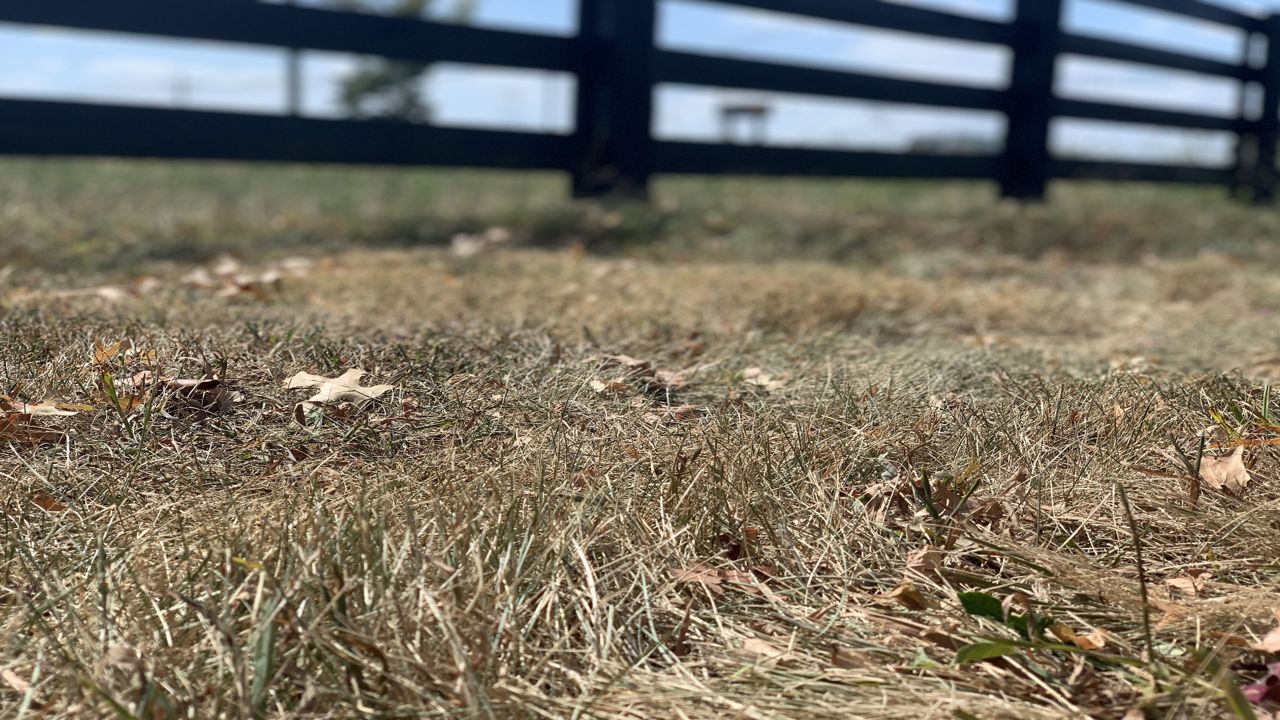
It has been the talk of the town. We need rain. It has been a couple of weeks since a widespread rain passed through Kentucky. As a result, drought conditions have settled in the last couple of weeks.
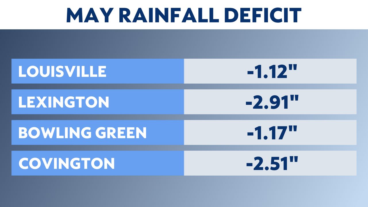
The beginning and middle of May were pretty wet, but the last two weeks turned out very dry with no rain. That trend has continued into the first week of June. May ended up below average in terms of rainfall by an inch or two.
Combine that with daytime temperatures in the upper 80s to lower 90s and low humidity and the ground has dried out quickly.
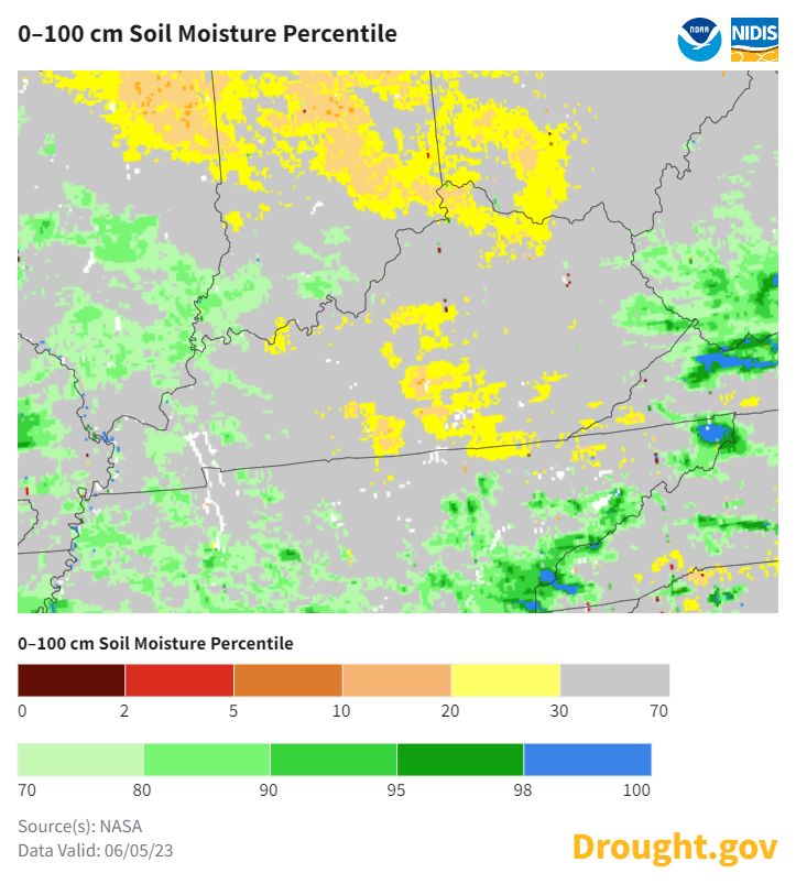
The soil moisture index shows north and south-central Kentucky are the driest areas.
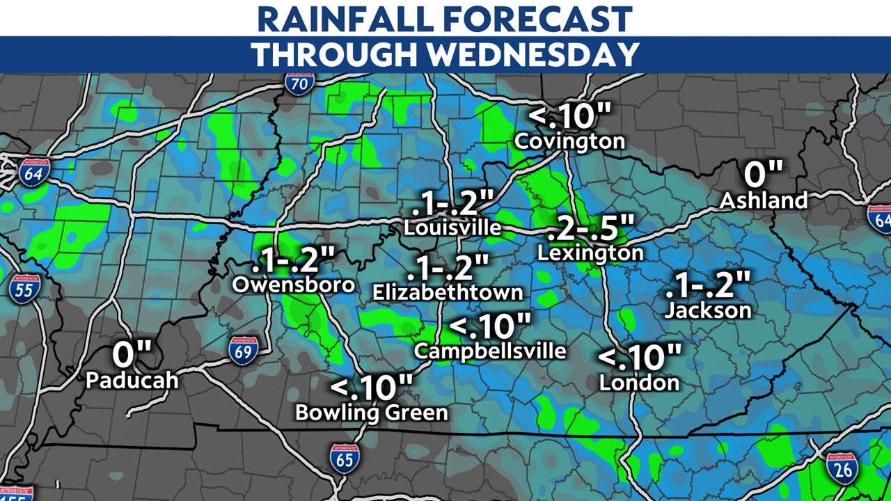
However, there is good news. A cold front will move through Kentucky from north to south on Wednesday, and that will bring a period of showers.
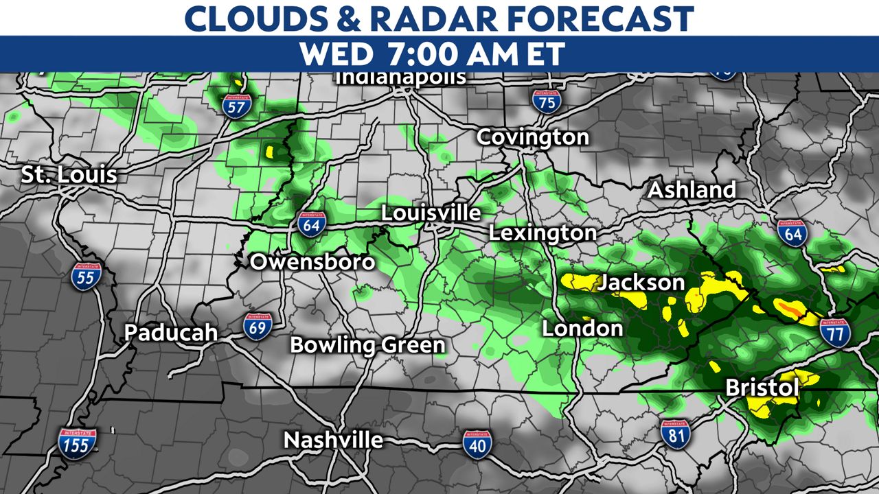
Not everyone will see the rain. Southwest Kentucky looks to miss out on much of the rainfall with this front.
A general quarter to half-inch will be possible in central and southeast Kentucky.
More rain will also be possible on Sunday as another cold front pushes through.
Our team of meteorologists dives deep into the science of weather and breaks down timely weather data and information. To view more weather and climate stories, check out our weather blogs section.