

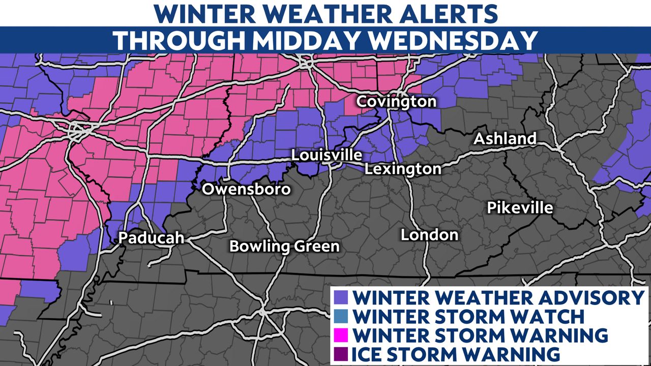
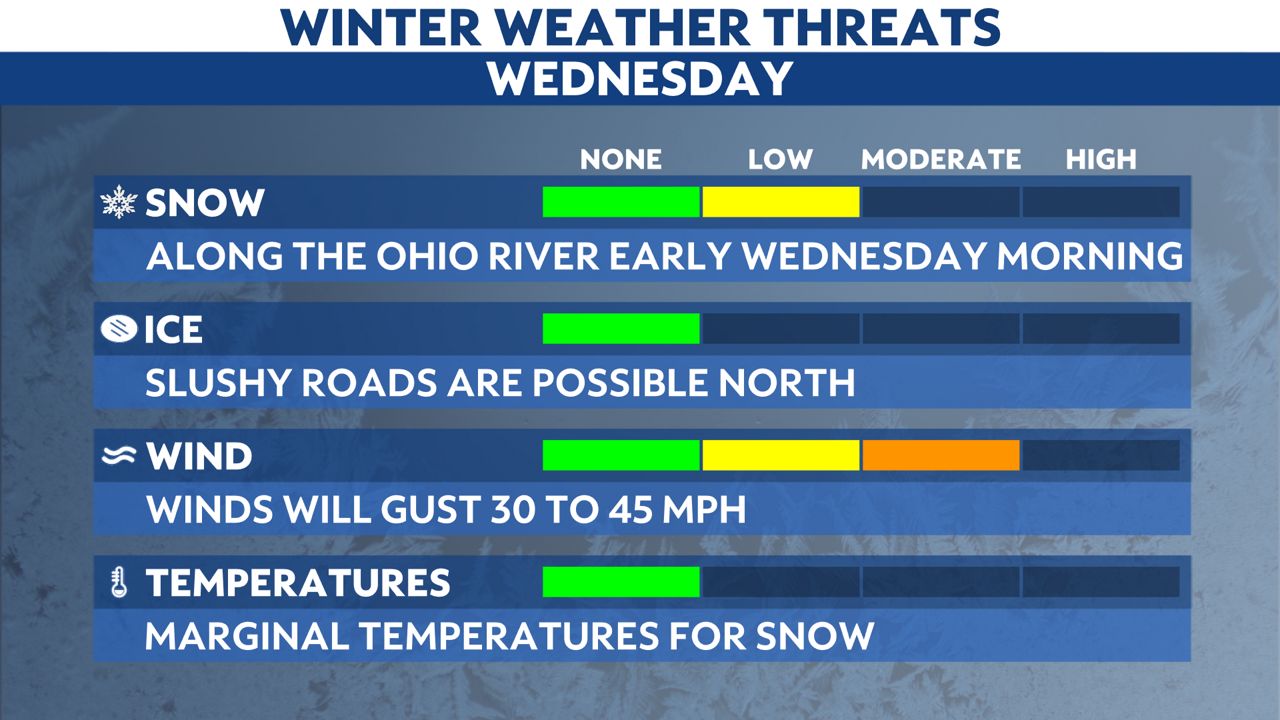
Winter weather will arrive for parts of Kentucky overnight into early Wednesday morning. The early morning commute may be slushy for areas along the Ohio River.
A Winter Weather Advisory is in effect overnight into midday Wednesday because a heavy, wet snow will fall in these areas for a few hours into early Wednesday.
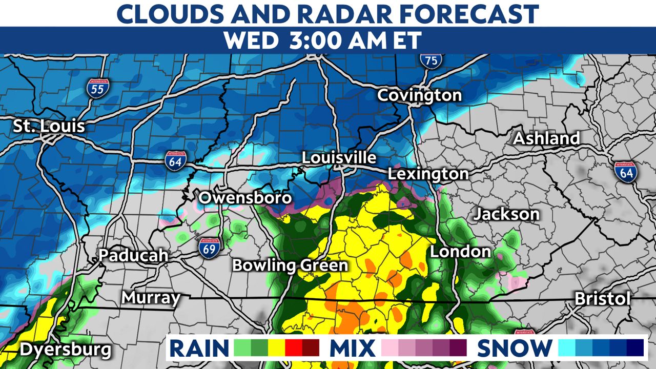
The precipitation will start out as rain with temperatures above freezing.
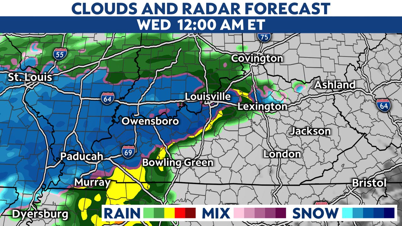
After midnight, rain will switch to a period of wet snow along the I-64 corridor points north. Temperatures will be just cold enough for snow, in the low to mid-30s. Central and southern Kentucky will see rain with this storm.
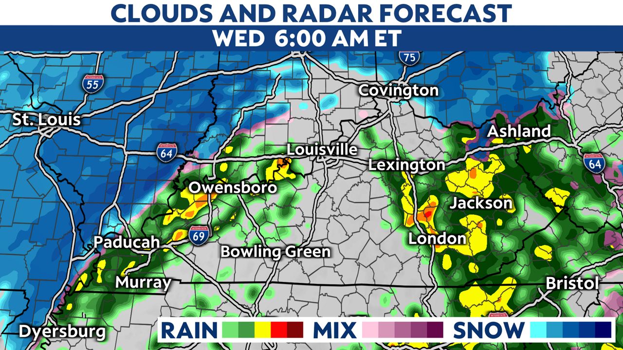
During the morning commute, most of the precipitation will be as rain, but some roads may be slushy, especially in northern Kentucky.
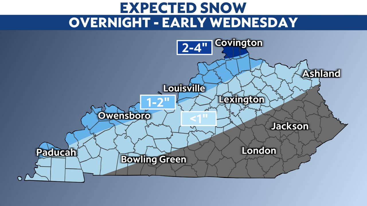
The highest snow totals will be the farther north you travel. We expect 2 to 4 inches in far northern Kentucky near Covington. In Louisville and Owensboro, a slushy inch or two of snow is possible.
Winds will also be gusty on Wednesday with a few lingering showers. Winds will occasionally gust to 45 mph. The highest winds will be in southern and eastern Kentucky, where spotty power outages are possible.
Our team of meteorologists dives deep into the science of weather and breaks down timely weather data and information. To view more weather and climate stories, check out our weather blogs section.