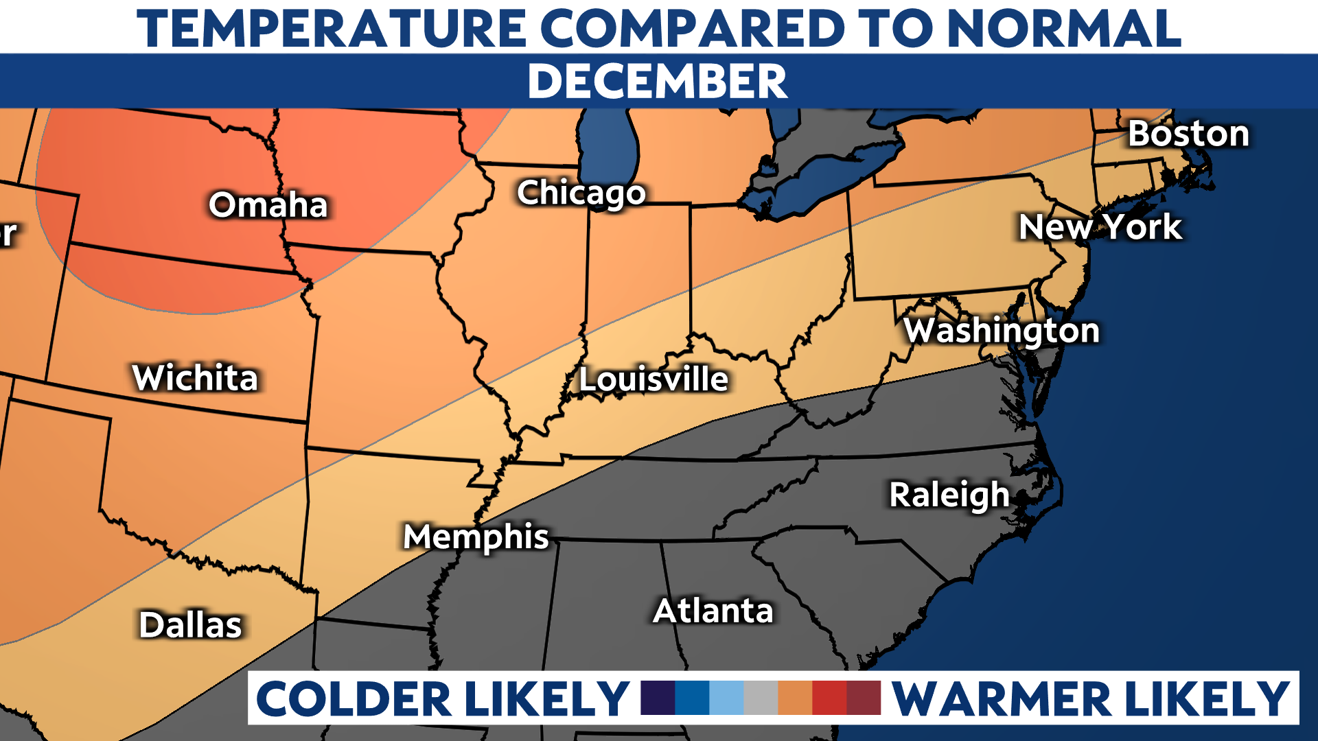
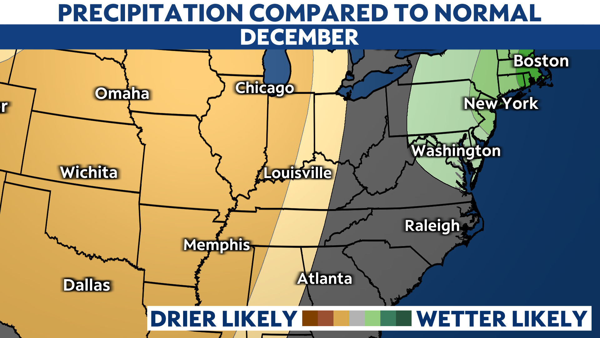
December is looking a little milder and drier than average across Kentucky.
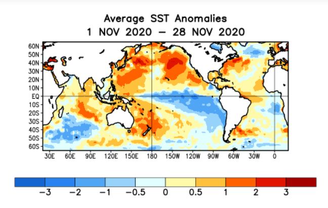
La Niña has taken hold over the equatorial Pacific this year. That means that the waters off the west coast of South America are below average.
In this type of pattern, Kentucky usually feels a milder winter with a storm track that is usually over top or near the state. This tends to send warmer air our way as the storms bring mild Pacific air with them and also tap into southerly winds out of the Gulf of Mexico.
You can see that sea-surface temperatures have been well below average so far in November and that looks to continue into December too. In fact, the Climate Prediction Center (CPC) says La Niña has a 95 percent chance of continuing through the winter months.
The NAO and Arctic Oscillation (AO) are closely related. The AO can be described by pressure variations.
In a negative phase of the AO, cold from Canada gets dislodged and descends south into the United States. In contract, a positive phase keeps the cold air locked up in the Arctic.
During negative phases, temperature gradients from north to south strenghten the jet stream and storm systems develop. With cold air in place, snow is more likely than rain.
So far this winter season, the AO has been positive but as you can see below, it has been trending slightly negative. These changes are difficult to forecast and are normally only accurate just a few weeks away.
This is only part of the equation and cannot alone forecast temperature or storm trends, so we must look at other indicators.

The CPC indicates that temperatures may run slightly above normal. November, by the way, also ran above average in Kentucky so the trend looks to continue this month as well.
In fact, later on this week, parts of the state could flirt with the 60-degree mark.

In a strong La Niña pattern, the region also tends to experience slightly wetter than average precipitation. Even though that is typical of this pattern, there is still January and February to go through to potentially see a pattern change.
Overall, temperatures this December look to be slightly above average with drier than normal precipitation. Snow and cold weather lovers, keep doing your snow dance!


