


Last month brought quite a wide range of weather to the Commonwealth. Warm, almost summer-like temperatures were felt at the start, and by the end we were witnessing big flakes of snow in parts of Kentucky.
Thanks in part to a very warm start to November, the average temperatures for the month were well above normal. High temperatures in the first 10 days of November reached well into the 70s and 80s, around 15-20 degrees above average.
Rainfall amounts varied across the Commonwealth, but as a whole, Kentucky lacked in precipitation compared to average. This was especially true in places in southwest Kentucky.
On the last day of the month, a storm system traveled up the Appalachians into the Ohio Valley. Widespread rain transitioned to snow on the 30th, dropping several inches across parts of eastern Kentucky.
Farther west, only trace amounts were reported.
Here is a breakdown of November 2020 in our four largest cities:

Actual Departure
Louisville
High 63.2° +5.3
Low 42.6° +3.1
Rain 2.67 -0.92
Snow 0.1” 0.0
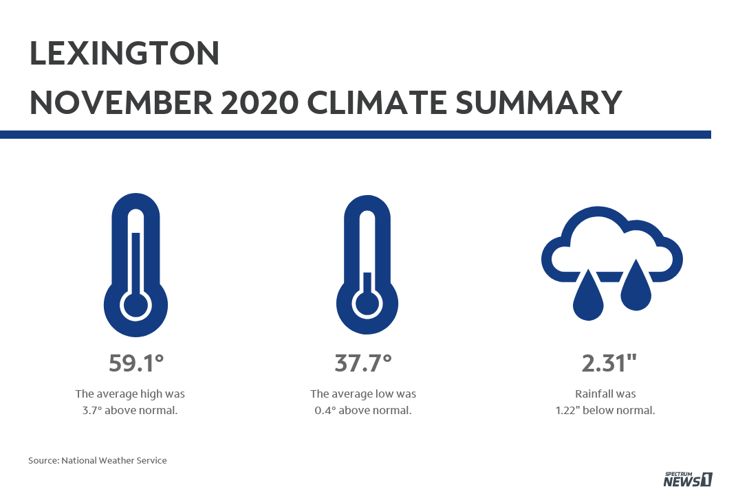
Lexington
High 59.1° +3.7
Low 37.7° +0.4
Rain 2.31” -1.22
Snow 2.3” +2.0

Covington
High 59.6° +5.6
Low 39.5° +3.3
Rain 3.75” +0.32
Snow 1.2” +0.8
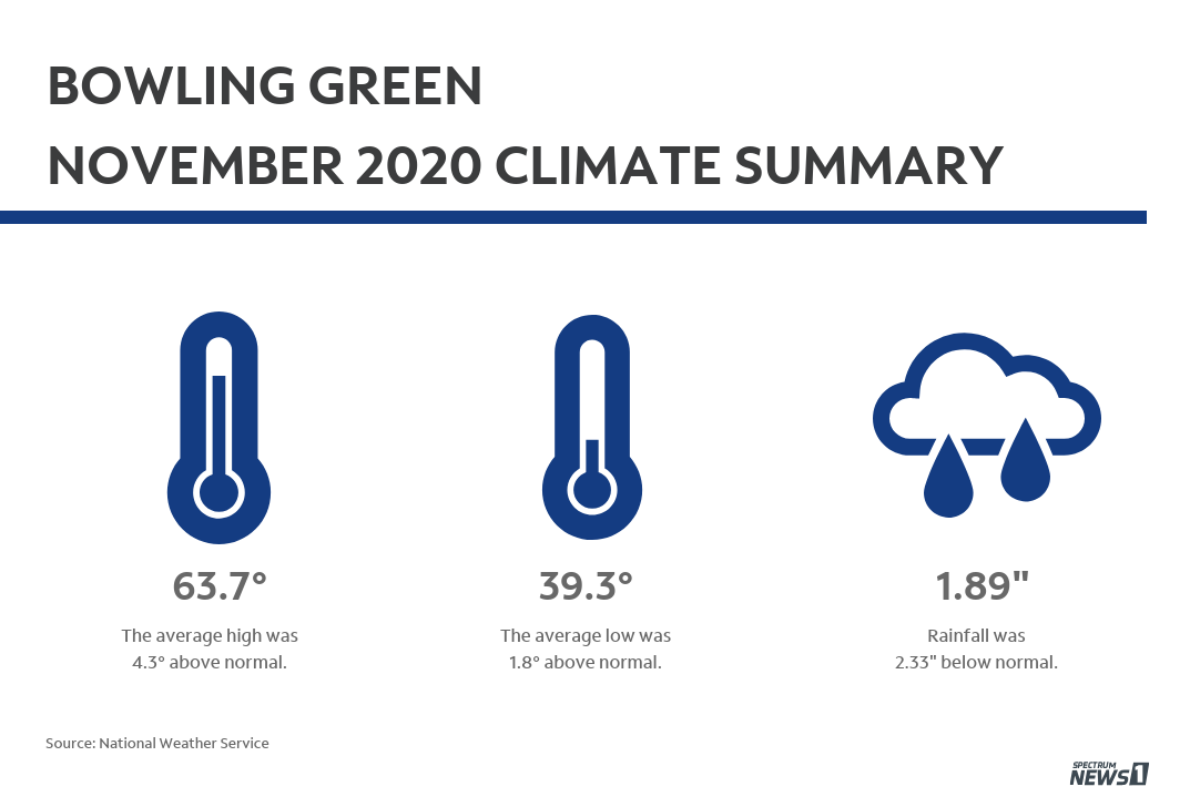
Bowling Green
High 63.7° +4.3
Low 39.3° +1.8
Rain 1.89” -2.33
Snow Trace 0.0