After more than a week of spring-like warmth, we go back to reality next week with chilly air returning.
If you plan on celebrating Valentine's Day this weekend, watch out for rain showers on Saturday. We'll dry out on Sunday, but temperatures will be a little cooler in the lower 50s.
Another system comes into the area to start to the week with mainly rain showers on Monday, but those could mix with wet snowflakes at times. That system will knock our temperatures back into the 40s for most of next week. Make sure to dress accordingly if you're heading out for Valentine's Day on Wednesday.
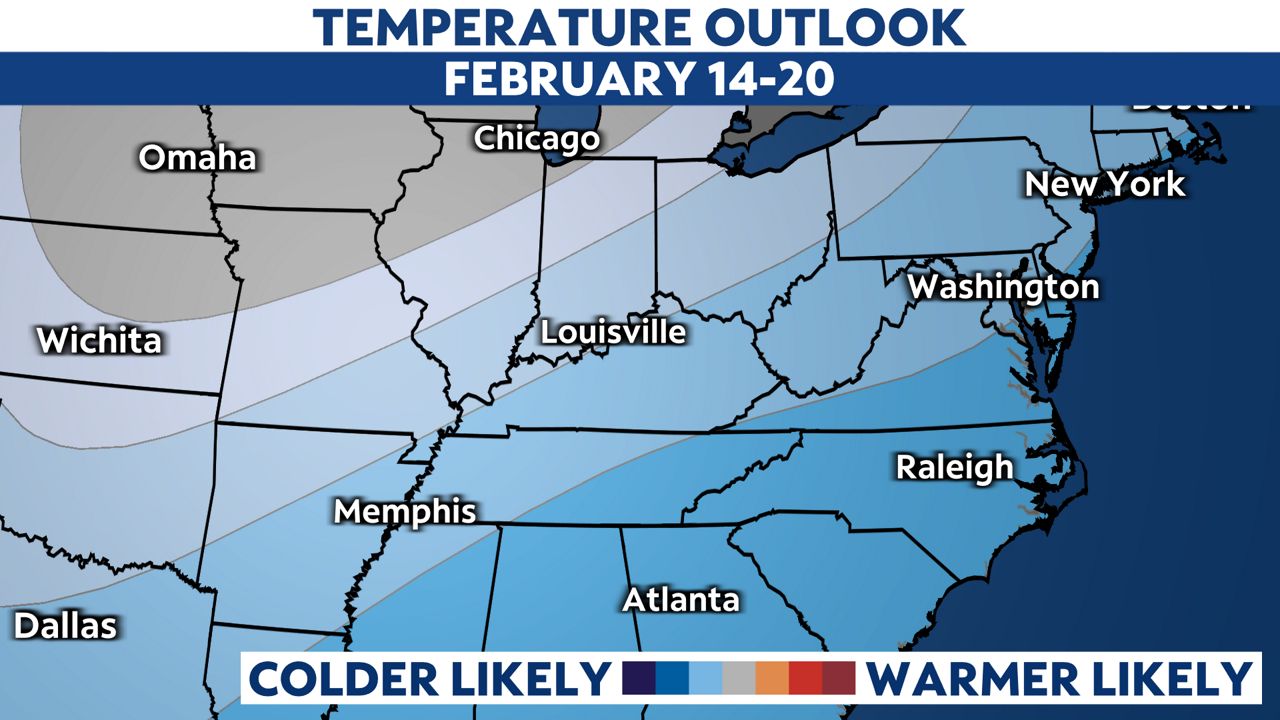
Here is a snapshot from the Climate Prediction Center of the chance of colder air returning from Valentine's Day and beyond.
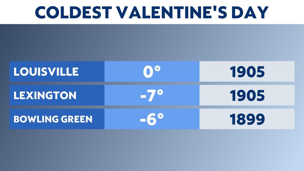
While it's going to be colder for Valentine's Day, it could always be worse. Look at the record lows in years past! Lexington and Bowling Green dropped below zero.
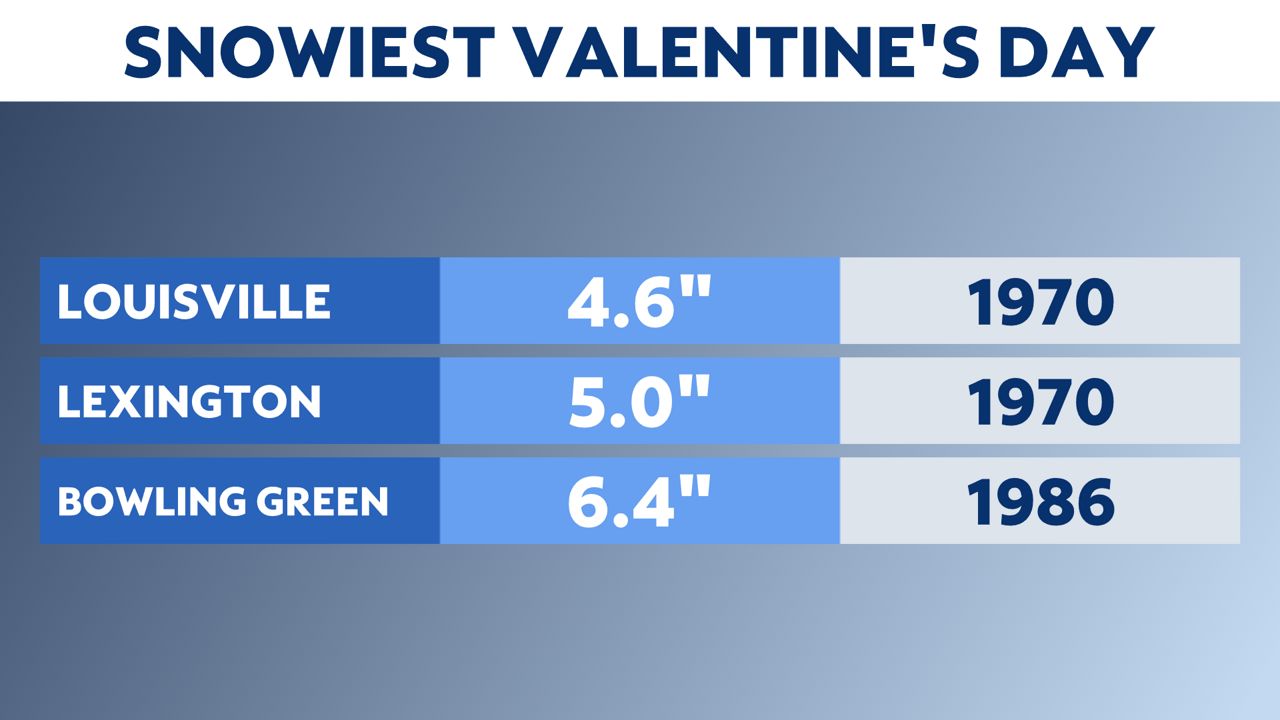
We have even had snow on Valentine's Day. Louisville's snowiest Valentine's Day was back in 1970, when we saw 4.6 inches of snow.
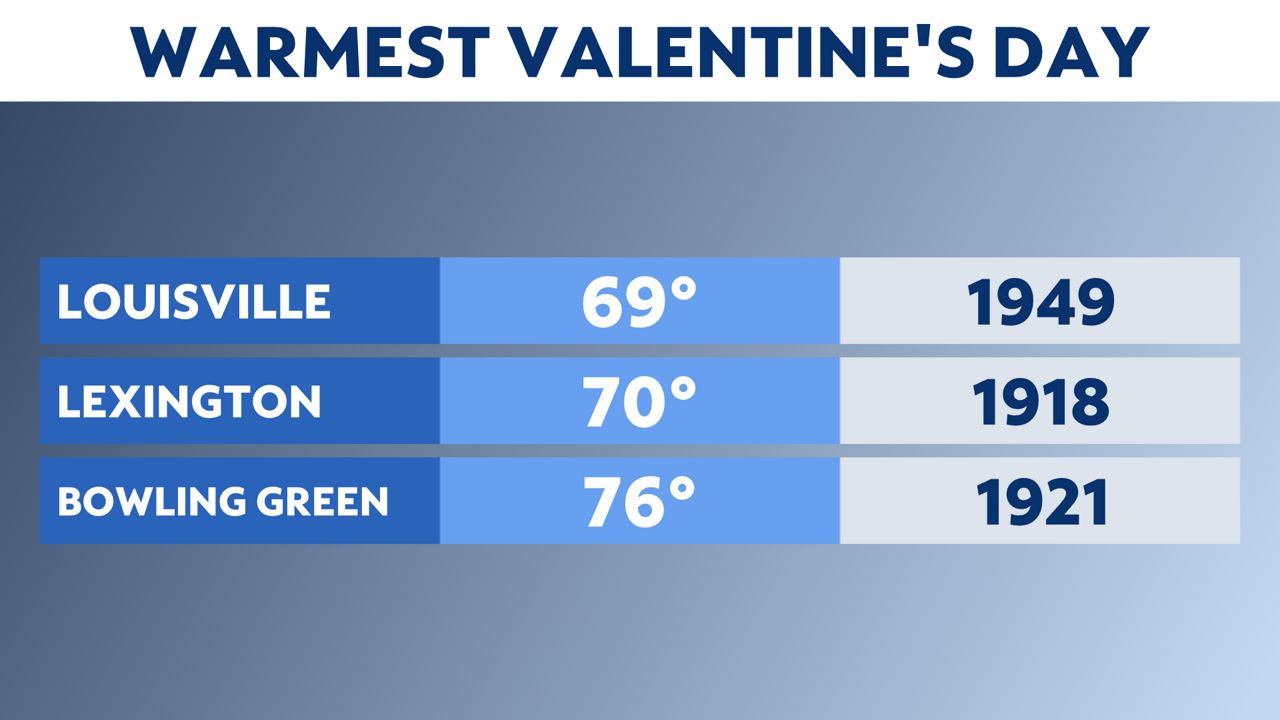
And what about the warmest Valentine's Day on record? Highs jumped up into the 60s and 70s. Bowling Green had a high of 76 degrees back in 1921.
Our team of meteorologists dives deep into the science of weather and breaks down timely weather data and information. To view more weather and climate stories, check out our weather blogs section.


