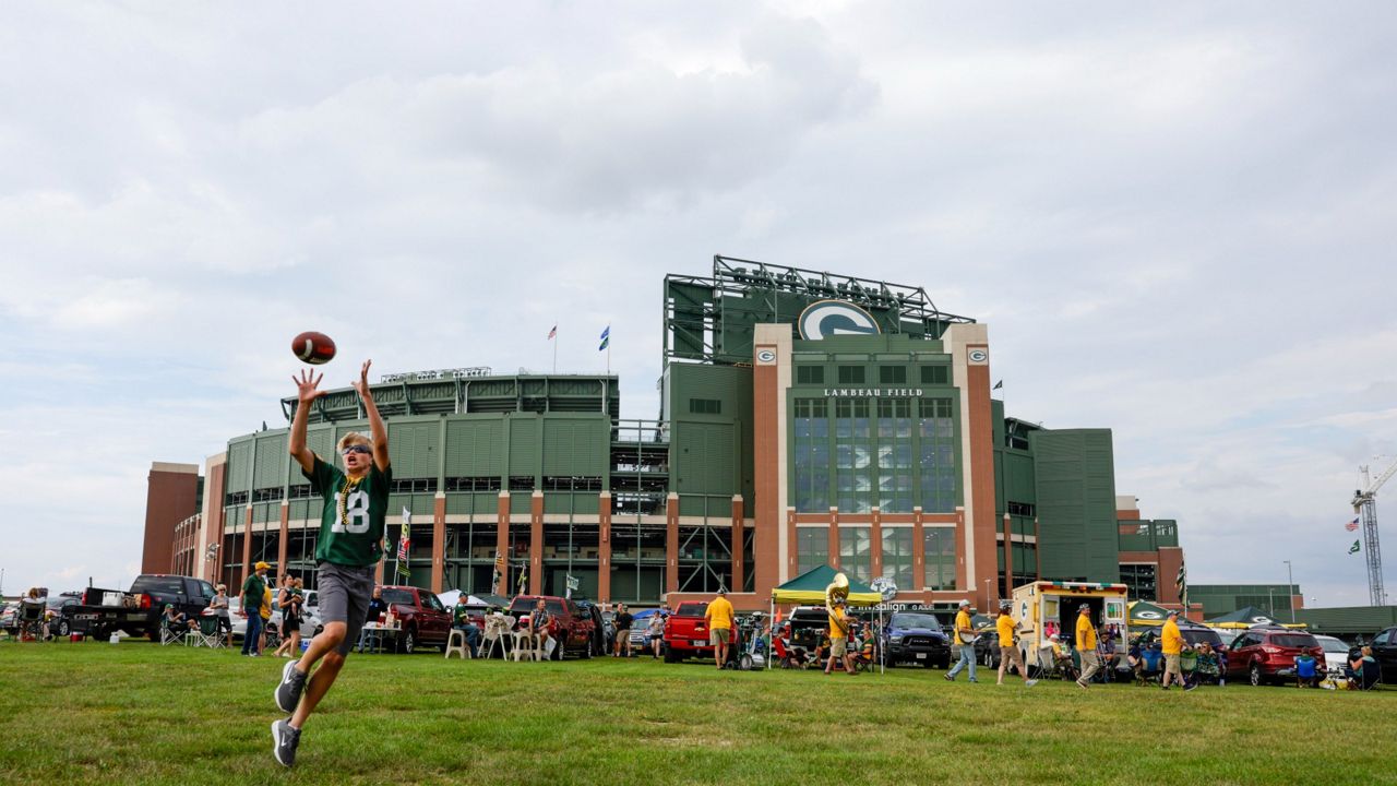
As we move into November and deeper into fall, some will start to see signs of winter across the Badger State.
Autumn is a season of transition and sometimes brings a bit of weather whiplash as days get shorter and the air gets colder.
That was the case in October, a month that started summer-like and ended wintry in Wisconsin.
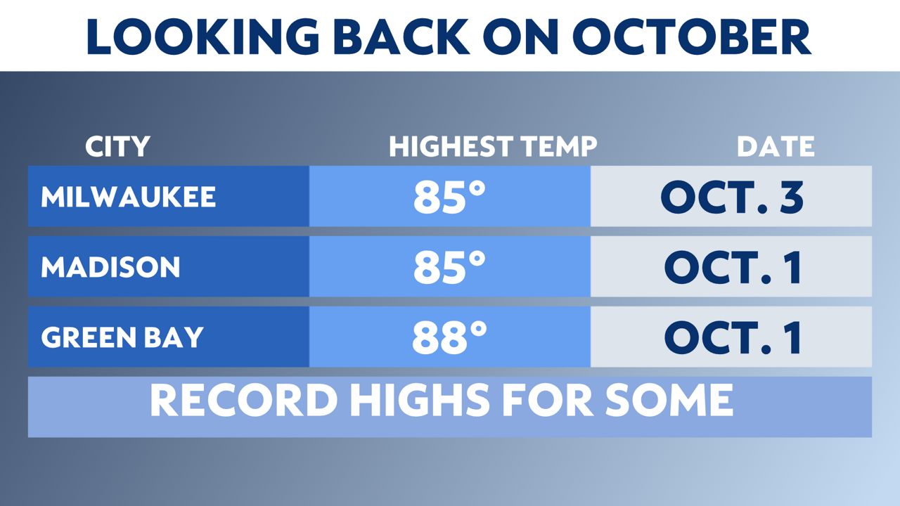
Although October is the first full month of fall, summer was still hanging on as the month began.
The highest recorded temperatures during the month statewide came in the first few days of October.
Many saw temperatures climb into the mid and upper 80s. Some recorded record high temperatures.
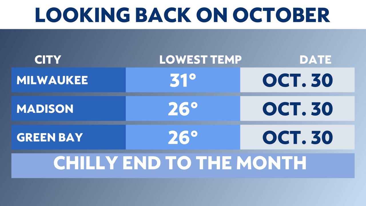
By the end of the month, however, it was a much different story.
A frigid air mass overspread the state in the last days of October, making for a wintry end to the month.
The lowest recorded temperatures statewide came on the last days of October, with many seeing low temperatures fall well below freezing and some receiving measure snowfall on Halloween.
As November begins, expect things to get even colder as the season moves on.
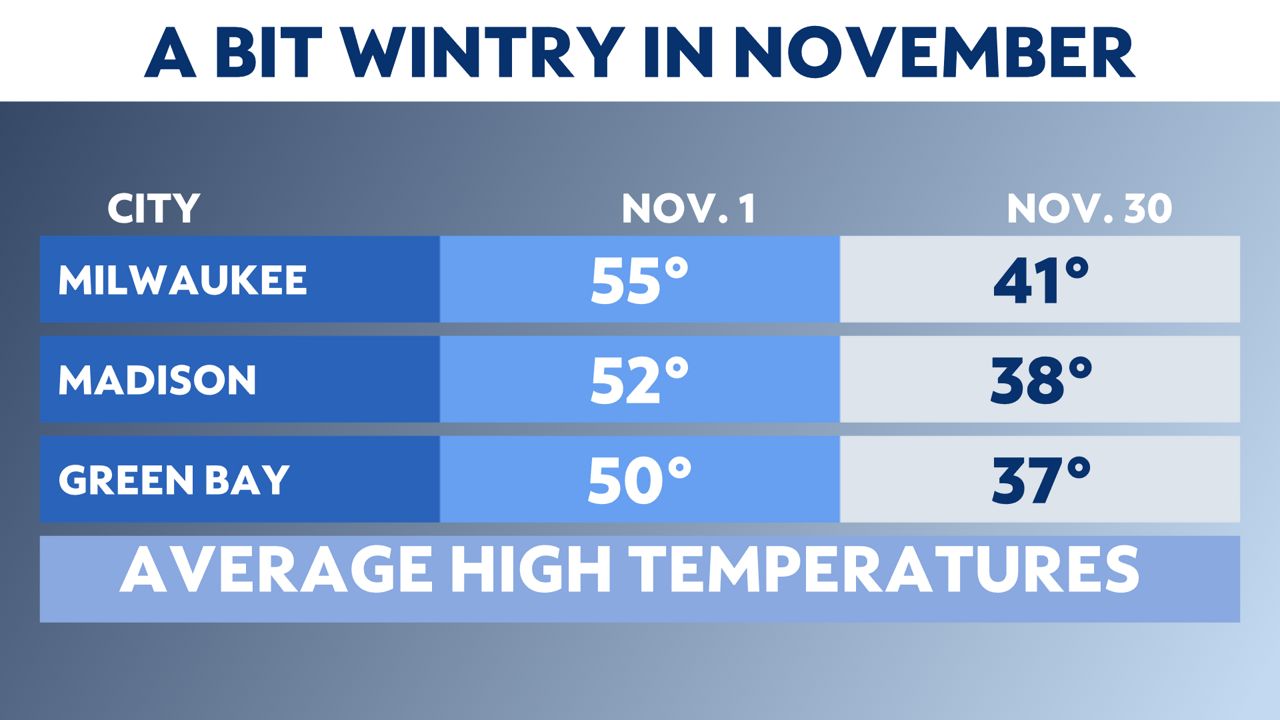
Despite the cold end to October, high temperatures on average should be in the mid-to-low for most across the state at the start of November.
The good news is that the cold air in place at the end of October will move out as November gets going.
High temperatures will return to the upper 40s and even mid-50s in the first few days of the month.
By the end of November, however, a wintry feel will be common and expected for most statewide as average highs only reach the upper 30s to low 40s.
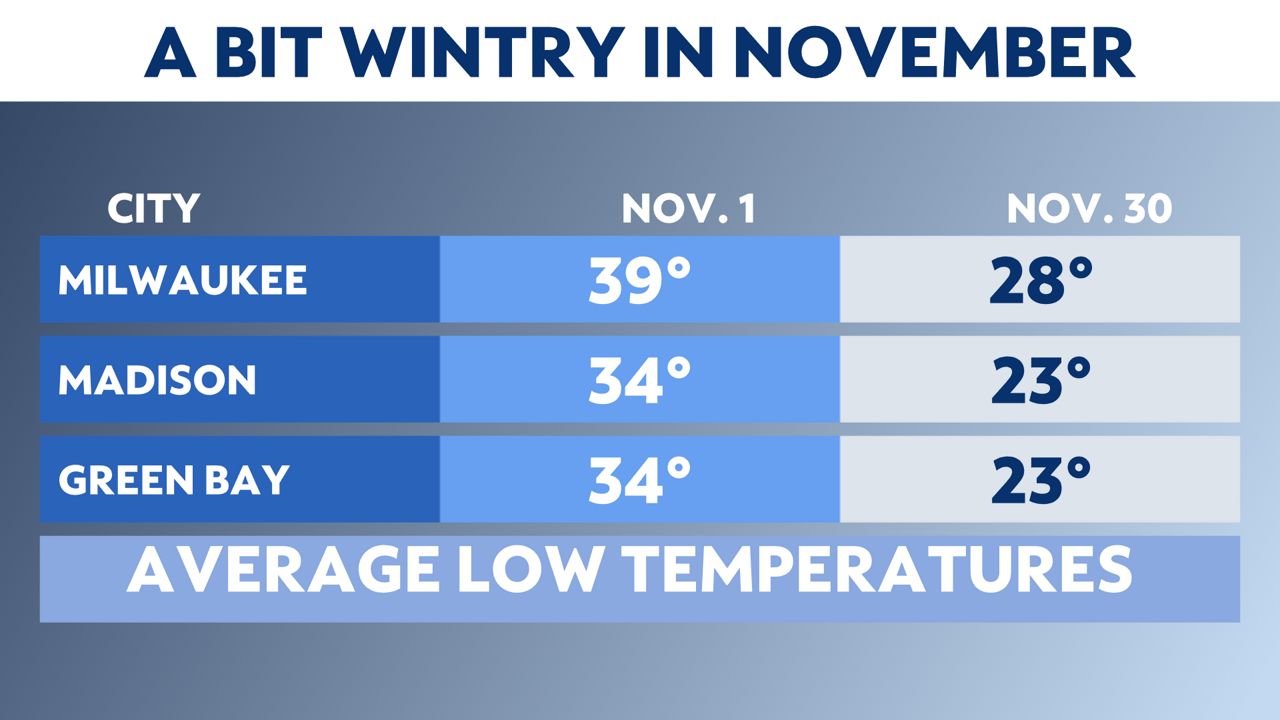
Expect shorter days and longer, colder nights as the new month moves on.
Daylight Saving Time ends on Sunday, Nov. 5, meaning that sunsets will come earlier. More hours of darkness will allow for November nights to turn very cold.
Starting the month, average low temperatures remain above freezing in the mid-to-upper 30s.
By the end of November, low temperatures will regularly fall below freezing in the low-to-mid 20s for most. Some in far northern Wisconsin will regularly see lows in the teens.
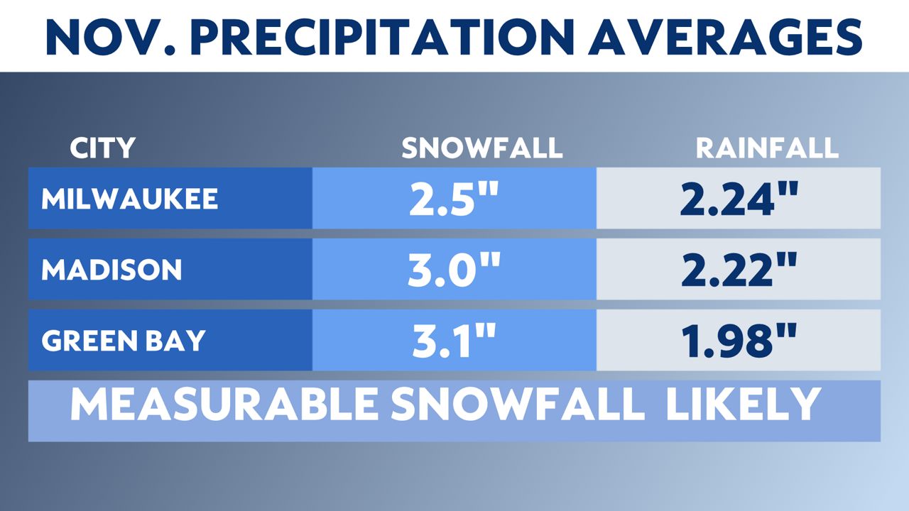
Perhaps the biggest wintry change in November that most are likely to see measurable snowfall across the state.
November is not an especially rainy month on average in Wisconsin, with Milwaukee, Madison and Green Bay all receiving less that 2.5 inches of rain on average.
However, those three cities, on average, receive at least 2.5 inches of recorded snowfall during the month of November.
Though fall continues through November, prepare for some wintry weather features across the Badger State as the new month begins.
Our team of meteorologists dives deep into the science of weather and breaks down timely weather data and information. To view more weather and climate stories, check out our weather blogs section.


