


While February will officially go out on a quiet note, can we expect more of the same as we turn the calendar to March?
With some sunshine and temperatures above average, the last day of February will shape up to be a gorgeous late winter day across Wisconsin. As we make our way into March and begin our slow transition to spring, many are wondering if Mother Nature will follow suit.
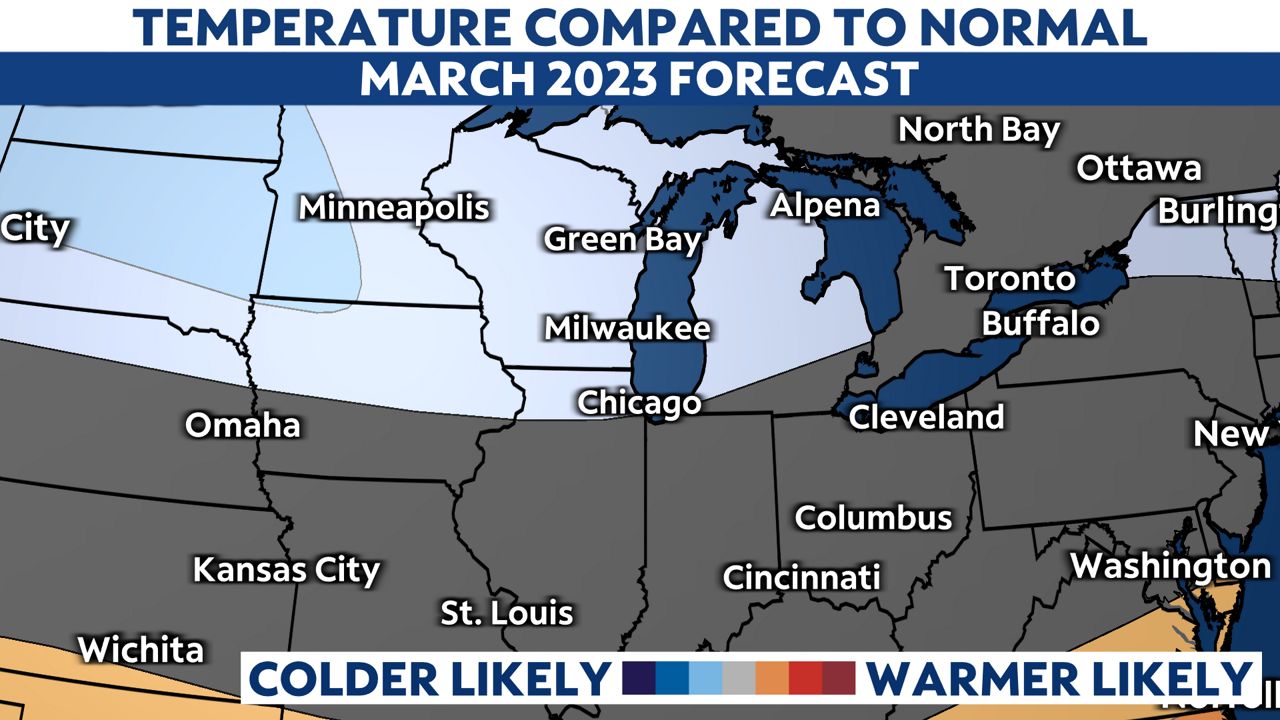
According to the Climate Prediction Center, March could feature colder than average temperatures around the state. La Niña conditions in the Pacific are at least partially to blame as the Polar Jet Stream holds its position to our south, favoring a colder pattern for much of the northern tier of the United States.
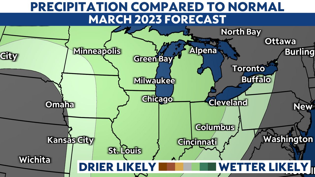
As far as precipitation, we also expect a wetter-than-normal month for March in Wisconsin. Whether that precipitation falls as rain or snow will depend on a variety of factors, including the air temperature for that specific day.
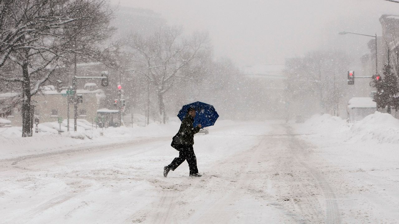
Keep in mind that some of the largest snowfalls in Wisconsin have occurred in March, so while many of us are looking forward to spring, winter might exit the state slowly.
At this point, it looks like March will start cold and snowy, with accumulating snow likely for much of the state on Friday, March 3.
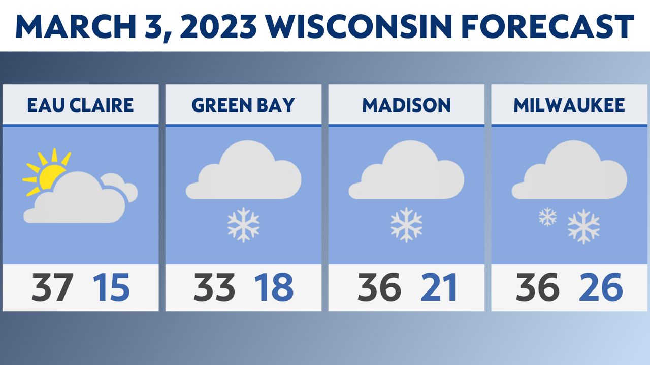
It's too early to say how much snow we could see, but this storm system is worth watching in the coming days.
Stay with Spectrum News 1 Wisconsin for the latest updates.
Our team of meteorologists dives deep into the science of weather and breaks down timely weather data and information. To view more weather and climate stories, check out our weather blogs section.