


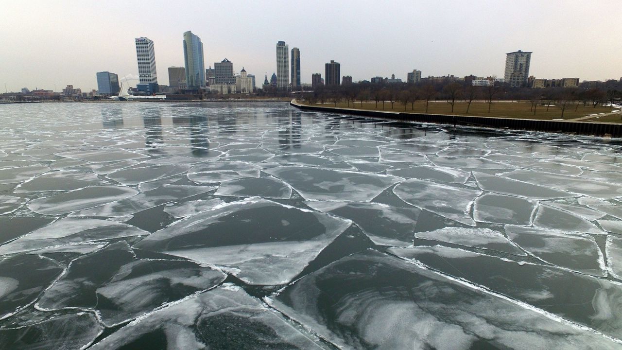
Even after a recent blast of arctic air across the Upper Midwest, ice cover on the two Great Lakes bordering Wisconsin remains well below average.
The Great Lakes experience a lot of variability year-to-year when it comes to ice cover. Although current ice cover on both Lake Michigan and Lake Superior remains significantly below average so far this year, which may have an impact on the weather in Wisconsin in the coming months.
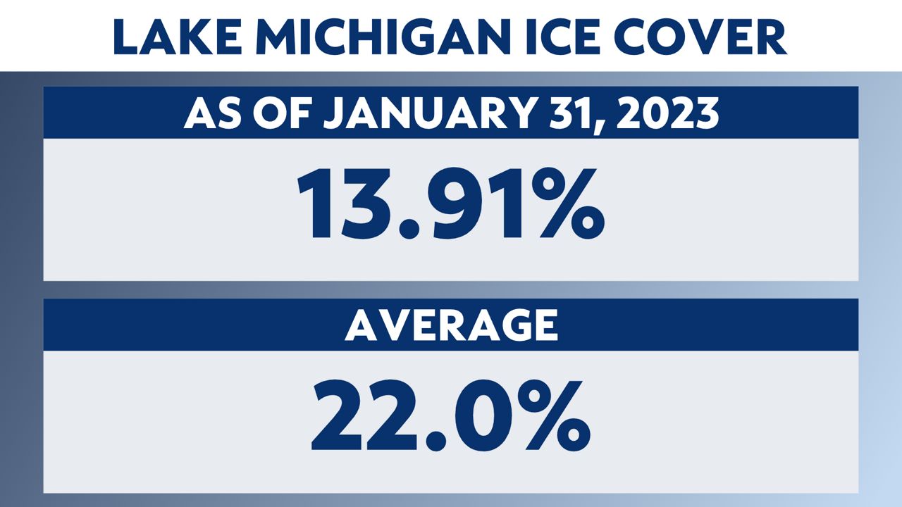
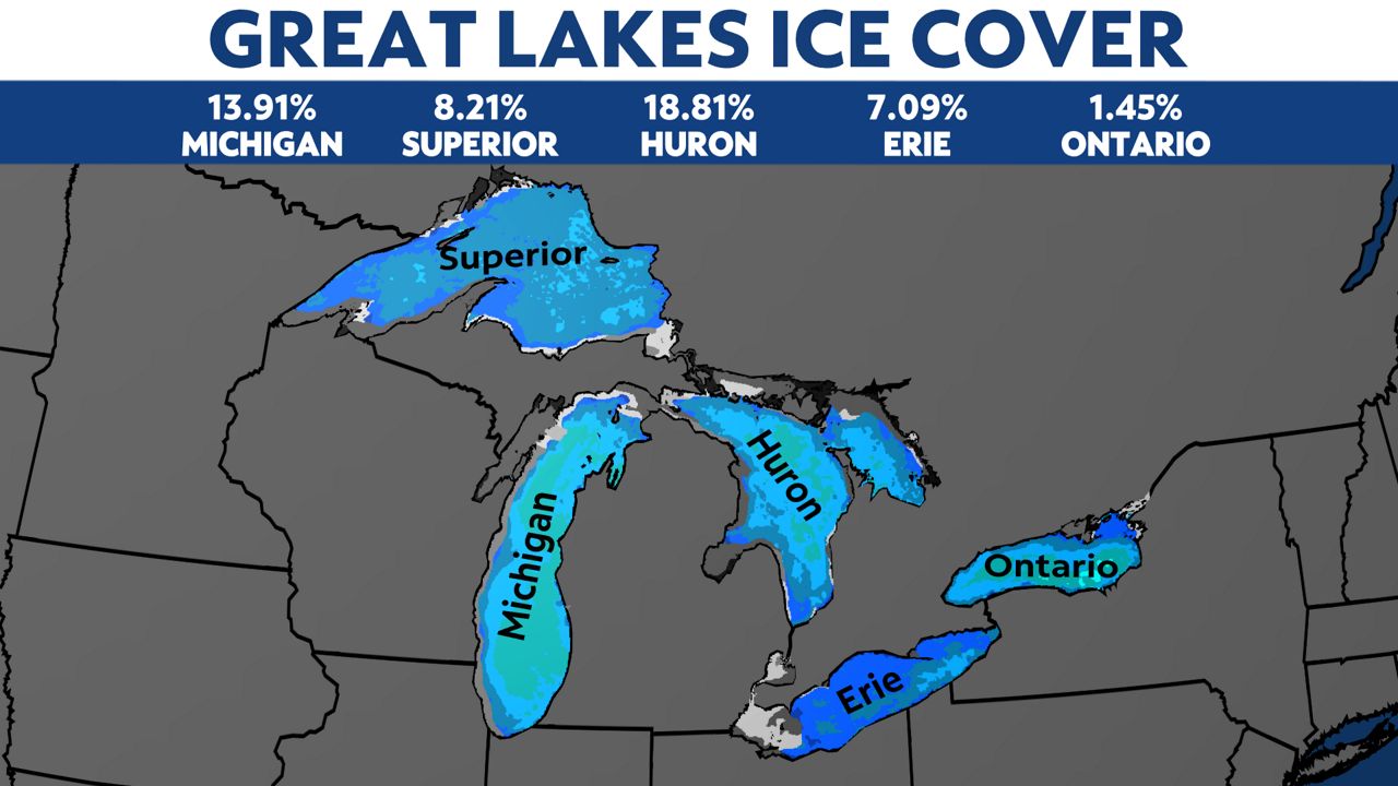
As of Jan. 31, only 13.91% of Lake Michigan was covered in ice. The average for this far into winter is about 22%.
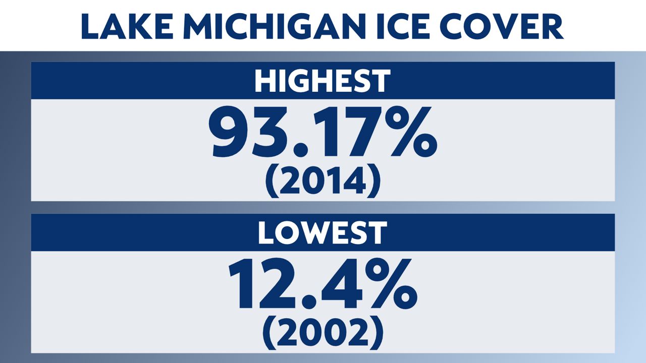
The highest ice concentration ever recorded on Lake Michigan was 93.1% in 2014, whereas the lowest was 12.4% in 2002.
Ice cover on Lake Michigan typically peaks in mid-February, so there is still some time to reach our seasonal average.
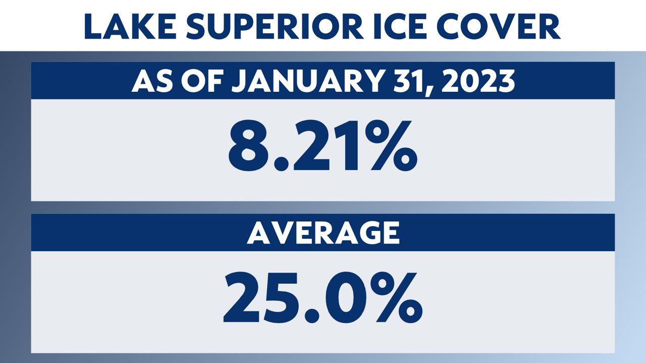
In addition, Lake Superior has also seen much less ice as well. As of Jan. 31, only 8.21% of Lake Superior was covered in ice, which is far less than the seasonal average to date of 25%.
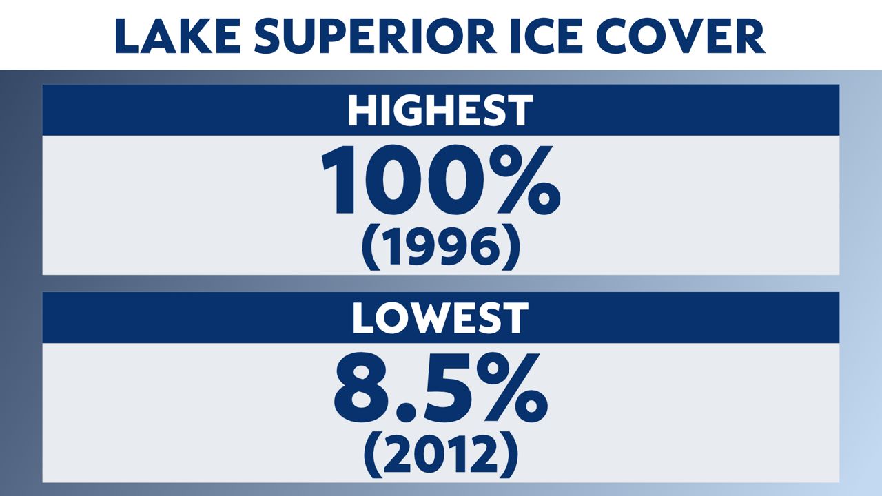
The highest ice concentration ever recorded on Lake Superior was in 1996 when ice covered 100% of the lake. To the contrary, the lowest occurred in 2012 when ice was only measured on 8.5% of the lake.
Ice cover usually peaks in early March on Lake Superior, so like Lake Michigan, there is still some time to reach our seasonal average. With that, Lake Superior still has a lot of catching up to do in the weeks ahead.
Lake Michigan and Lake Superior are not the only Great Lakes experiencing an overall lack of ice cover. Across all five Great Lakes, the total ice cover is measuring just about 11.6%. This is significantly less compared to last year at this time when ice covered about 40.0%.
The slow ice growth on the lakes could easily be attributed to mild January temperatures across the Upper Midwest and Great Lakes states.
The lack of ice on both Lake Michigan and Lake Superior could spell out the potential for more lake-effect snow events across Wisconsin.
As colder air blows over the relatively warm and ice-free lake, heat and moisture are transported into the atmosphere, eventually creating clouds that grow and produce bands of snow.
Wind off an unfrozen lake during an ongoing snow event can also add more moisture into that system, producing lake-enhanced snowfall, which increases snowfall totals over a certain area.
With the added snow potential, the ice extent on the lakes plays a role in determining the water temperatures later in the year. Less ice to melt could mean a quicker warmup for the lakes in the months ahead.
Our team of meteorologists dives deep into the science of weather and breaks down timely weather data and information. To view more weather and climate stories, check out our weather blogs section.