


It's been feast or famine when it comes to snowfall so far this season across Wisconsin.
While the snow continues to pile up in parts of Wisconsin, many other areas are wondering if and when they will see any significant accumulations.
Over the last couple of months, several winter storms brought significant snow accumulations to parts of the Badger State.
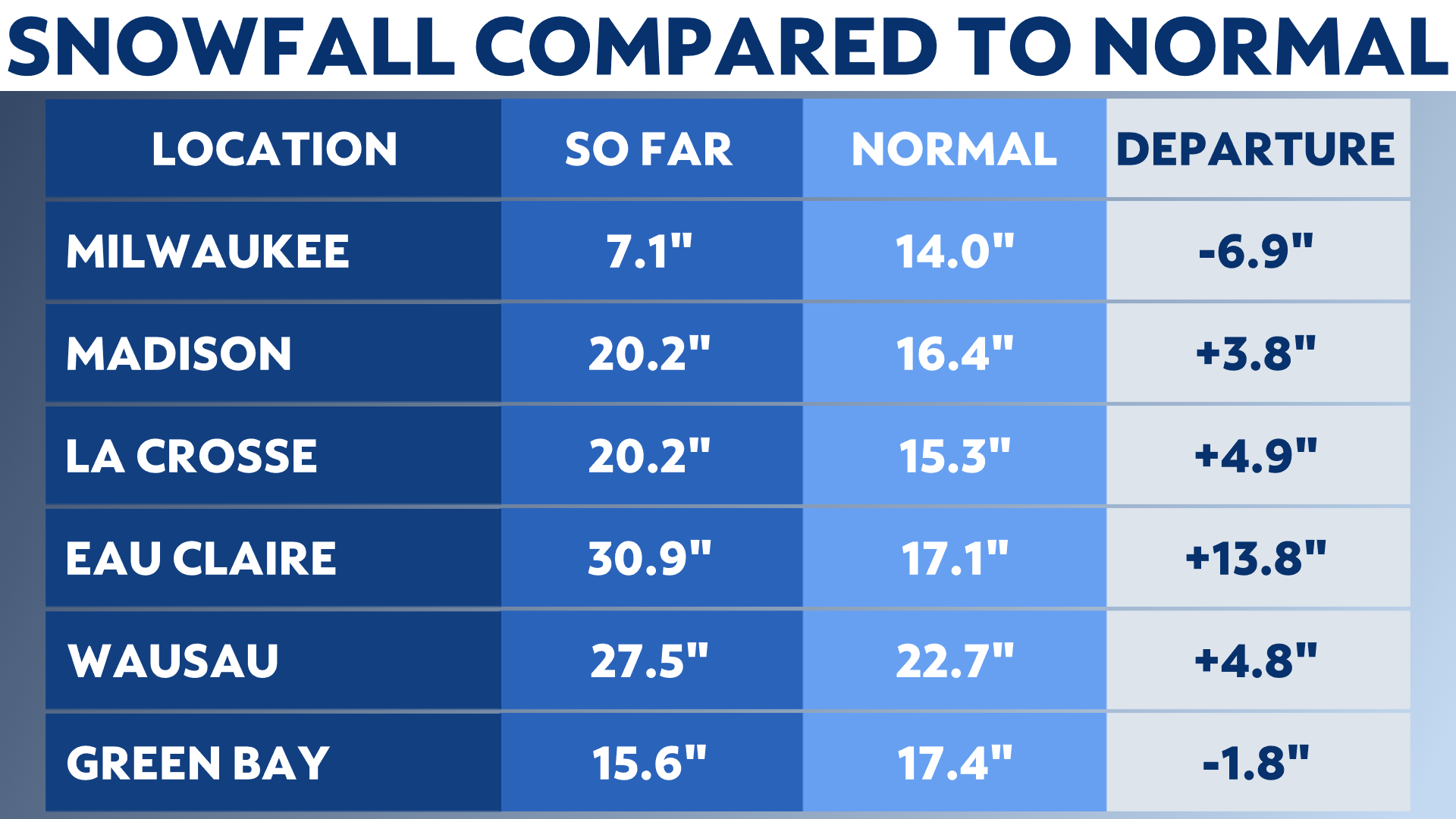
As of Jan. 2, 2023, Eau Claire measured a more than 30 inches of snow, with Wausau picking up over 27 inches. Snowfall totals even tallied up around 20 inches in both La Crosse and Madison. Accumulations for all of these locations are well above the seasonal norm up to this point.
On the opposite end of the spectrum, Milwaukee only received half of the snow normally measured by this time of year, while Green Bay is running about 2 inches below normal.
The track each storm took is part of the reason why there is such a large difference in snowfall totals from one part of the state to another. Most of the storms moved across or near southern Wisconsin, putting the northern and western parts of the state in the prime location for moderate to heavy snow.
Although temperatures stayed near or above freezing farther south and east, causing most of the precipitation to fall as rain or a wintry mix of rain.
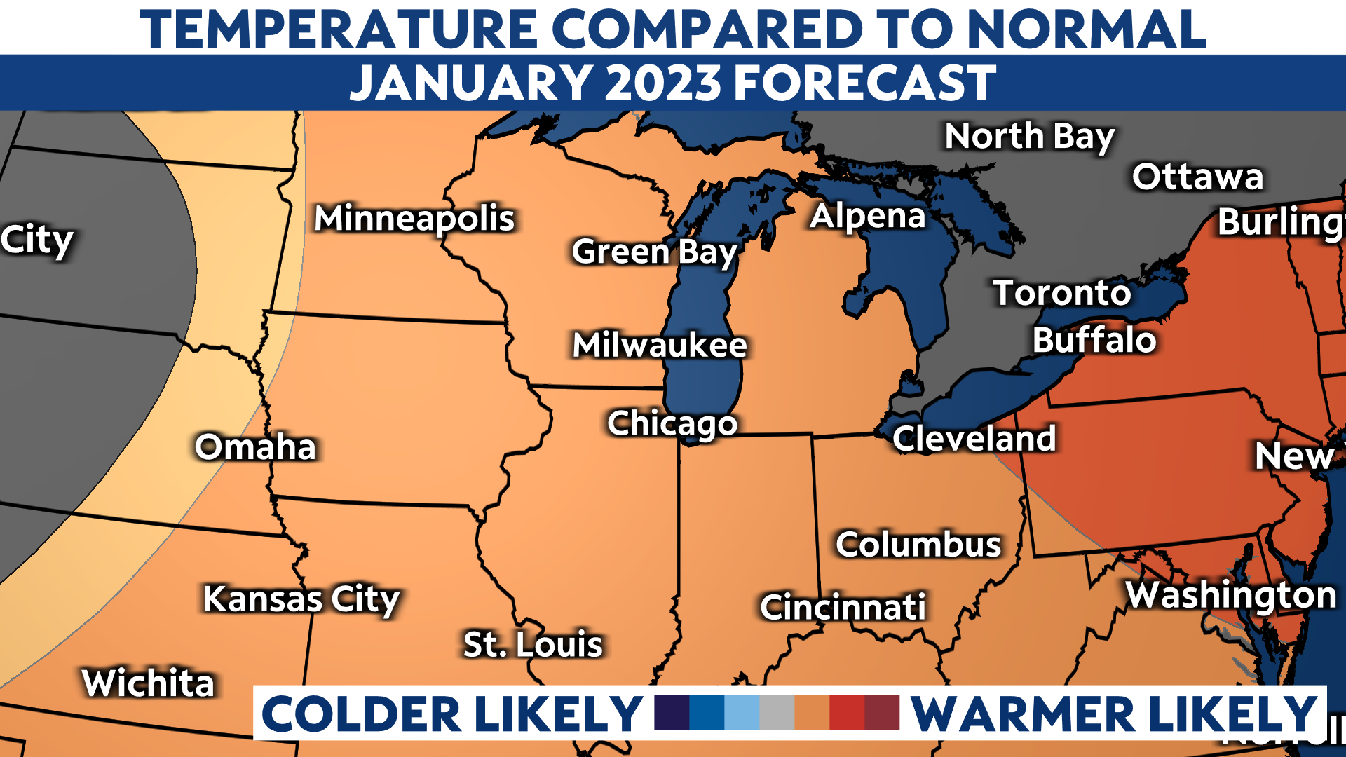
According to NOAA's Climate Prediction Center (CPC), temperatures in January are expected to trend warmer than normal.
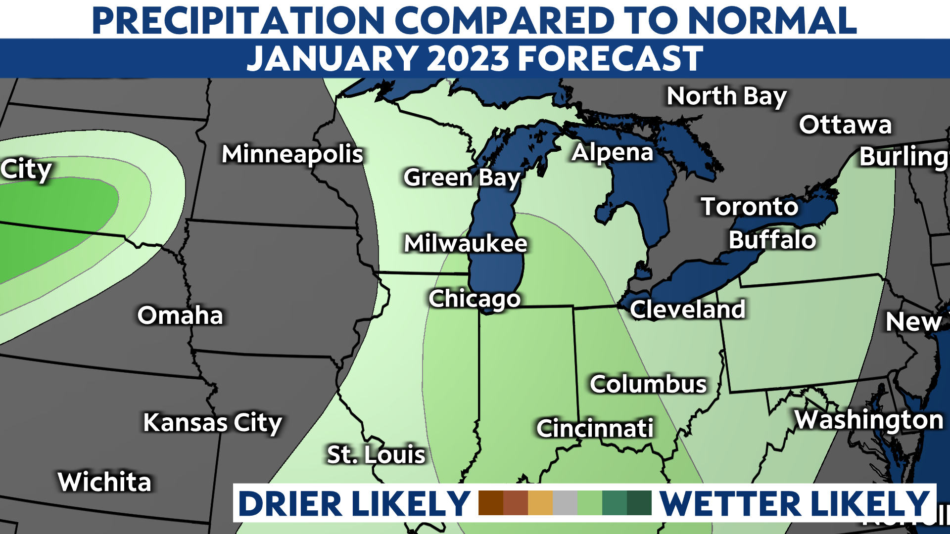
Precipitation across central and eastern Wisconsin is expected to be slightly higher than normal.
With typical high temperatures in Milwaukee ranging from 30 to 32 degrees, we could be in for more rain as opposed to snow. However, January is statistically our snowiest month in Milwaukee, averaging around 15 inches.
Snowfall during the early winter months, when temperatures are right around or above freezing, is highly dependent on the track of an incoming system.
With warmer temperatures and more precipitation likely during the month of January, the track of each system will be a large factor in what type of precipitation falls and if we will see our snowfall totals continue to climb up above, or at least catch up to normal.
As we continue to track a winter storm impacting Wisconsin over the next few days, several inches of snow are likely in the northern parts of the state, while areas in southern Wisconsin may only see minor accumulations of an inch or so.
Our team of meteorologists dives deep into the science of weather and breaks down timely weather data and information. To view more weather and climate stories, check out our weather blogs section.