


Along with today's toasty temperatures, we've got another big concern we're monitoring. Severe weather.
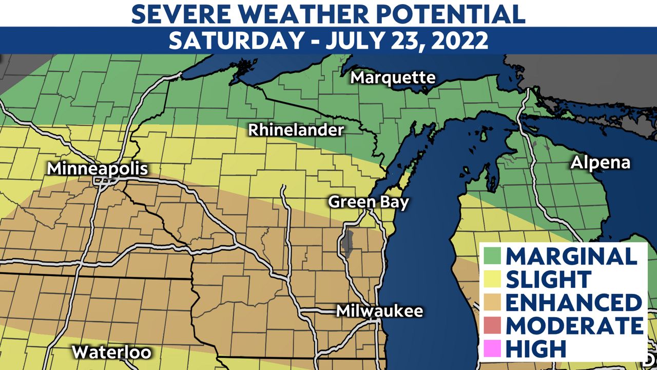
Strong storms will continue to move in across the state this afternoon and evening. While southern parts of the Wisconsin look to get hit with the worst of impacts, the entire state is under some level of risk.
The Storm Prediction Center (SPC) has put those areas shaded in orange under an enhanced risk (3 out of 5 on our severe weather scale) for severe weather. All hazards are on the table, including damaging wind, large hail and even a few tornadoes.
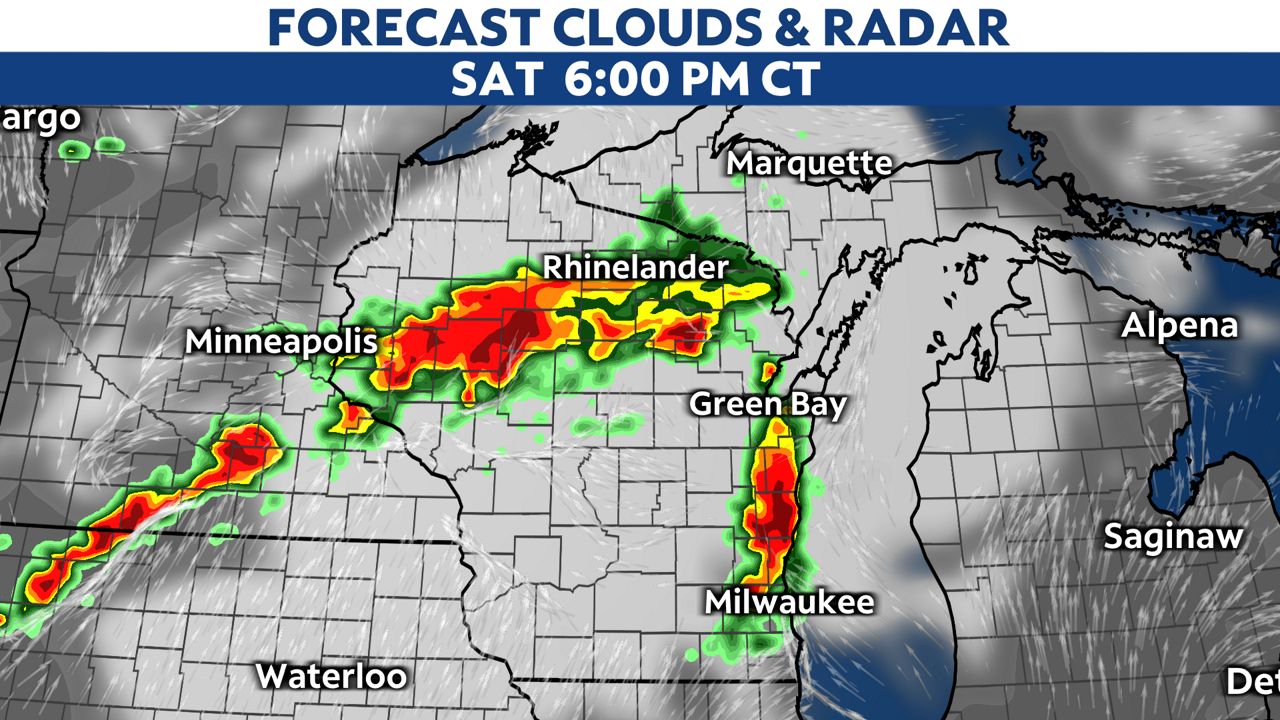
Storms will continue to move in from the north and west this afternoon and will head towards the southeast through this evening.
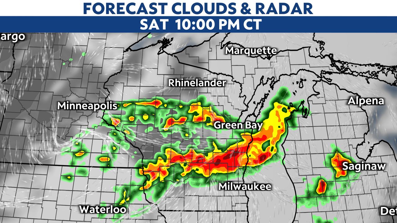
Eastern parts of the state won't see these storms until early this evening, where storms are expected to pass through until about midnight.
Although this strong wave of storms looks to clear out after midnight, some models show a second wave moving through afterward into early Sunday morning.
These storms could produce heavy downpours, which raises some concerns regarding flooding. Soaked surfaces from storms prior combined with additional rainfall could lead to localized flooding, especially in prone places.
Any storms should clear out as we continue into mid-morning on Sunday, giving way to a more quiet end to the weekend.
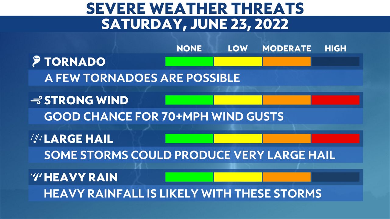
All hazards are possible with Saturday's storms. The primary threats will be damaging wind and large hail, but we still can't rule out tornadoes spinning up either.
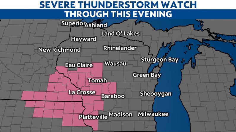
Severe Thunderstorm Watches are in effect across western and central parts of the state through this evening.

You can now get weather push alerts through your Spectrum News app. These alerts allow you to get advanced notice of various weather conditions in and around your location.
Also, download our app to get up-to-date information on traffic and road conditions, along with potential closures.
Stay alert and weather-aware. Your "Weather On The 1s" team will continue to bring you the latest weather updates on-air and online.
Check your local forecast | Send us your weather photos
Follow the "Weather On the 1s" Team on social media for the latest weather updates:
Chief Meteorologist JD Rudd: Facebook | Twitter
Meteorologist Kristin Ketchell: Facebook | Twitter | Instagram
Meteorologist Brooke Brighton: Facebook | Twitter | Instagram