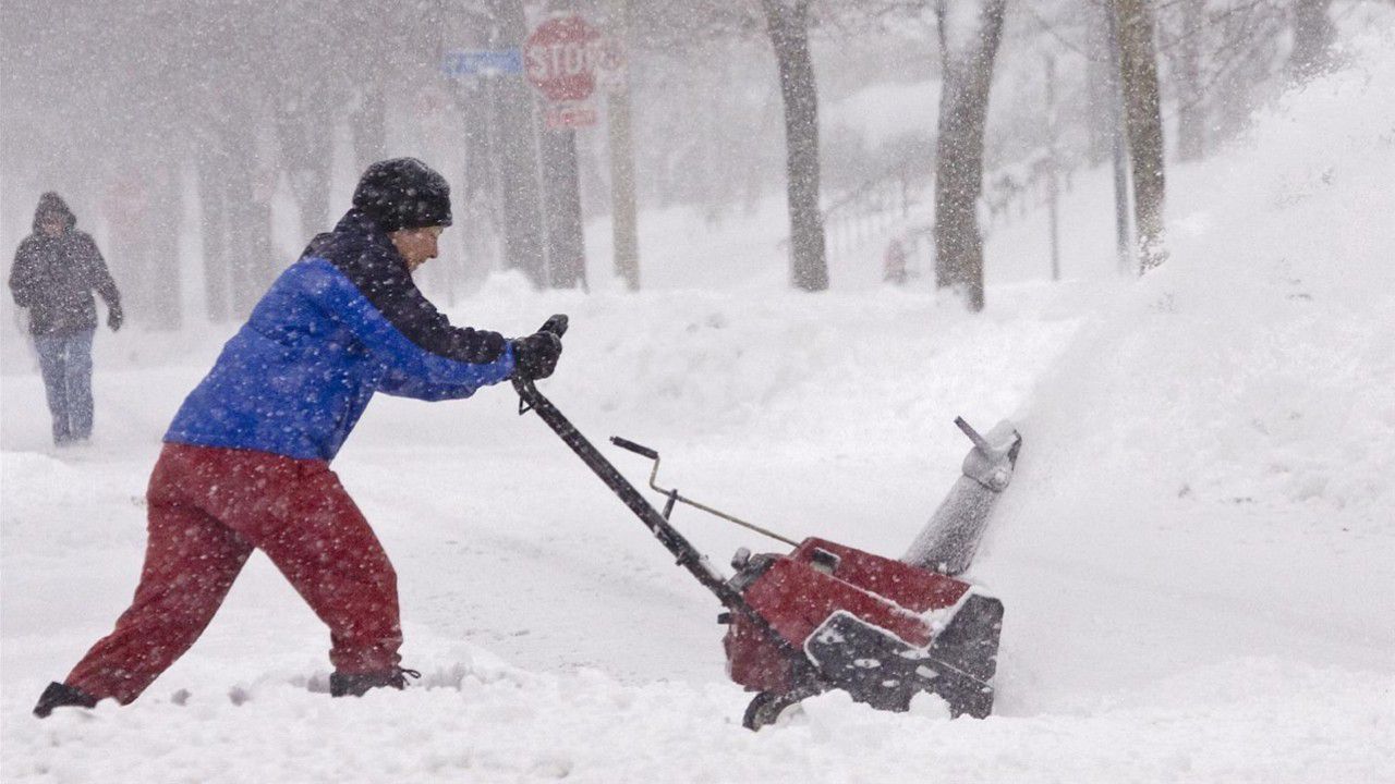
Unless you are a snow-lover, why would anyone ask for a massive winter storm to hit the state? The reason is simple. We currently have a huge deficit for moisture across parts of Wisconsin.
Since early winter, much of the state has been dealing with a "snow drought." We actually need several inches of snow to fill the void. Wisconsin typically relies on winter snowfall to alleviate the stress of lack of rainfall.
2021 was particularly bad for rainfall and moisture. Many parts of Wisconsin went into extreme or exceptional drought conditions throughout the summer and early fall months. Unfortunately, we were never able to catch up by the end of the year. We now start out 2022 in dire need of some moisture.
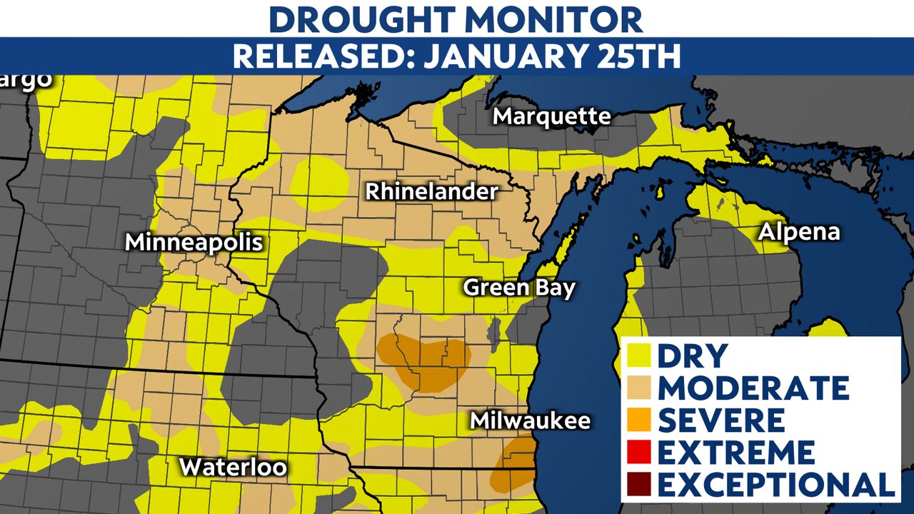
Our most recent Drought Monitor, which was released last Thursday, continues to show severe drought conditions for portions of the state, especially for southeastern and central Wisconsin.
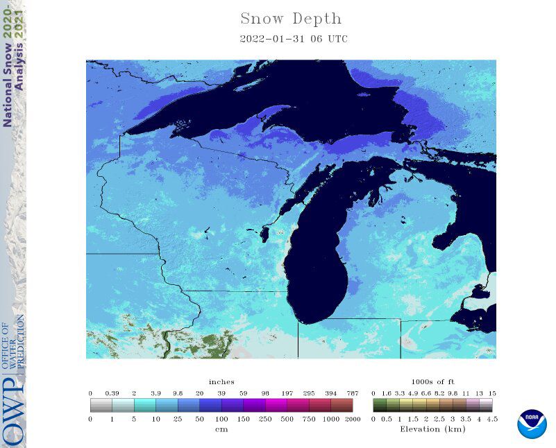
For many, it may be hard to believe that we need more snow. We've been sitting under a layer of snow since early January. However, it has been a very thin layer. This winter has been much drier than normal and has been relatively quiet.
We have had several winter storms push through the state; however, snow totals have been rather minor compared to previous years and the seasonal normal. The majority of the heavy snow has clipped northern Wisconsin and, unfortunately, has not fallen on the areas that need it the most.
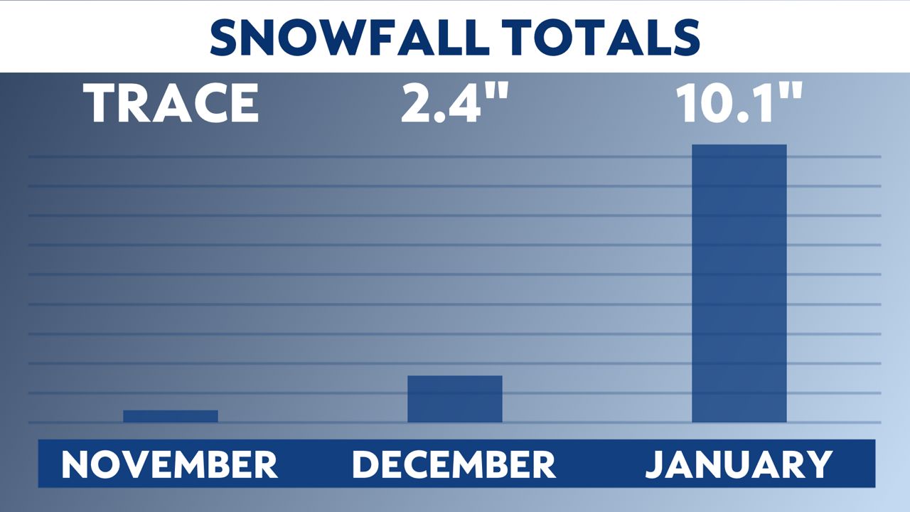
On average, our first typical snow happens in October. However, that was not the case for southern Wisconsin. We had a snow-free month and a long stretch until late November before seeing any measurable snowfall. Even then, snow was quite minimal. Milwaukee recorded just a trace of snow for November 2021. The normal amount is 2.5 inches.
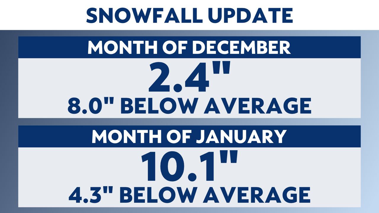
December wasn't any better. Milwaukee officially reported 2.4 inches of snow, well below the typical value of 10.4 inches for the month. Even January was extremely low compared to previous years. For January, Milwaukee reported 10.1 inches of snow; the average is 14.4 inches.
In comparison, we are well below last year, the 2020-2021 winter season, for overall measurable snow. Totals reached 44.8 inches from October 2020 to May 2021. This year, we have had a measly 12.8 inches of snow from November 2021 through January 2022.
To put things into perspective, we would need nearly two feet of snow by the end of February to get back to the seasonal average. That is a ton!
Furthermore, the lack of snow and rain has really affected the water levels of Lake Michigan. On Jan. 28, the forecasted levels were below 2021 levels on all lakes except Lake Ontario. Over the next month, Lakes Superior and Michigan-Huron are expected to continue their seasonal declines and fall by one to two inches.
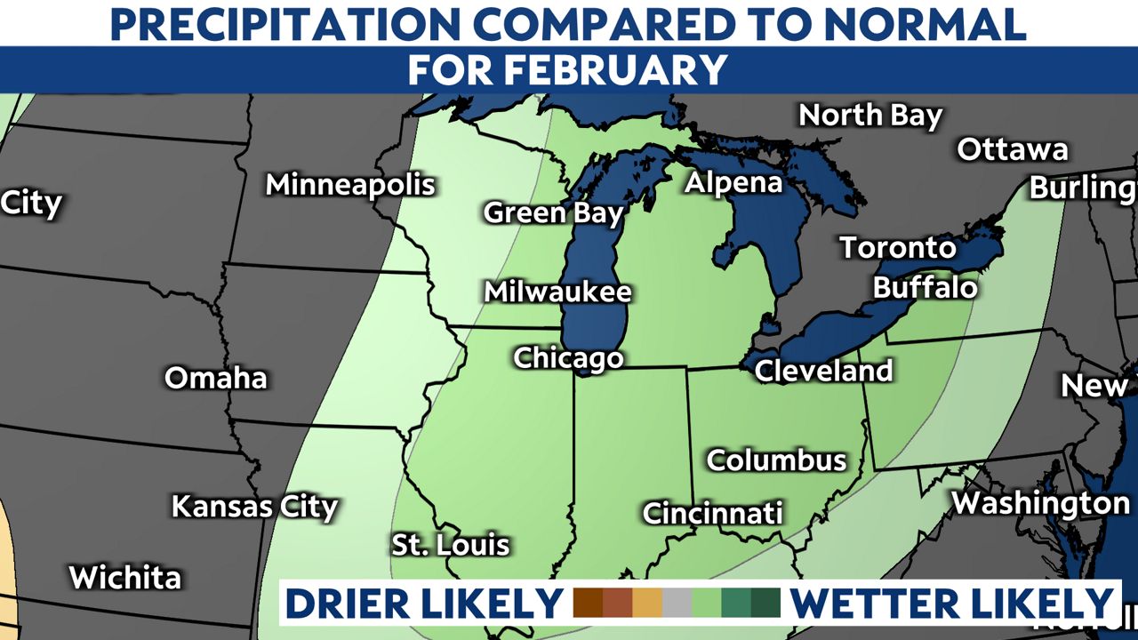
Fortunately, the long-range forecast for February 2022 is looking more productive. The precipitation forecast for the month calls for a wetter-than-normal pattern, especially for southeastern Wisconsin. This week's winter storm will skip the state with the heaviest snow.
However, the pattern is looking more active in the coming weeks. We may actually get our big snowstorm by the end of the month. At this point, any snow helps and we will definitely welcome it.
For more on upcoming winter storms, follow Spectrum News 1 meteorologists on-air, online or on your phone. The team is dedicated to keeping you and your family informed about any potential impacts that could affect your daily plans.


