

Much like 2022, the 2023 hurricane season got off to a slow start. The 2022 season ramped up quickly with Hurricane Ian, which made landfall in Cuba, Florida and again in South Carolina.
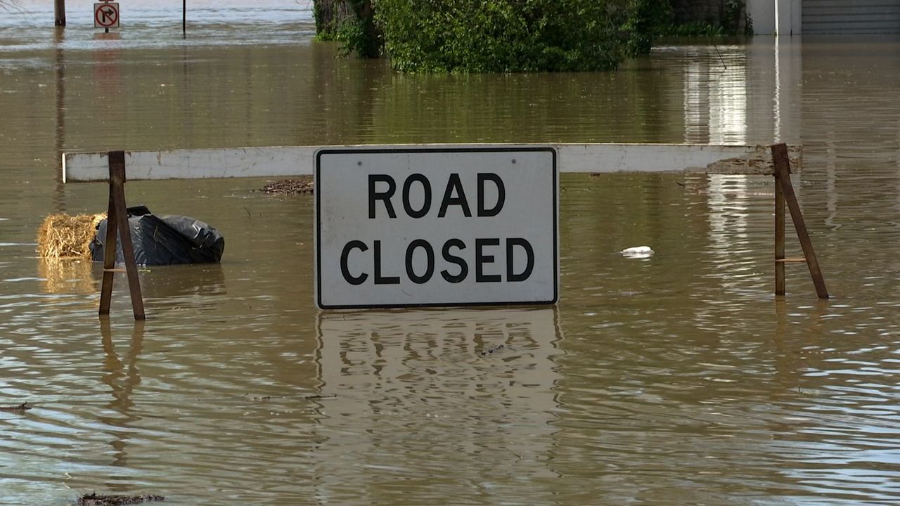
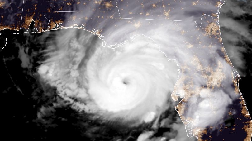
Earlier this year, a Pacific tropical system, Hilary, had a rare impact on California and the southwestern United States, causing flash flooding. Later in August, Hurricane Idalia made landfall in the big bend region of Florida as a major category 3 storm during the morning of August 30th with 125mph winds.
Since then, tropical systems have mostly steered clear of the U.S. until late this week. Ophelia is expected to form and move through North Carolina, Virginia and into the Northeast, into the first weekend of fall.
So far, though, no tropical systems have impacted the Buckeye State in 2023.
The last storm to have some impact on Ohio was from the remnants of Ian. While this storm did not directly move through Ohio, some impacts of Ian were felt in the Buckeye State.
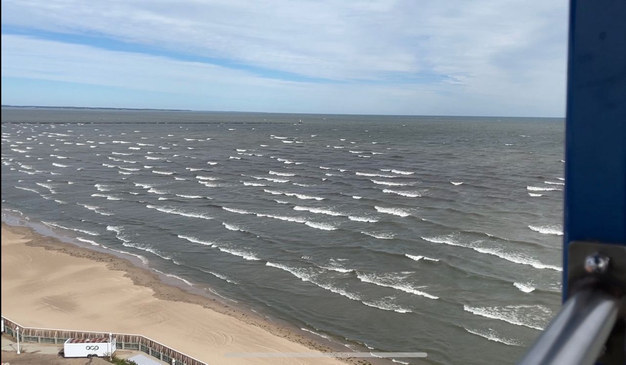
Ian dropped over an inch of rain in parts of southeast Ohio. While the rest of the state remained dry, much of the state experienced gusty winds of 25 to 35 mph over the first weekend of October. Lake Erie was stirred up with waves of 5 to 10 feet.
The Ohio Valley has often experienced the remnants of tropical systems.
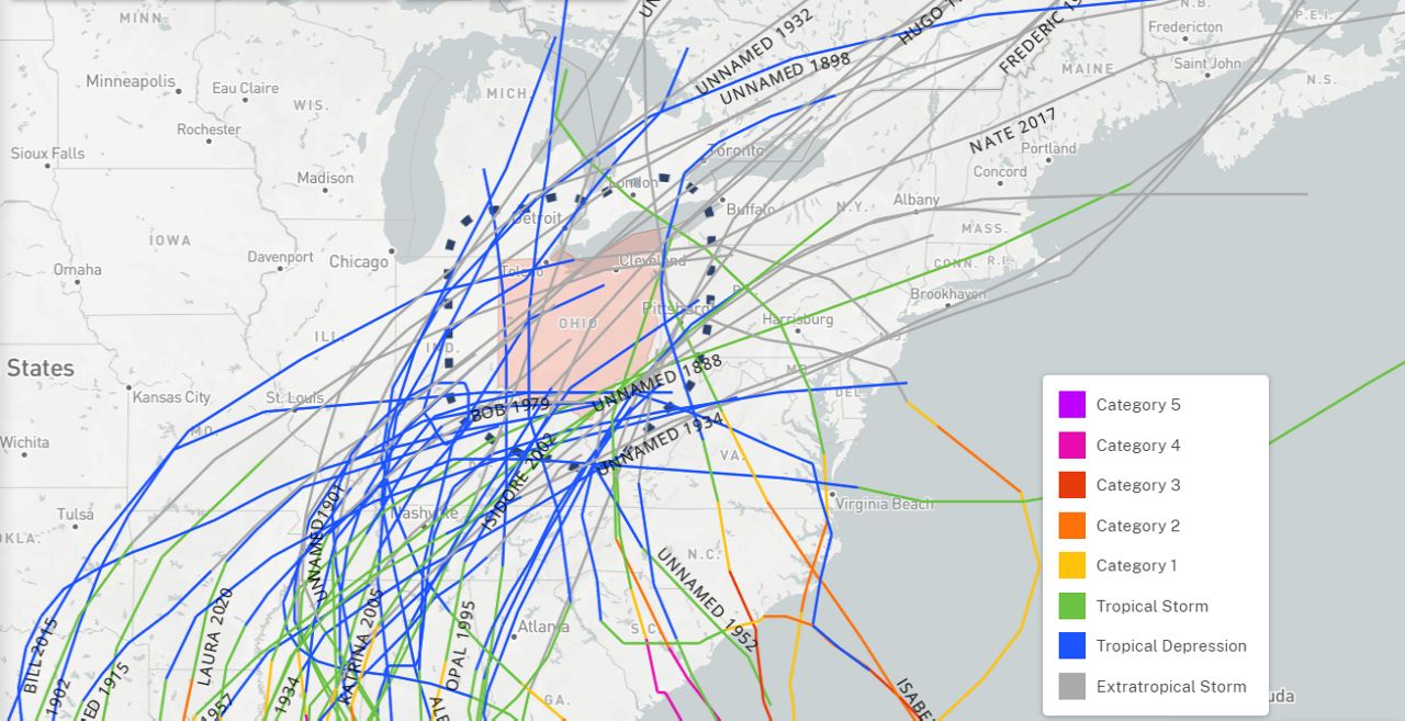
Since 1863, 27 tropical or remnant tropical systems have directly moved through Ohio. However, there have been over 60 that came within 100 miles of the state, close enough to affect our weather.
Despite a few notable exceptions, it is unusual for Ohio to feel any effects from a tropical system that makes landfall along the U.S. East Coast. One of those big exceptions was what some called 'Superstorm Sandy' that impacted Ohio almost exactly 10 years ago.
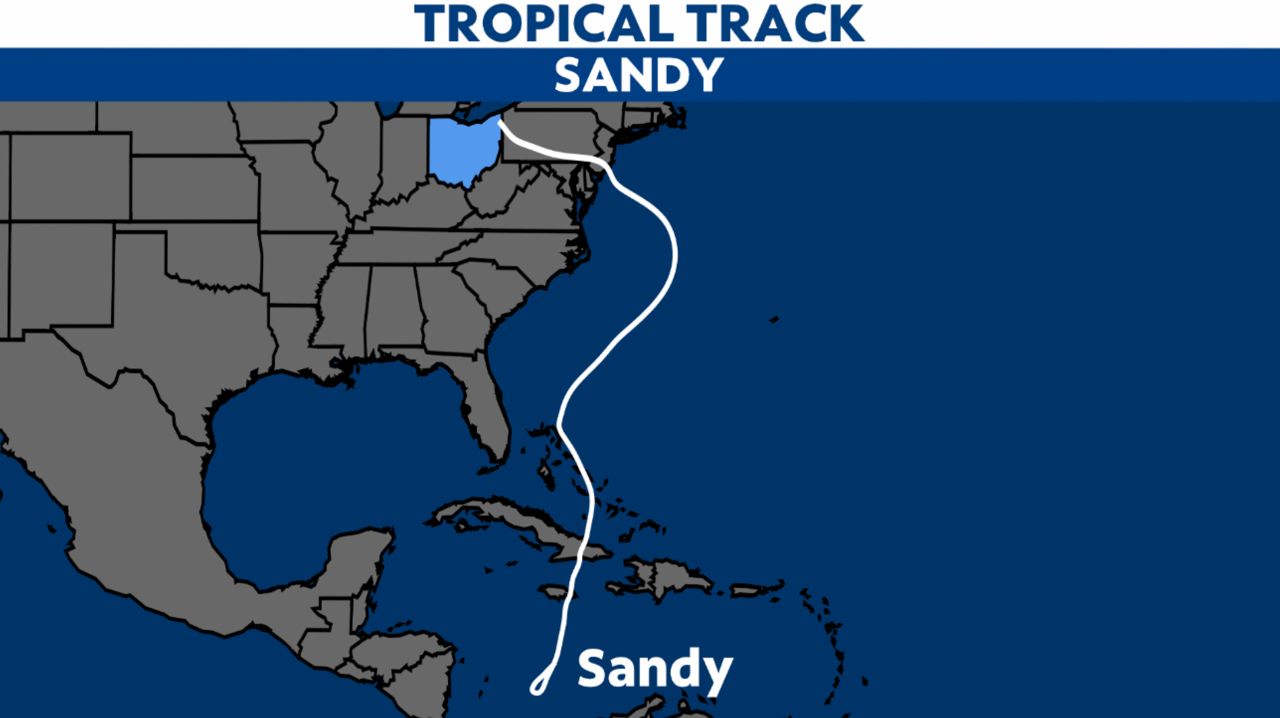
This storm also got the nickname “Frankenstorm” because the remnants of the system arrived in Ohio on Halloween of 2012. Besides the significant damage the storm did to New York and the Northeast, waves on Lake Erie jumped over 14 feet damaging or even sinking many boats in area marinas.
Heavy wind driven rain and even snow fell in northeastern Ohio as colder air got pulled in.
As you can see from this historical map of tropical system tracks that impact Ohio, most originate out of the Gulf of Mexico. This is because systems that track in this area can get picked up by the upper-level wind patterns across the lower 48 that help carry storms into our region.
One of the most impactful of those systems was Hurricane Ike.
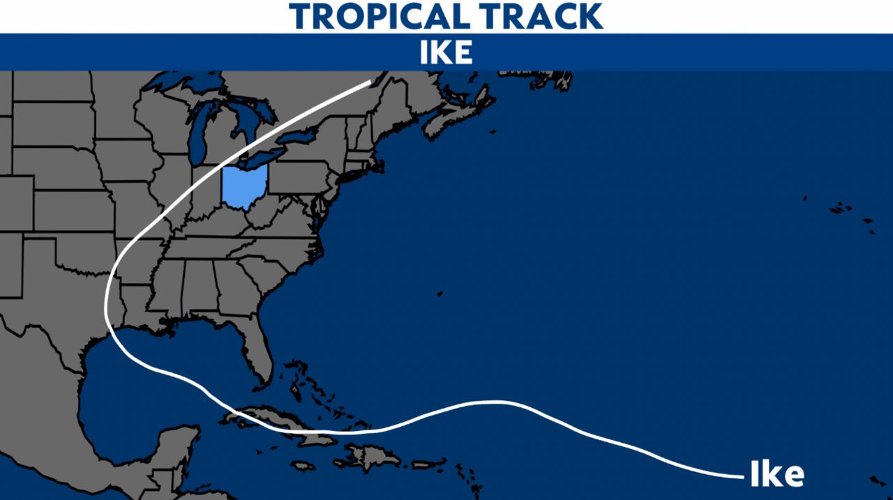
Ike was no longer a tropical system when it reached this far north, it maintained part of its upper-level wind field as it pushed into our area. The remnants of the system then merged with an incoming cold front, which seemed to intensify this wind field.
As the remnants moved over Ohio, abundant sunshine broke out across the region, which created strong mixing in the atmosphere. This mixing allowed for the strong winds aloft to move down to the ground, where damage occurred.
The strong winds knocked out power to 2.6 million people in Ohio alone, with 330,000 without power for over a week. Ike would go down as one of the costliest storms in Ohio history, costing over $1.25 billion in insurance claims.

So even though we are generally immune from hurricanes in Ohio, we have to pay attention to where their remnants end up.
Some big-named storms have wound up in Ohio, including Hurricane Katrina, which tracked right into central Ohio and rained itself out for nearly 30 hours.
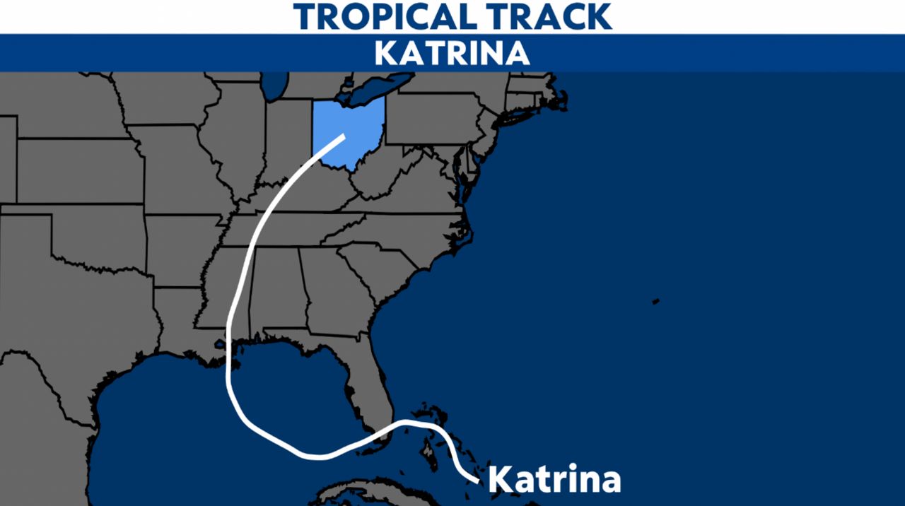
Katrina brought over 4 inches of rain to parts of the state. Because of the nature of tropical systems, they are typically efficient at rainfall production because of the size of water droplets.
Even though Ohio has been spared from any impacts from tropical systems the last couple of years. Remember that hurricane season runs from June 1 through Nov. 30. So, keep a close eye on where these systems are - and could be going over the coming weeks.
Our team of meteorologists dives deep into the science of weather and breaks down timely weather data and information. To view more weather and climate stories, check out our weather blogs section.