


Some showers and sprinkles are possible this evening and tonight, with northeastern Ohio having the highest chance of seeing raindrops. Otherwise it's a cloudy and milder night in the 40s and 50s.
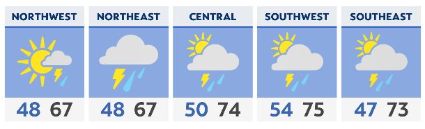
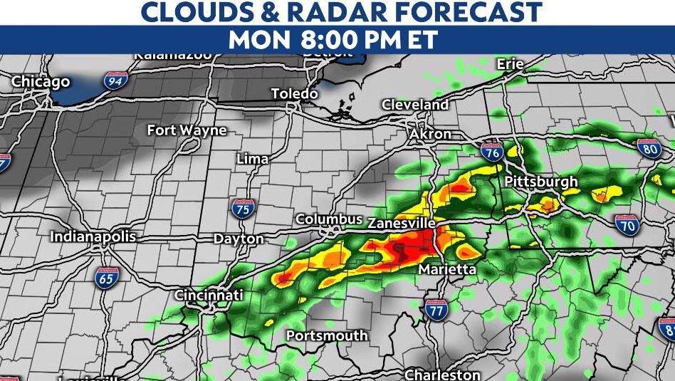
A cold front will then swing across the state Monday afternoon and evening. The result will be showers and thunderstorms and a risk of severe weather. This is especially true for locations along and east/south of the I-71 corridor.
If you live in northern and western Ohio, there's a solid chance you don't see any rain at all on Monday.
Those with the absolute highest chance of seeing damaging winds, hail and isolated tornadoes are locations east of I-71 and south of I-70. This includes cities like Athens, Zanesville, Marietta, Columbus, Logan, Chillicothe, Portsmouth, Lancaster, and Hillsboro.
Things will dry out Monday evening as colder air returns to the state. Expect blustery, chilly and cloudy conditions on Tuesday with a chance of showers and sprinkles. NE Ohio has the highest chance of seeing rain on Tuesday thanks to Lake Erie.
Unseasonably cool air will stick around on Wednesday with plenty of sunshine in the forecast. Temperatures then warm back up to end the week with 60s and 70s ahead of our next system.
Rain and storms will be possible Friday and during Easter weekend. The highest chance of rain during this period will be late Friday through late Saturday. Easter Sunday looks mostly dry at the moment.