


A batch of storms is possible as we say goodbye to summer.
What You Need To Know
- It will be hot and muggy on Wednesday
- A strong cold front will come in late
- Storms could produce all forms of severe weather, including brief tornadoes
- The main threat for severe weather is through 11 p.m. Wednesday
Highs will be in the upper 80s and lower 90s. Check your hourly forecast here.
Toledo may get close to tying their record high for Sept. 21, which is 93 degrees in 2017.
The higher heat and humidity with the approaching strong cold front will set the stage for some isolated to scattered severe weather. The highest chance will be roughly along and north of I-70.
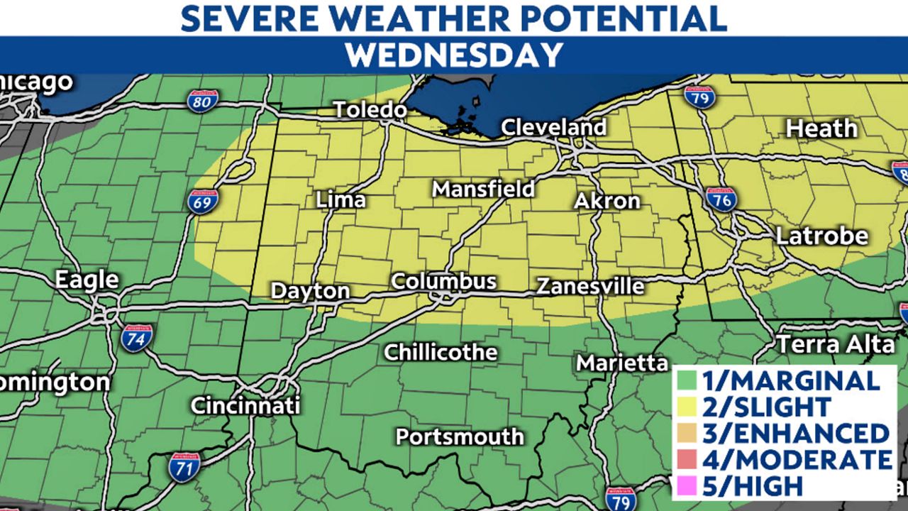
A level 2 of out of 5 risk for severe storms is in yellow, with a level 1 out of 5 for areas in green.
All forms of severe weather are possible. The main threats will be damaging winds and large hail, but a few brief tornadoes are also possible. The main window will be through 11 p.m. Wednesday.
Turn on your weather notifications in the Spectrum News app to stay ahead of storms.
Storms will diminish overnight, but much cooler air will come in for Thursday and Friday.
Highs will be in the 60s with overnight lows in the 40s to end the week.