


Temperatures, humidity and the threat for severe weather are all going up today.
We will see afternoon highs peak in the lower to mid-90s, but heat index values will be near 100 degrees.
All of this heat and humidity will make things very unstable as a cold front comes in tonight.
-1)
Most of the state is under a slight risk for severe weather (level 2 out of 5).
Strong to severe storms will begin around 4:00 p.m. this afternoon.
-3)
Although you'll need to stay weather-aware through midnight.
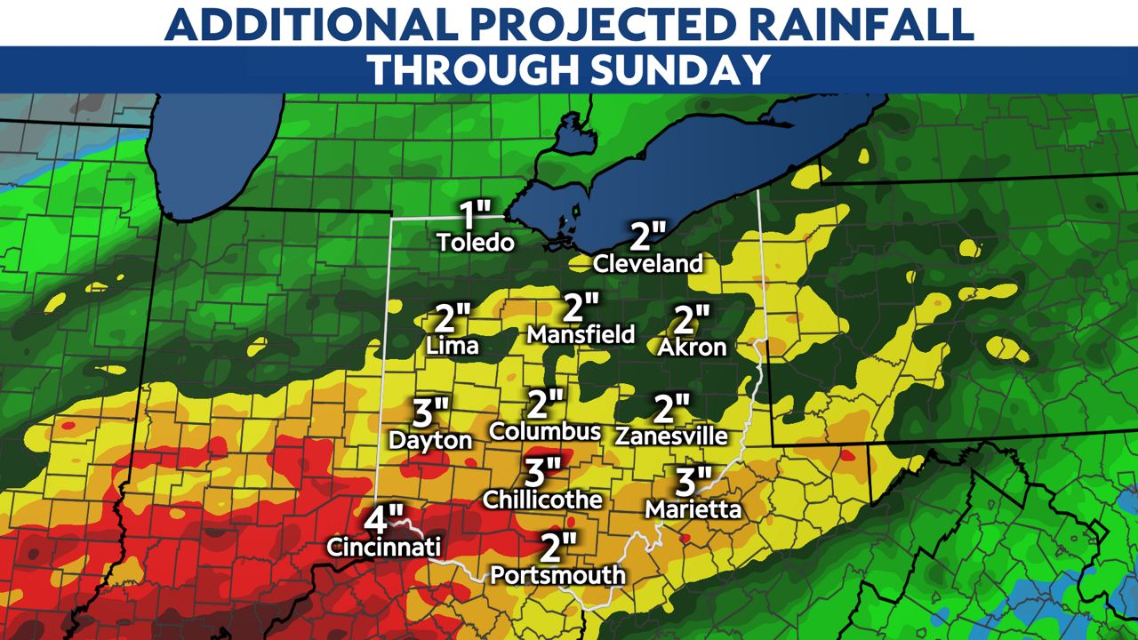
Storms could produce damaging winds, tornadoes and even flash flooding.
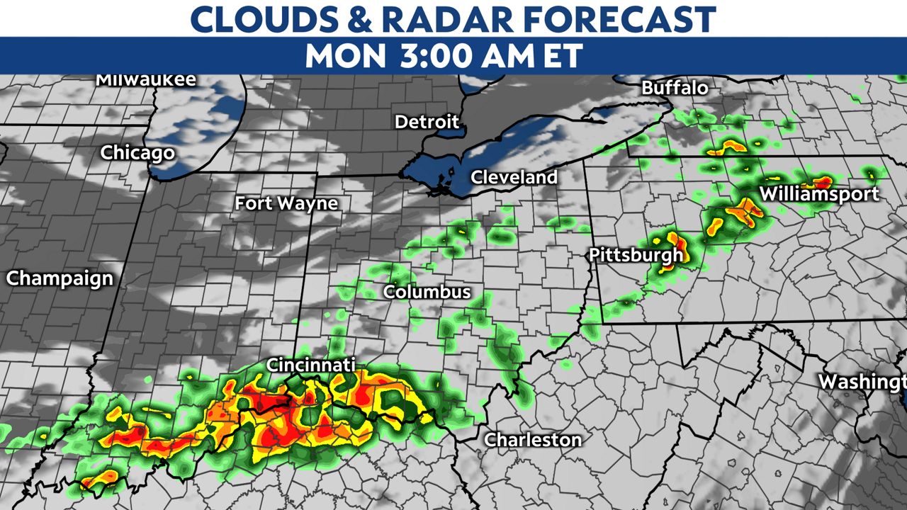
Strong, gusty storms will head into southern Ohio overnight before conditions finally begin to improve once the front clears the region.
This cold front will make a big difference in our weather pattern. Temperatures will cool down by about 10 degrees by Monday afternoon.
Even though we will lose the high heat and humidity in the upcoming workweek, stormy weather will stick around. Widespread rain and storms are possible both Wednesday and Thursday afternoons.