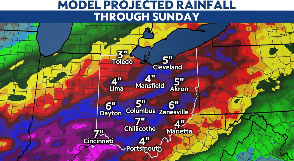
We're falling into fall with a major cold front today, which will impact the entire Ohio valley.
It's a varying forecast with our first blast of cooler air and the coolest we have been since May! As this front will open up the doors to cooler shots of air in the upcoming months, it also brings rain, storms and wind through tonight.
There have been 1-2 inches in parts of NW Ohio from overnight and morning rain, and we aren't finished. Additional rain, heavy at times, increases the flooding threat in those areas.
A Flood Watch is in effect through tonight/early Thursday morning for northern and western Ohio. Rainfall totals could be between 2-4 inches, but some spots potentially could receive up to 6 inches by Thursday.
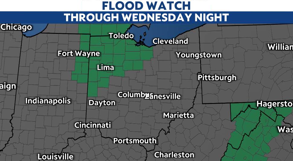
Remember, if there's water on the roadway: Turn around, don't drown.
Roads will likely be wet all day throughout Ohio, so allow extra time for travel and drive slowly, especially at night.
Areas in western Ohio cool down first, with widespread rain continuing into tonight. By this afternoon, temperatures will be in the 50s for western Ohio.
It's a different and warmer forecast for eastern Ohio as the potential for afternoon and evening storms along the passing cold front could be severe.
Severe chances are possible for eastern and central Ohio, with a marginal and slight risk in place today.
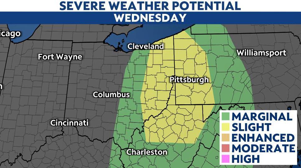
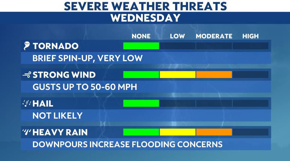
Stay weather aware as storms that fire up along the front could produce gusty winds and downpours that could impact visibility. There's also an additional concern for flooding with heavy pockets of rain.
Highs push the 70s in eastern Ohio, whereas areas in western Ohio are much cooler later today in the 50s!
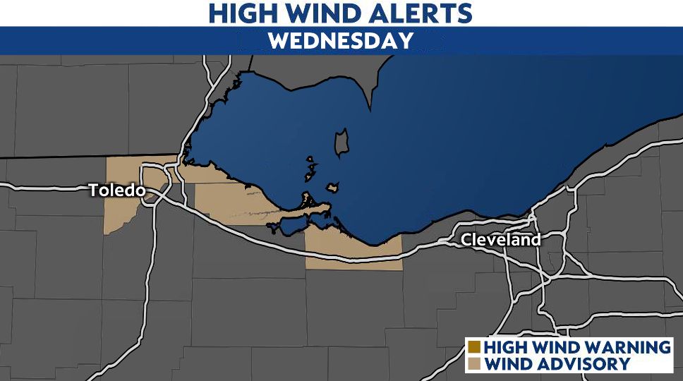
Winds also pick up along the front. There's a Wind Advisory for areas along Lake Erie in between Toledo through Sandusky as gusts could approach 45 mph into this evening.
It won't be long before all of us experience that blast of cool air by tonight after the front exits. Expect blustery conditions as the temperatures fall into tomorrow.
Widespread rain and storms become more scattered and eventually lighter through Thursday.
Thursday will be the coolest day we've had since May! Dress for highs to stay in the 50s to barely lower 60s.
Clouds linger most of Thursday with on-and-off light showers.
The good news is our weather drastically improves heading into the weekend, with sunshine and 70s and some showers possible Saturday.


