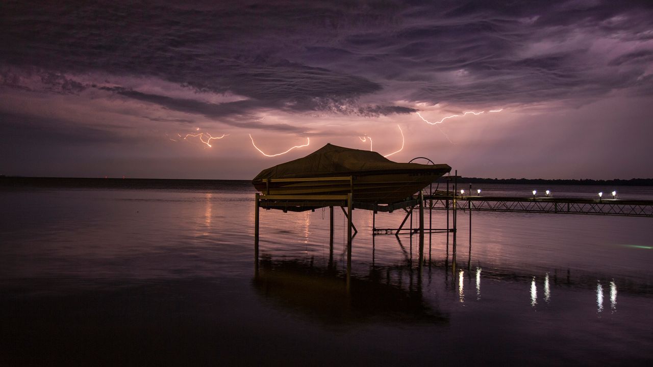
“Summer weather” might make you think of hot temperatures and lots of sunshine. That’s true, and it influences severe weather patterns this time of year.
Much of the United States east of the Rockies has at least some historical odds of severe weather at the start of meteorological summer. They’re highest in the Plains, sprawling east into the Ohio Valley and southern Appalachians, similar to most of spring.
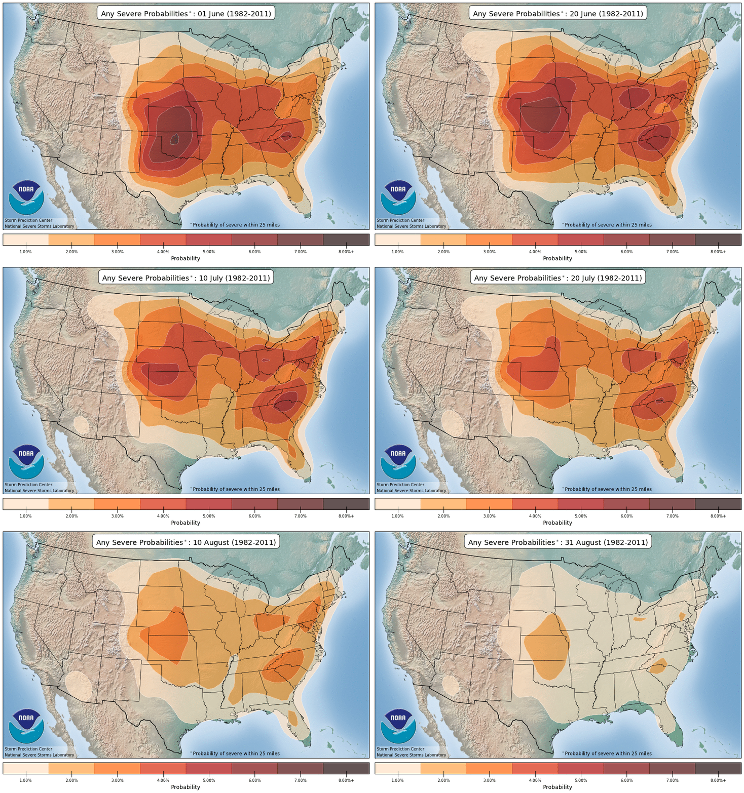
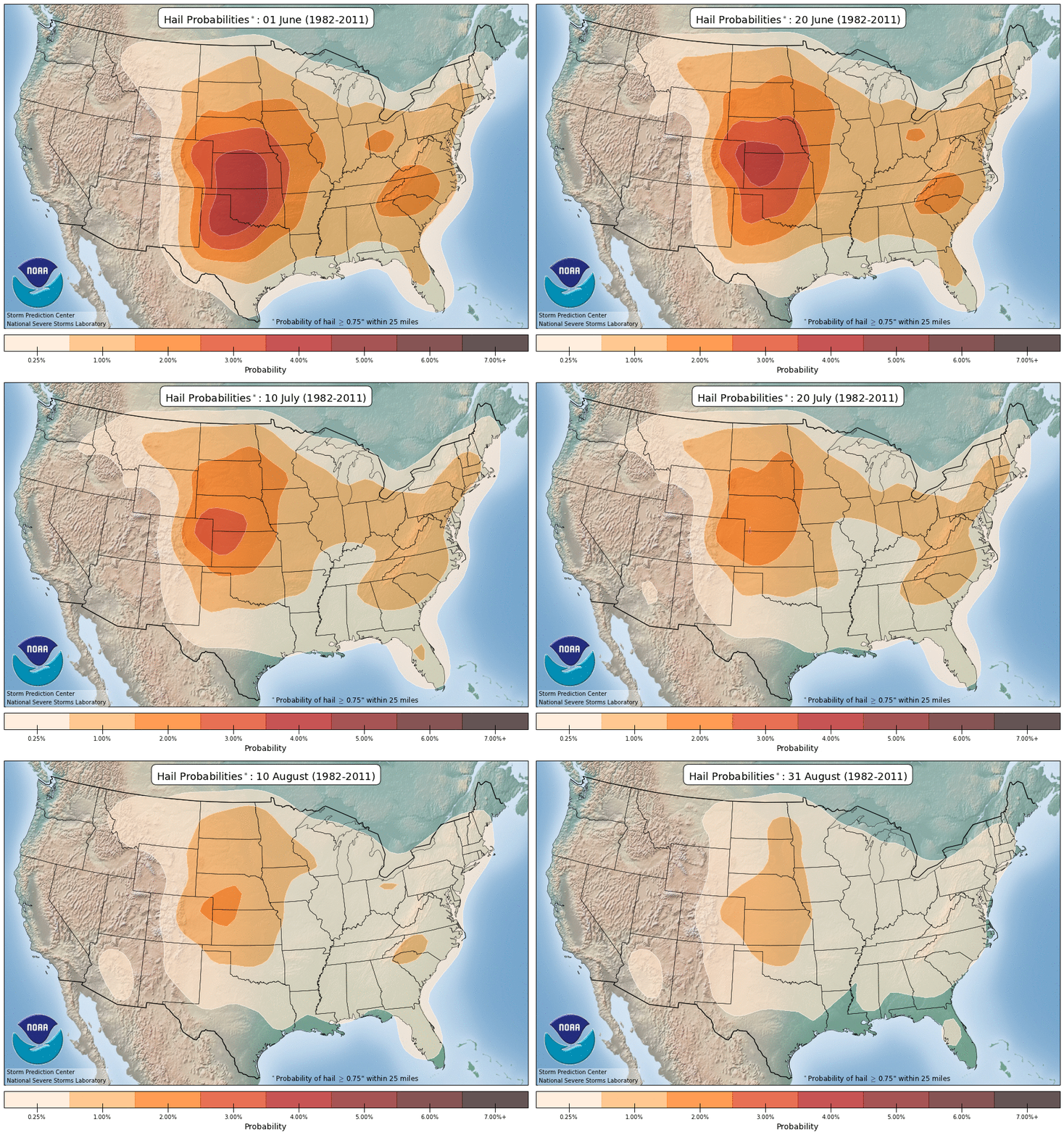
By early July, some of the highest odds shift north a bit. As the summer wears on and July turns to August, the overall odds of severe weather diminish. The ingredients needed for big thunderstorms aren’t as common as heat takes over and winds aloft relax.
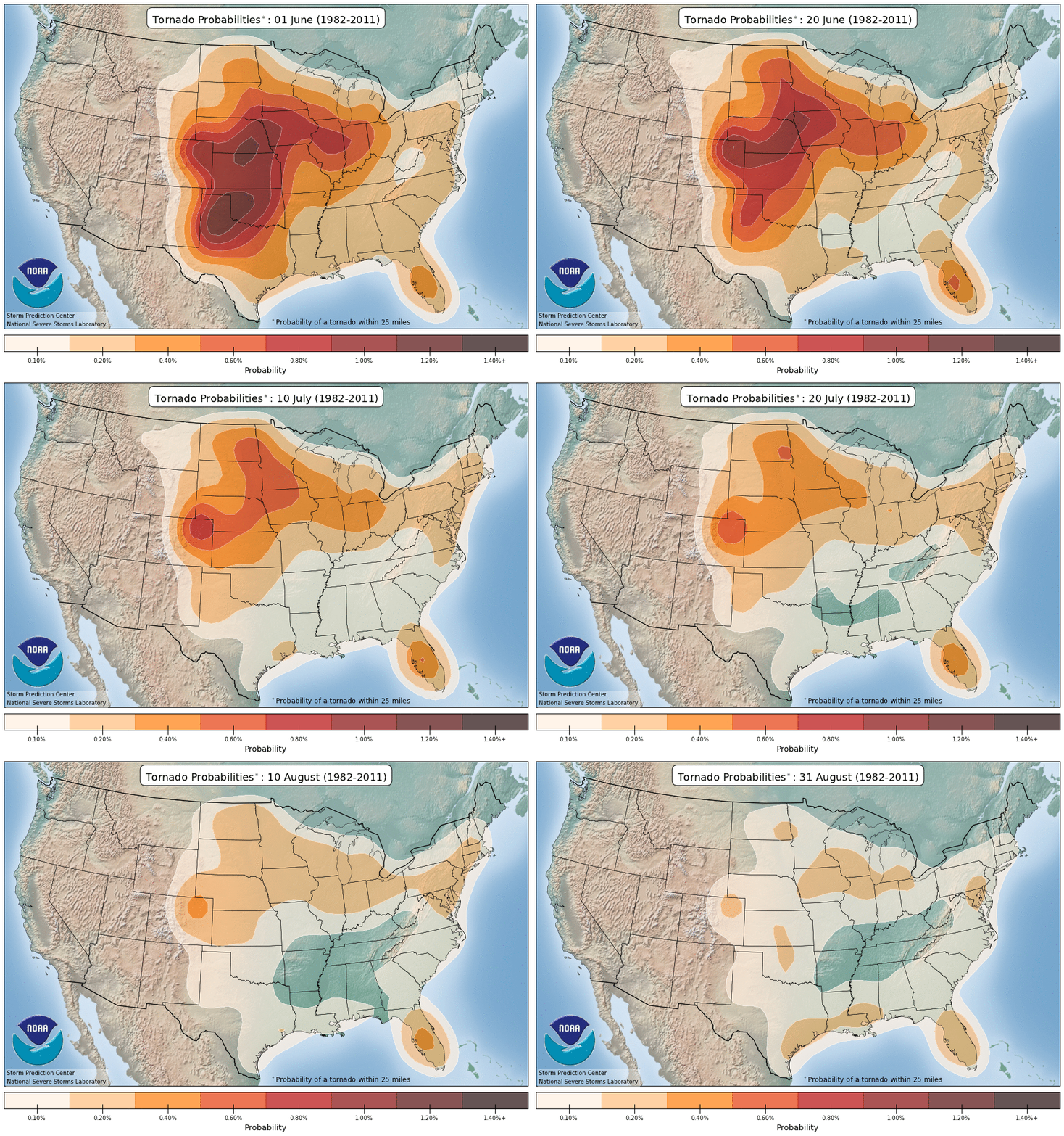
The greatest tornado activity is over the Plains and Midwest. The Florida peninsula also shows up, thanks in part to waterspouts and the occasional landfalling tropical system. Over time, the tornado chances really shrink across the country.
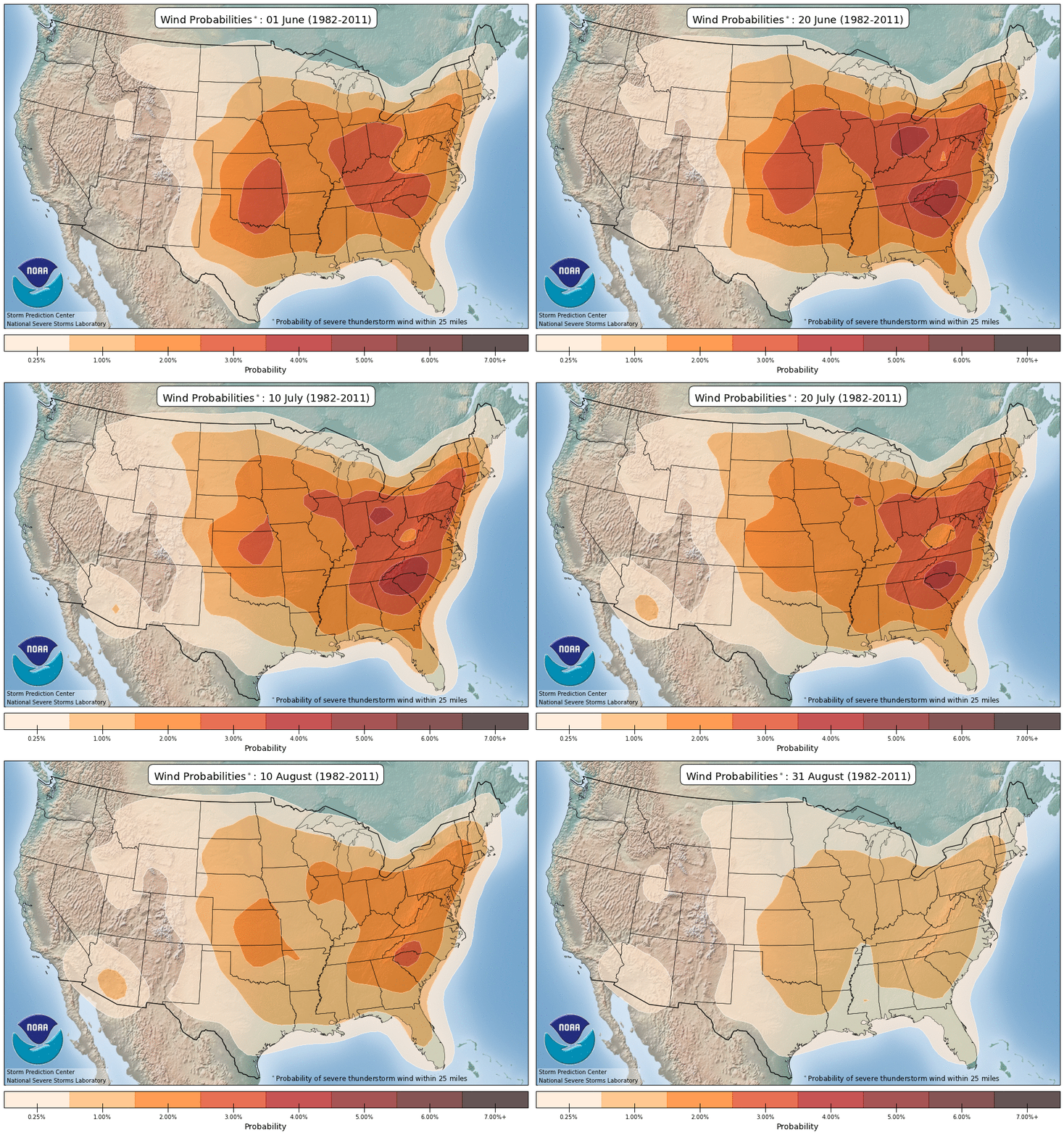
Strong winds follow a different pattern. They’re most common over the Midwest, Ohio Valley and either side of the Appalachians. The odds remain relatively high all the way into August over the eastern U.S. In the depths of summer, storms tend to gather into organized clusters around the edge of the hottest weather, tapping into the high amounts of moisture that are sitting around.
Hail-producing storms need cold air aloft, and that isn’t as easy to come by as the summer goes on. While large hail does often happen at the start of summer, especially in the Central Plains, the chances shift northwest into July. The higher elevations near the Rockies allow the storms to tap into what cold air does remain well above our heads.
Even though the historical odds of severe weather go down over the summer, you can’t let your guard down. The outer bands of tropical storms and hurricanes often bring tornadoes that spin up quickly, and thunderstorms can tap into the heat and humidity and become destructive windstorms known as derechos.


