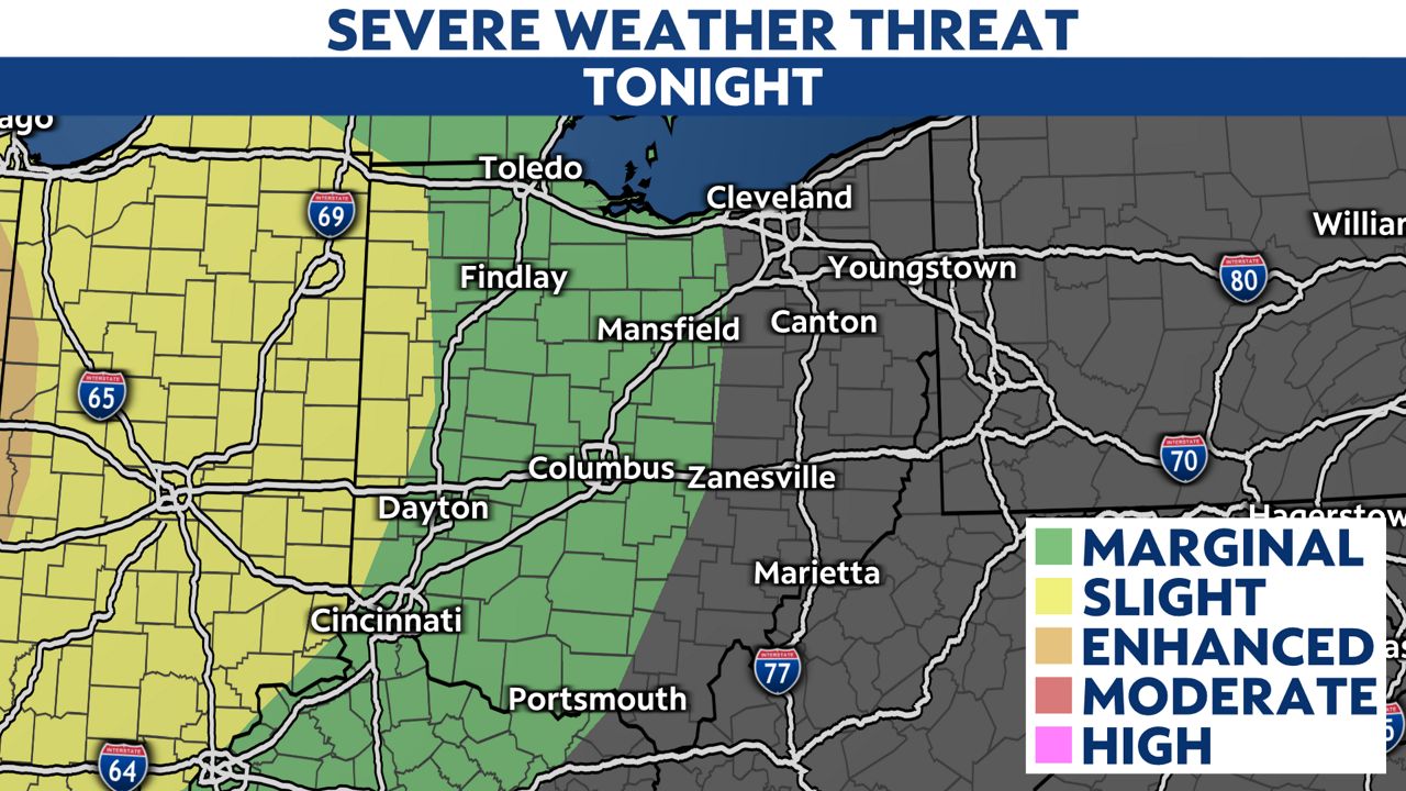
OVERVIEW: Storms and heavy rain move across the Ohio valley into early Friday morning. Flash flooding is our primary concern with heavy rain overnight.
Allow extra time Friday morning roads could be wet from overnight rain. Round 1 is tapering off throughout Friday morning, and moving off to the SE. There will be a lull in activity around mid day, but then more scattered showers and storms developing Friday afternoon into early Friday night which will be the second round of activity expected. The severe weather potential will shift toward mid, eastern and southeastern Ohio especially. Like the first round, threats with severe storms include strong wind gusts, heavy rain, and hail.
Temperatures range across the state...western and south Ohio will reach the low 80s this afternoon however cooler conditions are expected to the north near 70.
Heading into our weekend the warm front lifts north, so summer-like temperatures surge across the state. It'll feel like summer as dew points climb as well!
Looking into Saturday, there's a pop up showers, few storms in northern Ohio, but further south should be mainly dry. Highs climb into the 70s and middle 80s. Sunday is even warmer as highs for the entire Buckeye state reach 80s. Our next storm system pushes in late Sunday into Sunday night with more storm chances. Some could be strong to severe storms wrapping up the weekend. Quiet weather returns by Monday.
Friday morning- Mainly flash flooding as severe threat continues to diminish.
Watch for heavy rain and lightning into Friday morning as cluster of storms tracks south.
Friday-Round 2 of storms develops Friday afternoon and into early Friday night. Severe risk shifts toward mid and southeastern Ohio especially. Threats include gusty winds, hail, and heavy rain.
Saturday-Highs in the 70s to middle 80s! Warm and humid, feels like summer. Chance of showers, few storms mainly north...otherwise most are sunny and dry.
Sunday-Warmest day yet! 80s across the board! Even pushing upper 80s far south! During the day looks sunny and dry, our next chance of storms develops late day. And increase into Sunday night.
Monday-Cooler. Partly sunny with highs in the middle and upper 70s.
Tuesday-Partly sunny and more seasonable. Highs in 60s and 70s.