

FLOOD POTENTIAL GROWS-
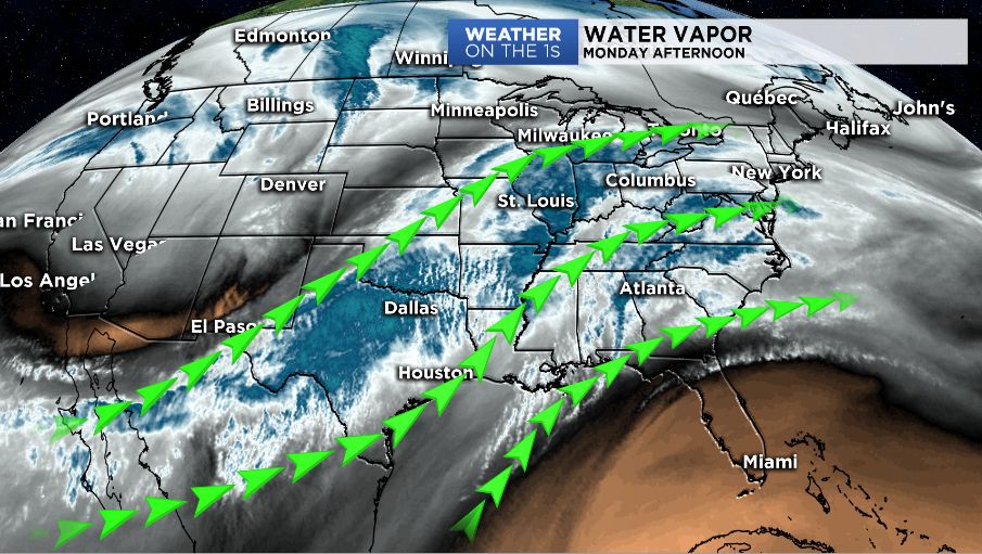
Already, there are numerous flood warnings along various rivers across Ohio, including the Ohio River between Cincinnati to Portsmouth. The number of flood warnings is expected to grow through midweek. More heavy rainfall will push into the state Monday afternoon and last into Tuesday. The latest models show another 1-2" of rain is likely. While the amounts may not seem all that high, the ground is totally saturated and the water has no place to go but to run off into area rivers and streams.
A blast of cold air will follow the rain on Wednesday leading to widespread snow showers. Strong winds are also expected behind the front with wind gusts as high as 50mph possible. The strong winds could combine with snow showers to lead to actual snow squalls across parts of the state. A snow squall is a sudden moderately heavy snow-fall with blowing snow and strong, gusty surface winds. It is often referred to as a whiteout and is similar to a blizzard but is localized in time or in location and snow accumulations may or may not be significant.
Just as fast as temperatures drop for midweek, the weather will whip-lash back into milder than average temperatures Thursday into Friday with yet another round of moderate rain to end the week. Temperatures will then tumble again for the weekend with another chance for snow showers.
Hang on to your hats - it'll be another wild weather week!