

OHIO — The weekend ahead is active as our pattern changes. Sunday has the highest chance for severe weather.
We are expecting a wave of morning rain early Sunday, widespread activity gives us a wet start to the day. As the rain tapers off for most by lunchtime, there's some dry time in the afternoon.
It's windy and warm, otherwise, ahead of the front as highs reach the 70s again. Some southern spots push 80.
Any breaks in the clouds during the afternoon could add to the instability in the afternoon with daytime heating before the storms arrive into Ohio.
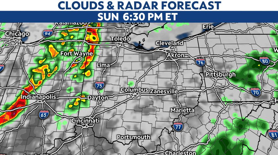
Another wave of rain and storms develops off to the west and pushes through Indiana by Sunday afternoon-evening.
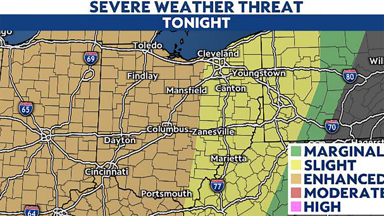
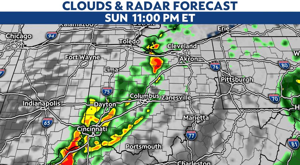
The line of storms reaches western parts of Ohio late Sunday with the threat of severe storms along the boundary.
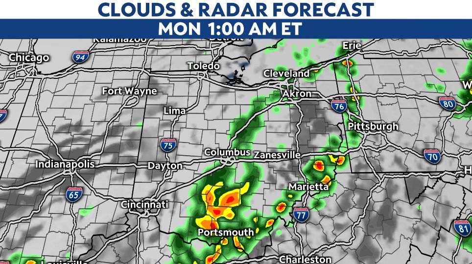
After midnight, storms track east in central and eastern Ohio late Sunday night. This line of storms will be weakening a bit but still capable of producing several strong/severe storms overnight.
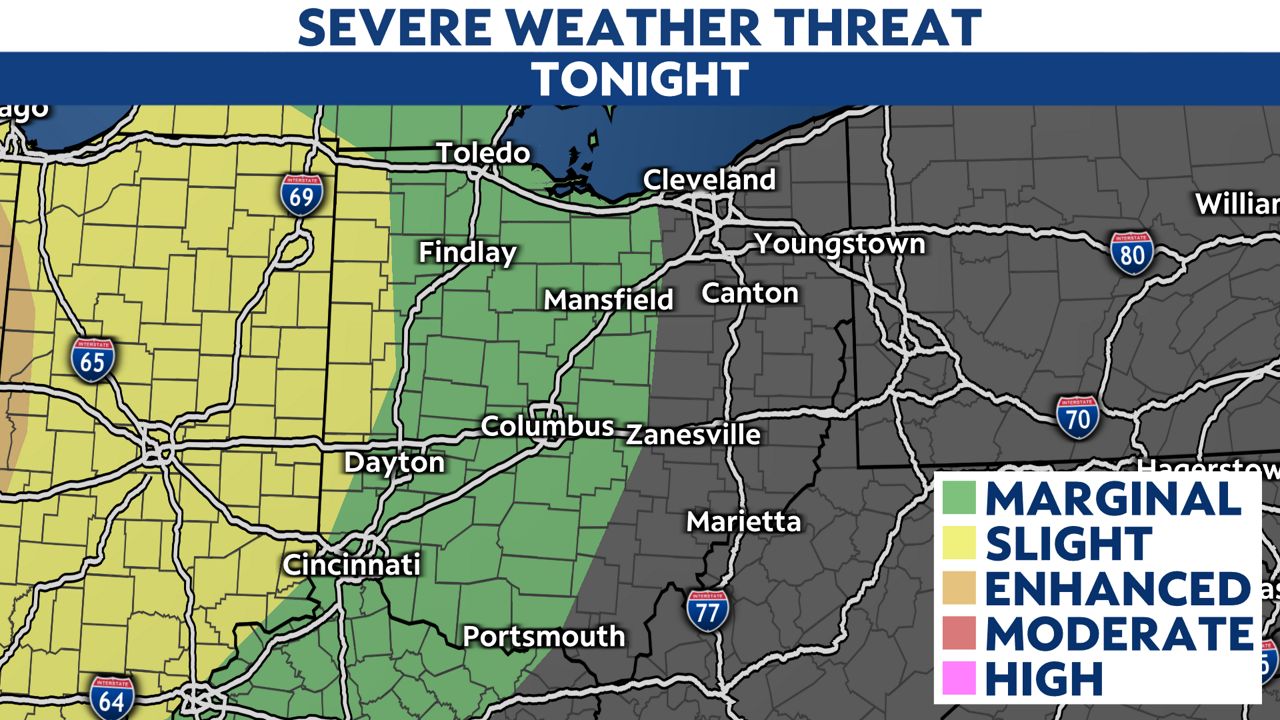
Eventually by Monday morning, our local threat for severe weather diminishes with mainly rain chances early in the day as temperatures begin to dip. We'll fall back into the 50s early next week.

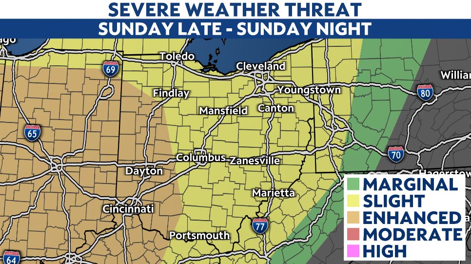
The severe threat for Sunday evening into night is higher for western Ohio. Severe storms could produce damaging wind gusts, hail and lightning. We also can't rule out an isolated tornado possible.
Heavy rainfall is also possible at times.
Time to plan ahead for the severe weather threat, especially with most of the activity expected overnight.