


We are going to get a true taste of winter heading into next week!
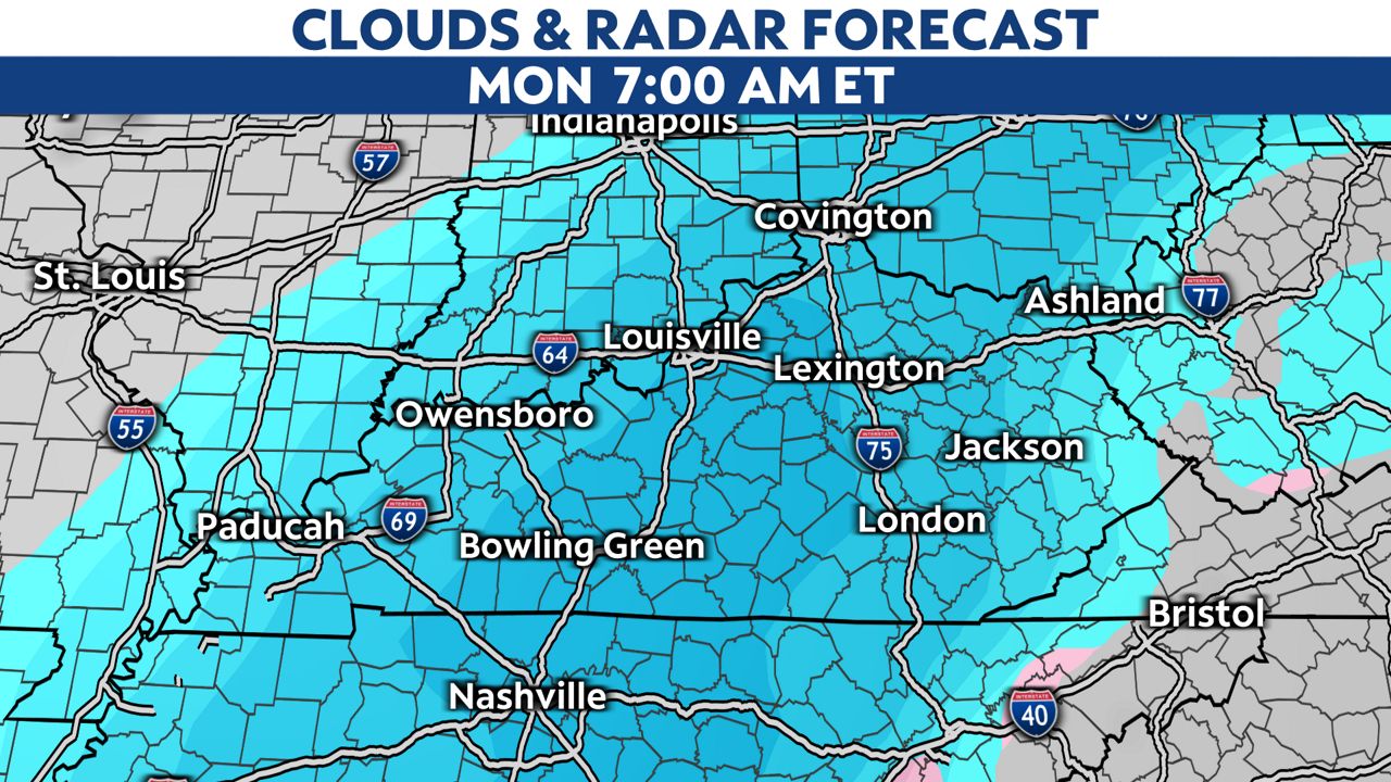
An arctic front will move through from late Sunday into Monday of next week.
It will be cold enough to produce all snow for the area and accumulating snowfall will be possible.
With this system still five days out, it is too early to talk about how much snow we will pick up.
But, it's certainly a system we will watch over the coming days.
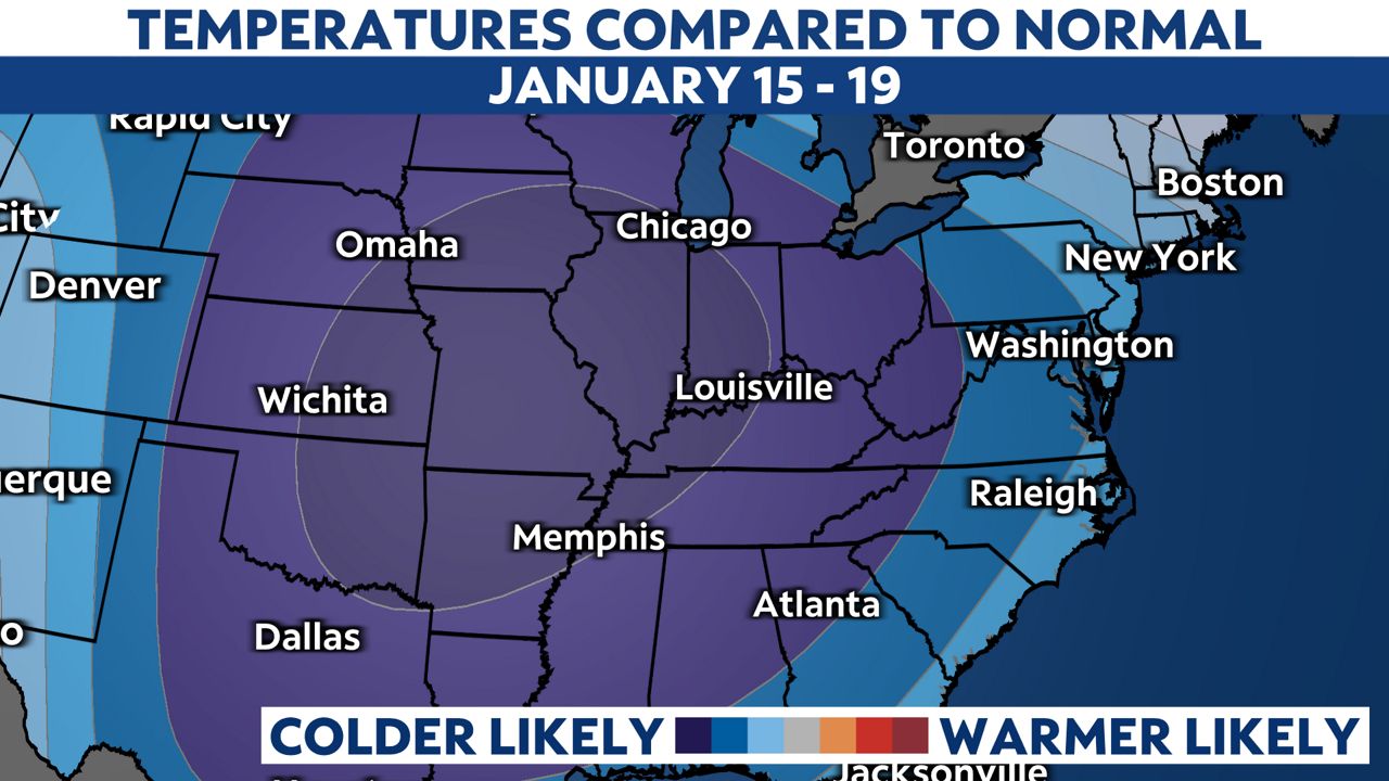
The bitterly cold air will quickly build in behind the front. It will be the coldest air of the season so far.
The Climate Prediction Center almost has us in the bullseye of the colder-than-average temperatures.
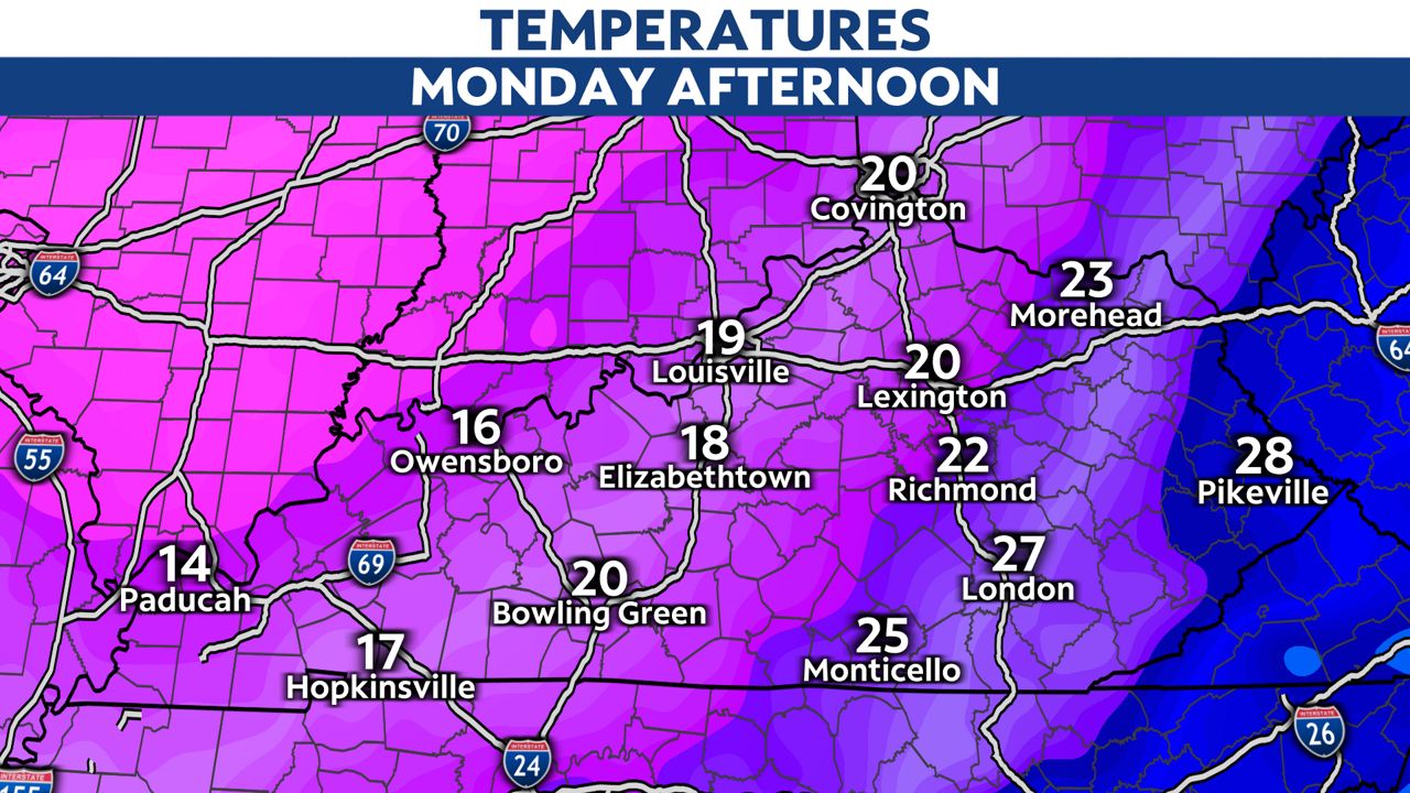
So, how cold are we expecting to get?
Right now, it looks like afternoon temperatures will only climb into the teens and lower 20s.
Overnight lows will dip down into the single digits.
With the cold here for most of next week, the snowpack will likely stick around.
Right now, it doesn't look like we will get back above freezing until the following week.
Our team of meteorologists dives deep into the science of weather and breaks down timely weather data and information. To view more weather and climate stories, check out our weather blogs section.