


Thunderstorms will be scattered Sunday morning with more thunderstorms developing in the evening and first part of Sunday night.
Sunday morning a few showers and thunderstorms will be possible with a sunshine during the afternoon hours.
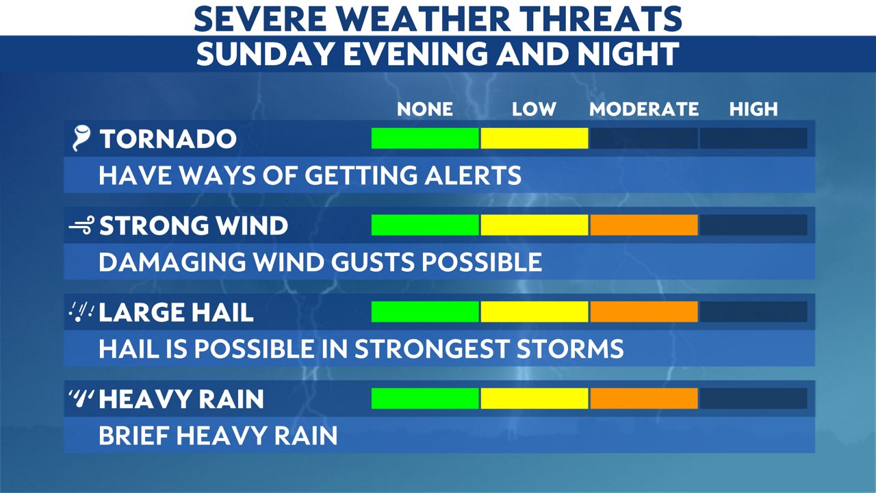
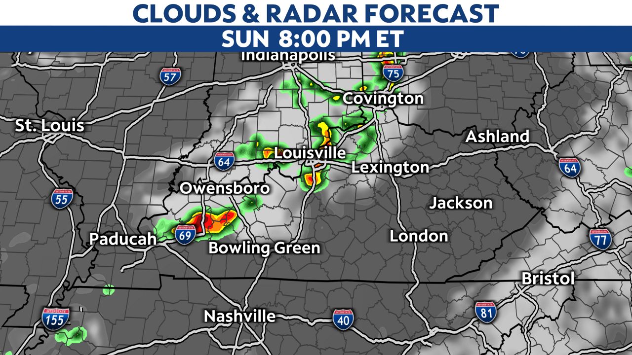
The evening and overnight, another round of thunderstorms will be likely. This round has the best chance of turning severe with wind, hail and a tornado as well.
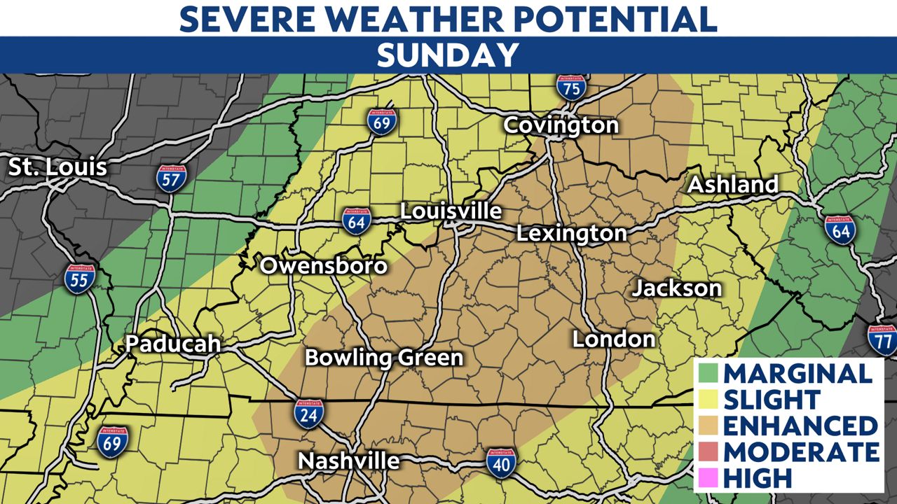
The Storm Prediction Center has put most of Kentucky under a a level 3 or enhanced risk for severe storms Sunday.
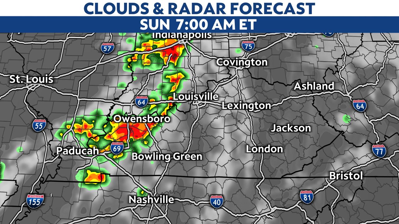
The first round of thunderstorms will be likely in the morning hours. Heavy rain, wind and small hail will be possible with the storms.
The midday hours will be mostly sunny, warm and humid with highs in the upper 80s to even mid-90s in southwest Kentucky. This will be the fuel for the storms in the evening. This is why severe weather will be possible later Sunday into Sunday night.
Our staff of meteorologists are here to bring you the latest updates as necessary.

Stay weather aware and prepare ahead of time before severe storms arrive. Sign up for weather notifications to receive the latest weather updates, and keep up with this article for the latest details on this event.
Our team of meteorologists dives deep into the science of weather and breaks down timely weather data and information. To view more weather and climate stories, check out our weather blogs section.