The threat for heavy rain and storms will last through Friday.
A slow-moving front moved in from the north overnight and will continue to affect us today. Our biggest concern will be heavy rainfall.
During the afternoon on Friday, our flooding threat will continue to go up. Heavy rainfall will be likely with a few thunderstorms. The severe weather threat looks low during this time.
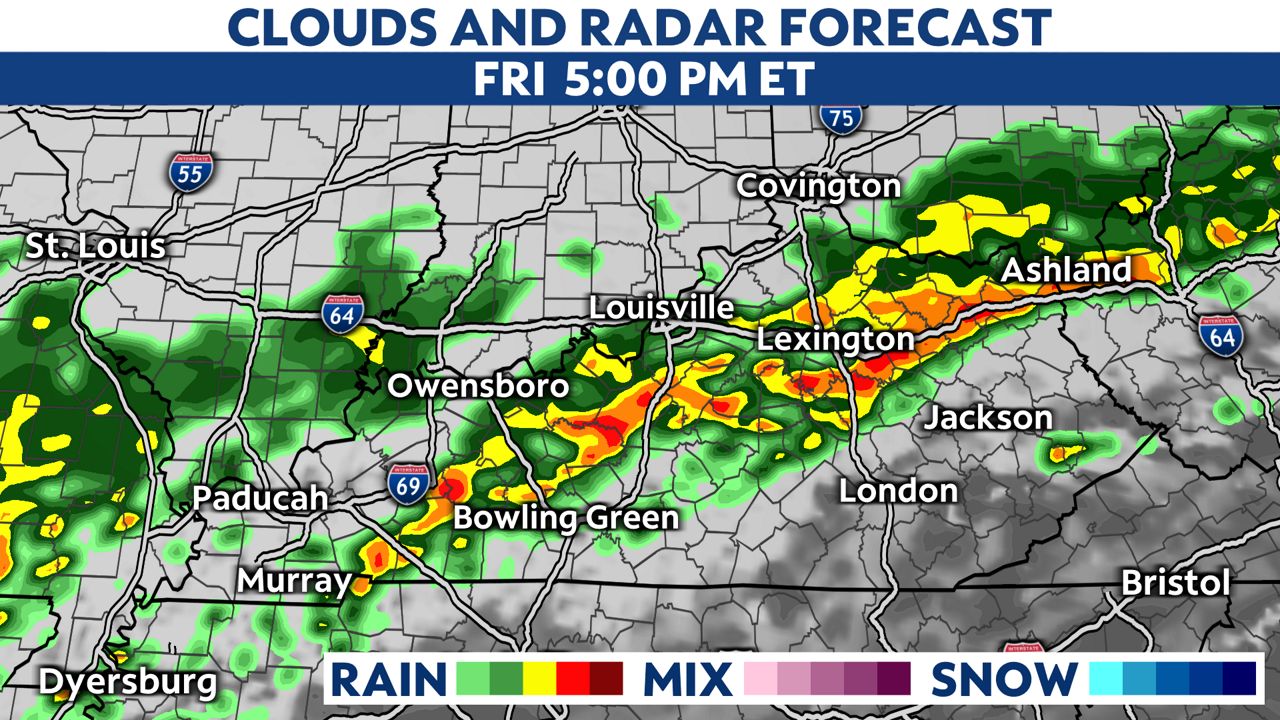
Our best chance for strong to severe storms will arrive with the passage of the cold front. This will happen after 9 p.m. in western Kentucky.
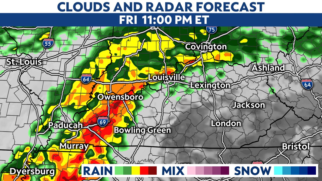
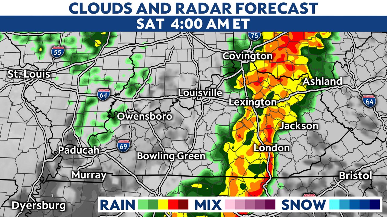
The heavy rain and storms will depart early Saturday morning.
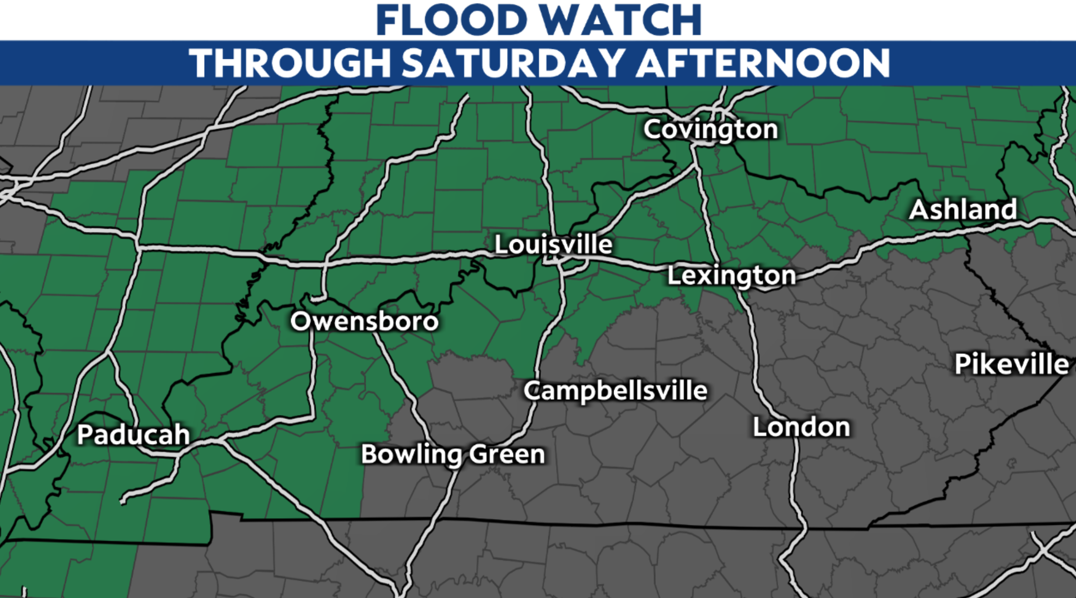
With the prolonged period of heavy rainfall ahead, a Flood Watch is in place for the northern and western part of the state. The watch will continue through Saturday.
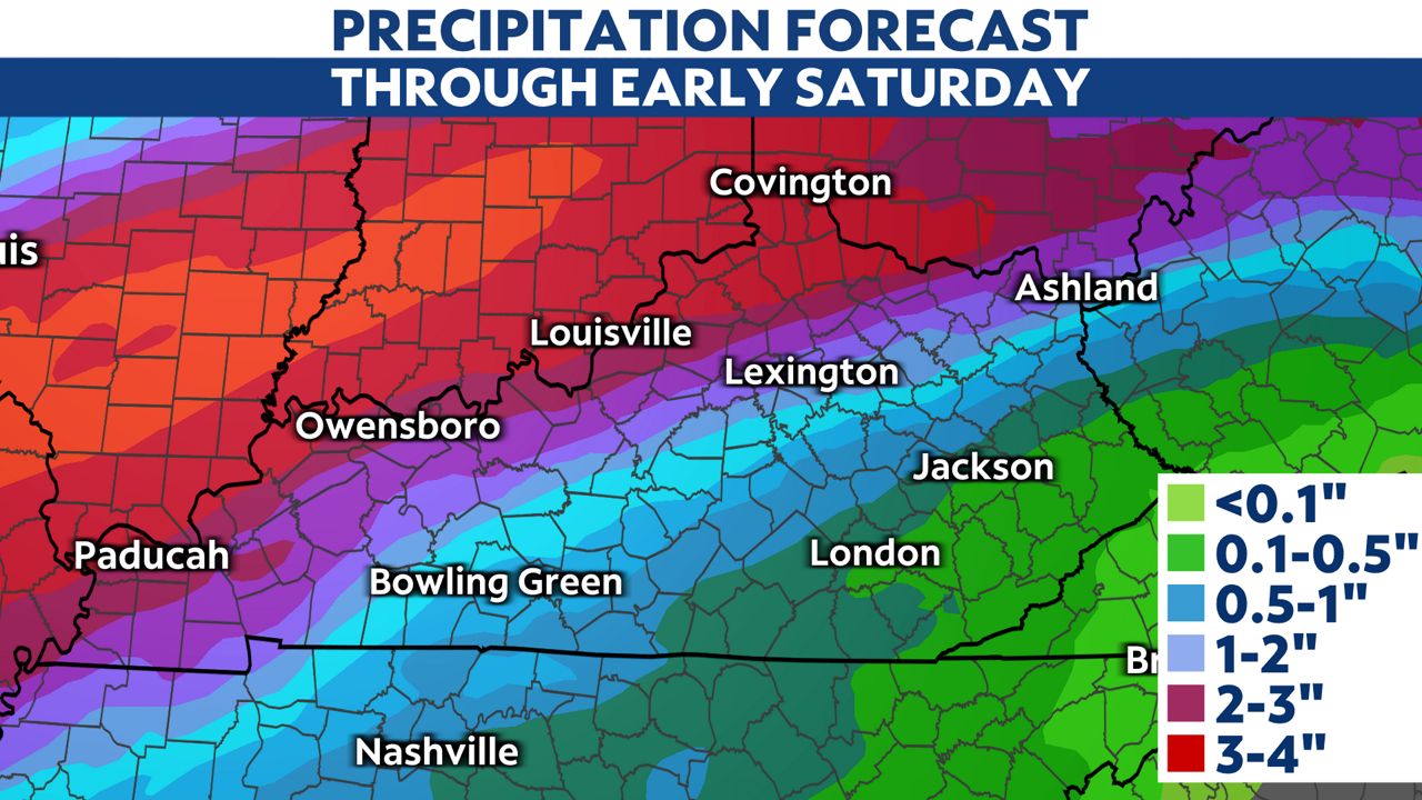
The highest rainfall totals will fall along the Ohio River and north into Indiana, where 2 to 4 inches of rain could fall. Slightly lower amounts are expected in central and southern Kentucky.
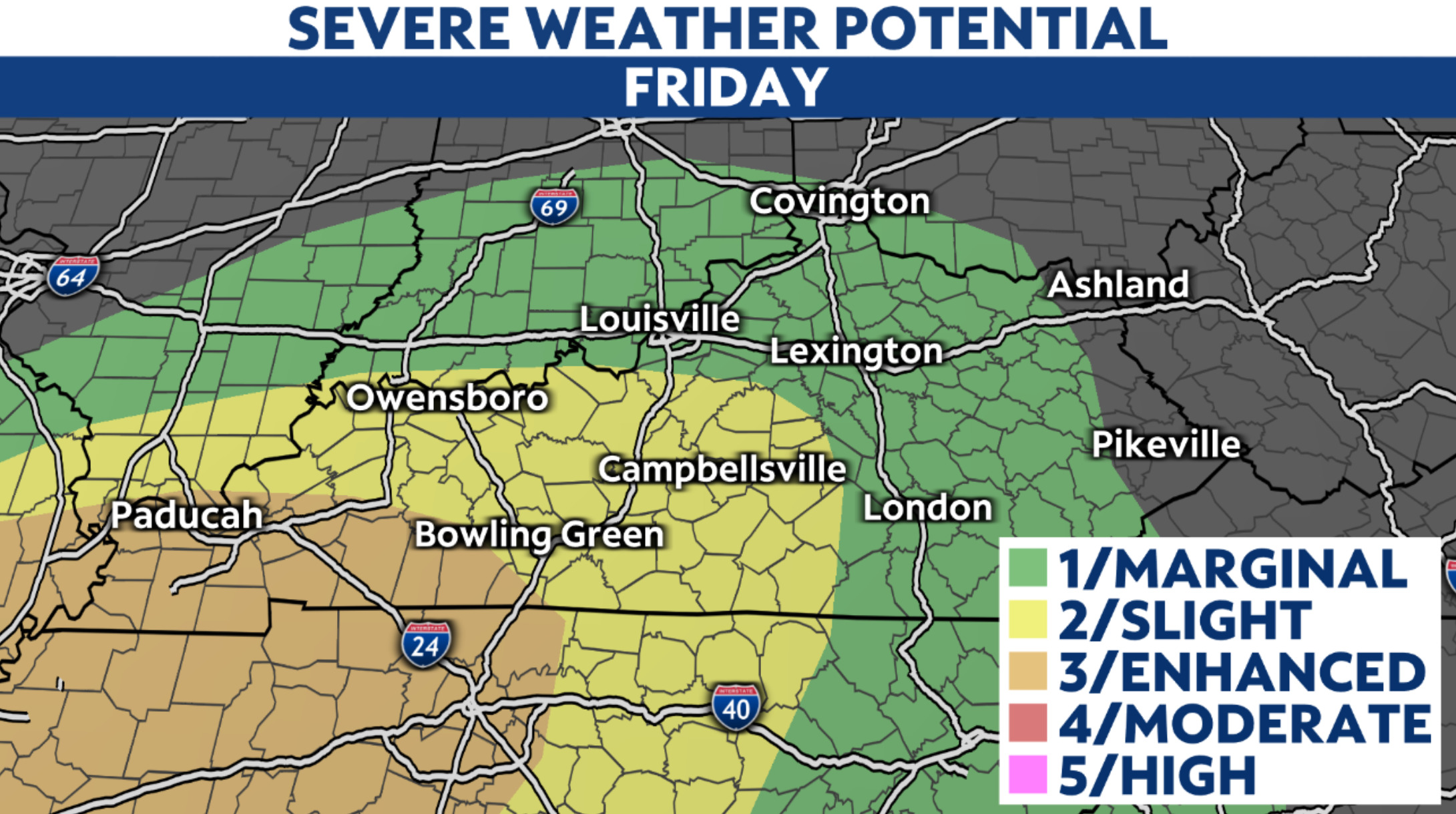
We are also keeping an eye on strong to severe storms Friday night with the cold front.
The Storm Prediction Center has an enhanced risk of severe storms for southwestern Kentucky and a slight risk for the central and western half of the state. The primary concerns will be damaging wind gusts and an isolated tornado threat.
Our team of meteorologists dives deep into the science of weather and breaks down timely weather data and information. To view more weather and climate stories, check out our weather blogs section.


