


A strong storm system will affect Kentucky throughout the day.
Today is a day to be weather-aware with a potent system arriving from the southwest.
Pockets of moderate to heavy rainfall will be possible this morning, which may lead to flash flooding.
The severe weather threat early this morning is low. But, the rain will slow you down for your commute to work.
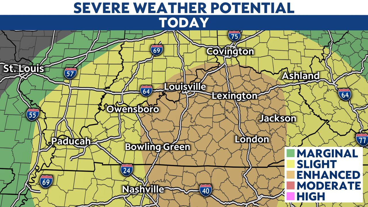
The Storm Prediction Center has the entire state under at least a slight risk for severe storms developing today. Parts of central and eastern Kentucky are under the higher enhanced risk.
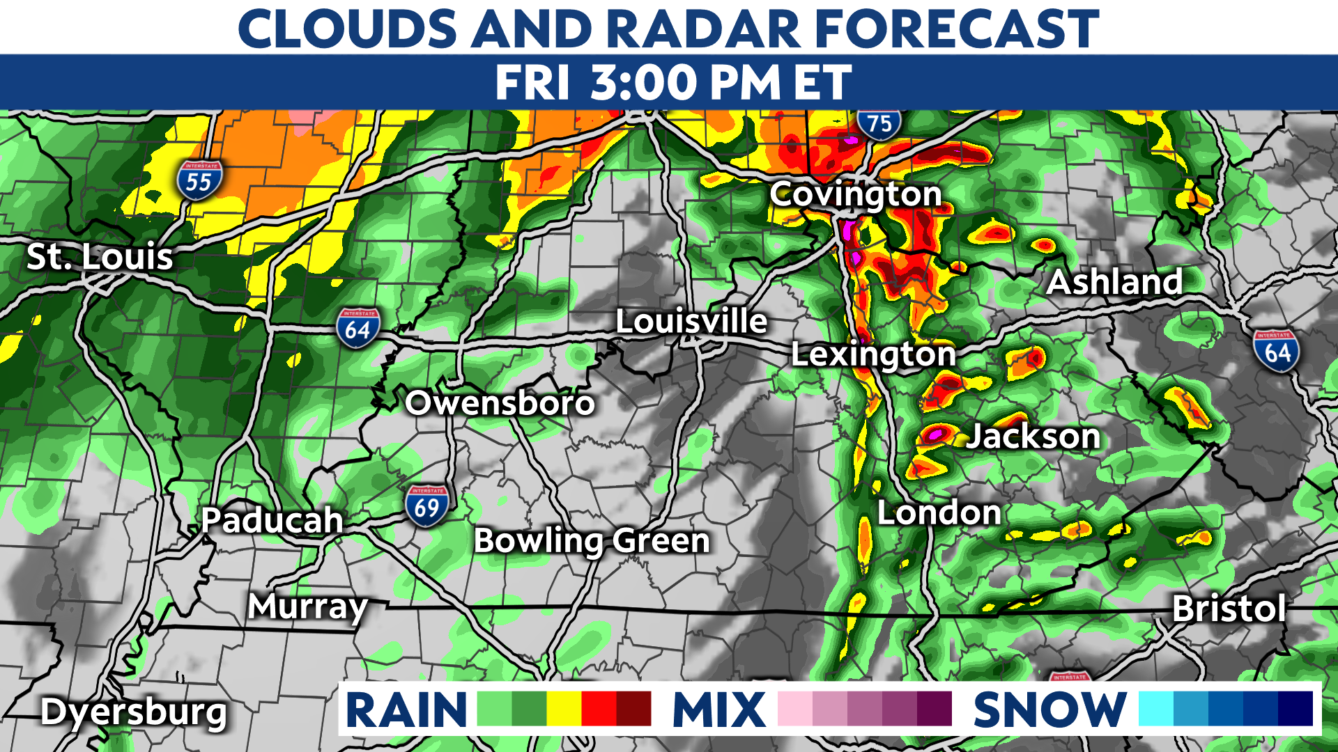
Our severe weather threat goes up later this morning through mid-afternoon with a cold front working from west to east across the state. Strong to severe storms could bring damaging wind gusts and isolated tornadoes.

The storm threat moves east between 3 p.m. and 5 p.m. We will be left with clouds and a few lingering showers late in the day.
Outside of any thunderstorms, the wind will be very strong throughout the day.
A Wind Advisory is in place for most of Kentucky, with wind gusts of 45 to 55 mph possible. Gusts over 55 mph are very possible in parts of central and eastern Kentucky, where a High Wind Warning is in place. Widespread power outages are expected within the High Wind Warning area.

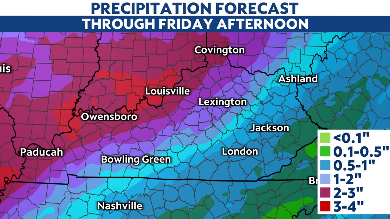
We will also be on the lookout for a flooding threat, especially in the northern half of the state.
A Flood Watch is in place through this afternoon. Rainfall amounts will be between 2 to 3 inches.
Locally higher amounts will be possible north and northwest closer to the Ohio River.
Our team of meteorologists dives deep into the science of weather and breaks down timely weather data and information. To view more weather and climate stories, check out our weather blogs section.