


Unseasonably chilly air will settle into Kentucky this weekend and stick around for a while.
A potent cold front will swing through the area later in the day Friday, bringing a big shift in temperatures. All of November so far has been above average with lots of 60s and 70s. But get ready to break out the winter jackets with highs only in the 40s this weekend into next week.
The Climate Prediction Center has much of the U.S. in below-average temperatures all of next week. For us here in Kentucky, it's a 80 to 90% chance that we will have below-average temperatures.

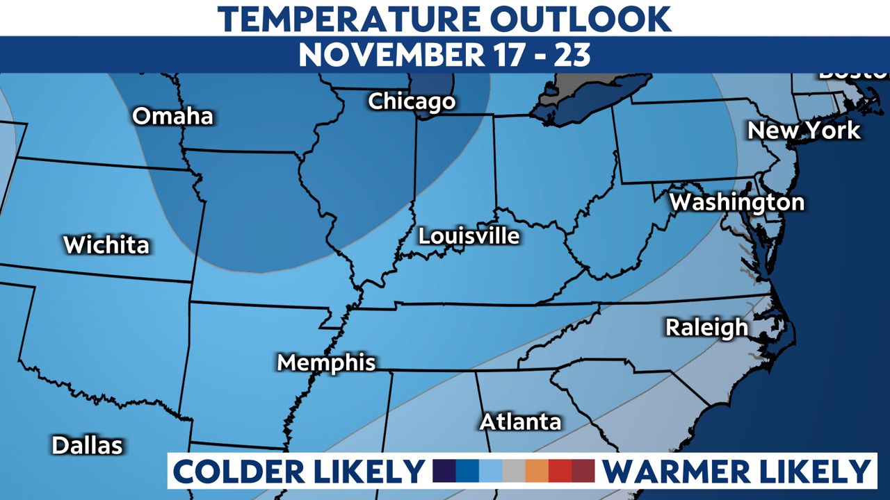
We are even looking at below-average temperatures to continue into the week of Thanksgiving. The CPC 8 to 14 day outlook (Nov. 17-23) still has Kentucky in a 60 to 70% chance of below normal temperatures.
And with some of the cold air, we have a couple of chances for snow. The first one arrives this Saturday as a rain and snow mix early in the day. No impacts are expected. The second chance will arrive next Tuesday with the chance of a wintry mix.
Our team of meteorologists dives deep into the science of weather and breaks down timely weather data and information. To view more weather and climate stories, check out our weather blogs section.