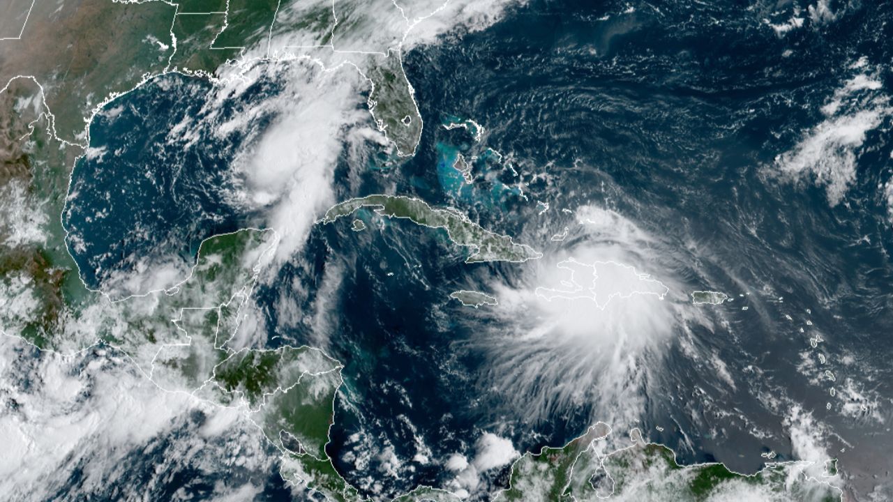
August is here and that means that the average peak of hurricane season is approaching. This month usually marks the beginning of more tropical activity in the Atlantic.
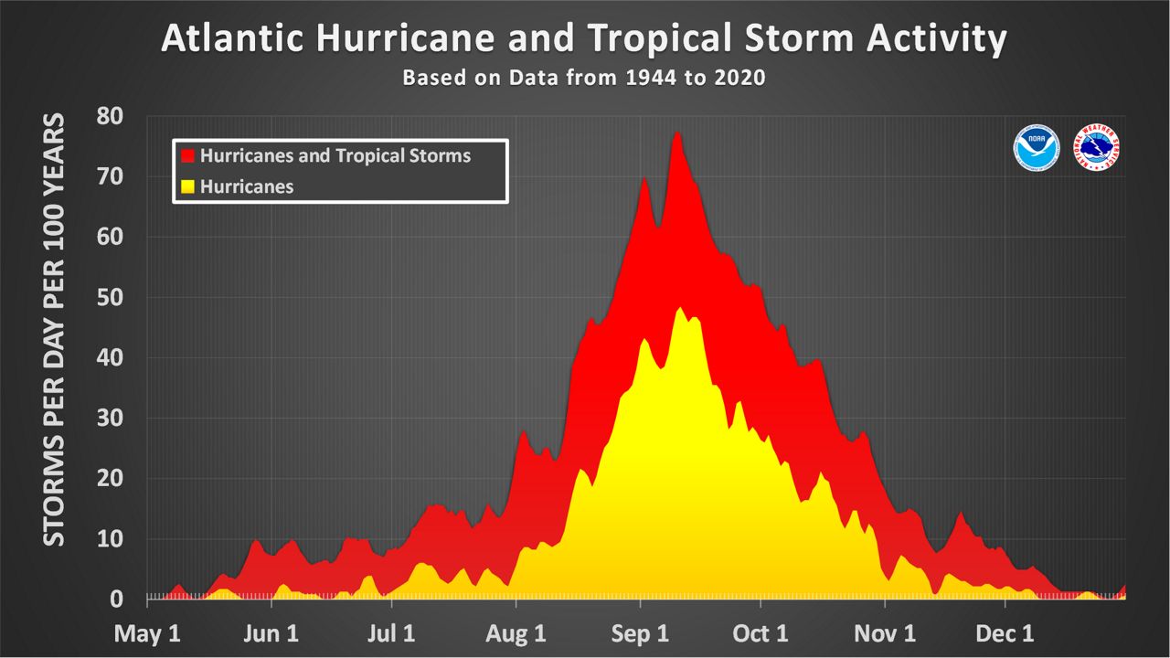
This graph from NOAA shows that the trend of more tropical storms and hurricanes in the Atlantic Ocean gets going in August. The peak period arrives in the first half of September.
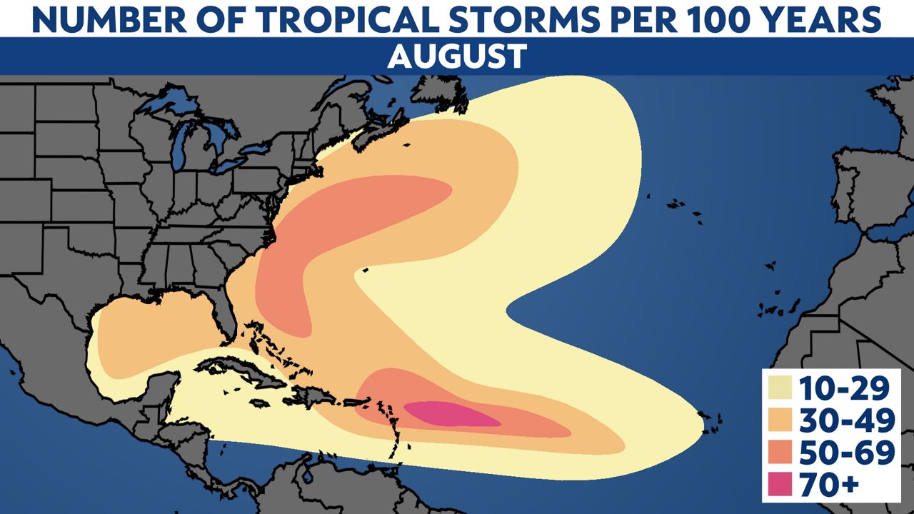
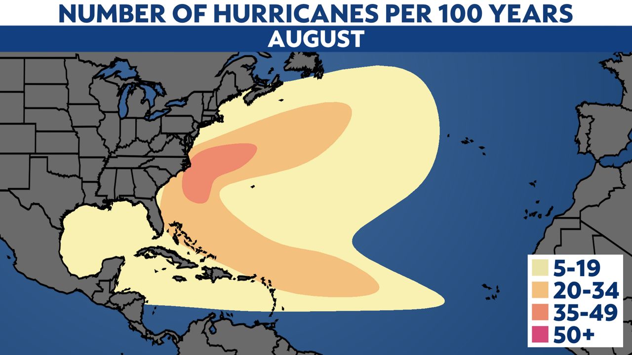
Looking at the rate of named storms (at least a tropical storm), you'll notice that most develop in the Gulf of Mexico, off the East Coast or east of the Caribbean. Development closer to the Cabo Verde Islands off the coast of Africa also is more common than earlier in the season.
Storms often travel into the Gulf Coast or near the Eastern Seaboard.
For storms becoming hurricanes, most activity carries along the East Coast. Hurricane development is less common in the Gulf of Mexico.
Our team of meteorologists dive deep into the science of weather and break down timely weather data and information. To view more weather and climate stories, check out our weather blogs section.


