


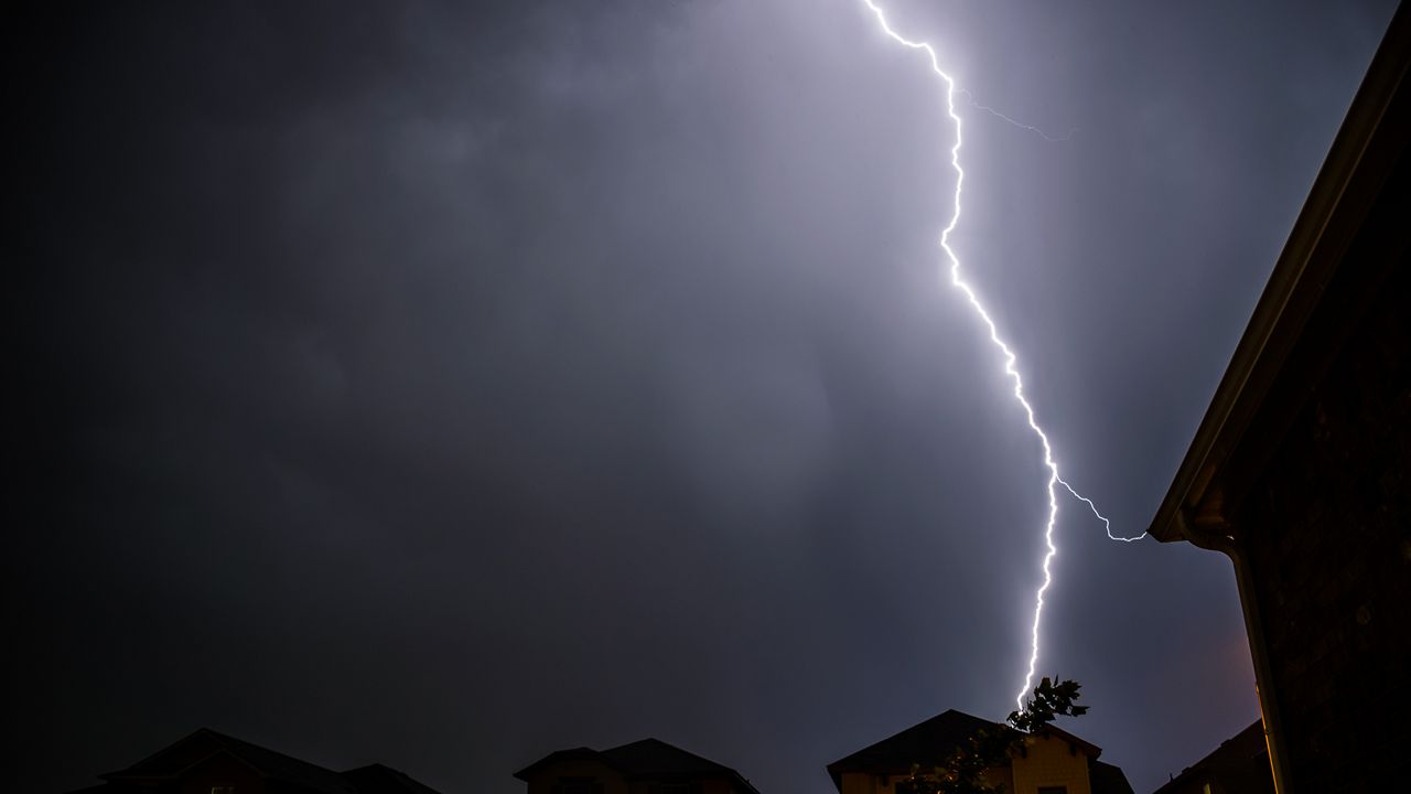
A strong cold front brings heavy rain and thunderstorms overnight, with the primary threat being gusty winds.
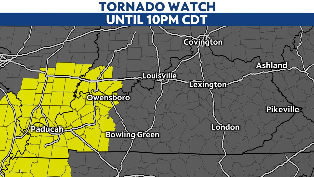
A Tornado Watch is in effect until 10:00 p.m. CDT for most of Western Kentucky.
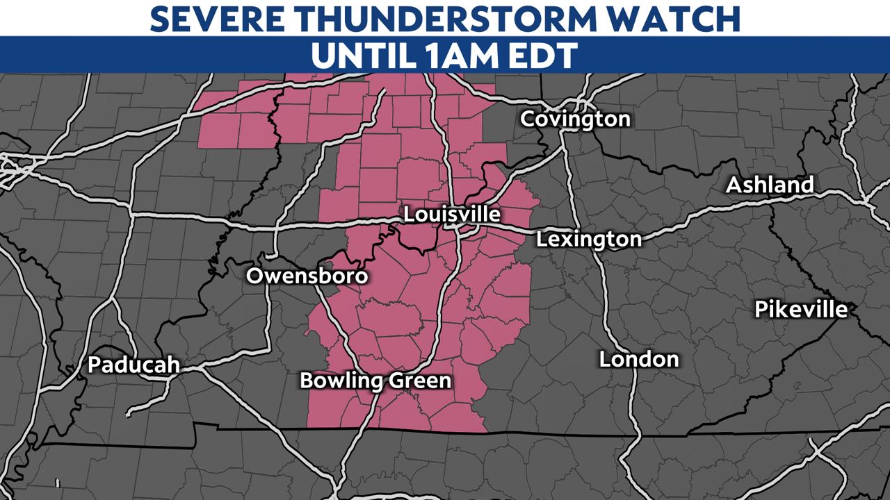
A Severe Thunderstorm Watch is in effect for central Kentucky through 1:00 a.m. EDT.
Winds into the evening will gust 40 to 50 mph at times, even outside of thunderstorms.
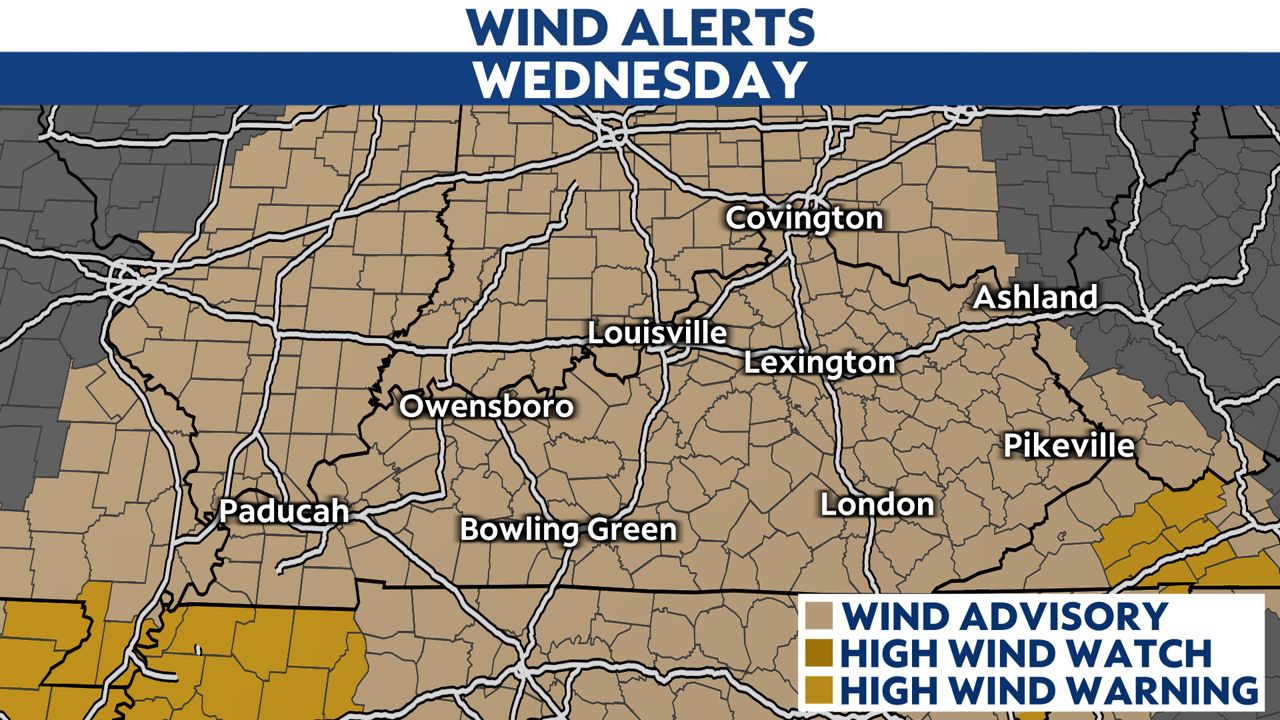
A Wind Advisory is in effect for the state into the overnight.
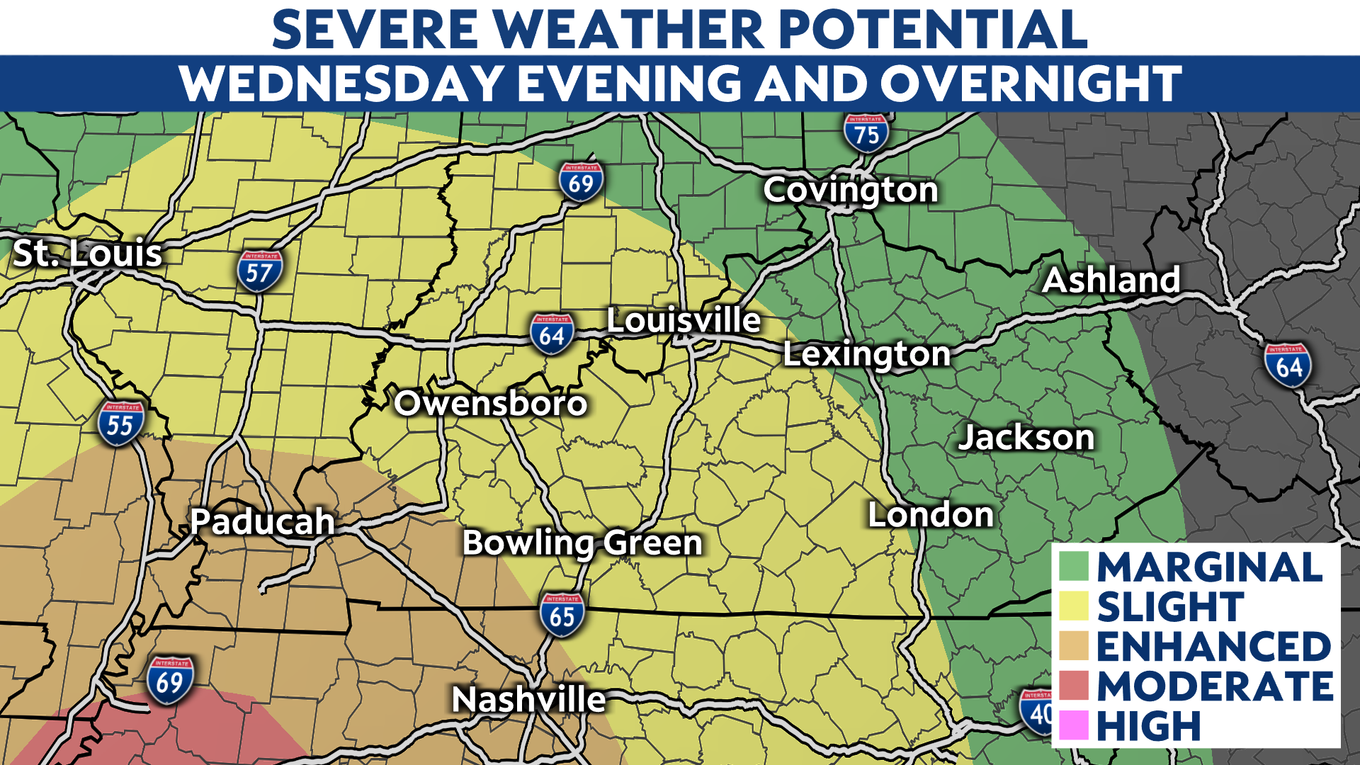
The Storm Prediction Center has highlighted western Kentucky for a severe weather risk. The highest threat for damaging winds, and perhaps a tornado, is in southwestern Kentucky.
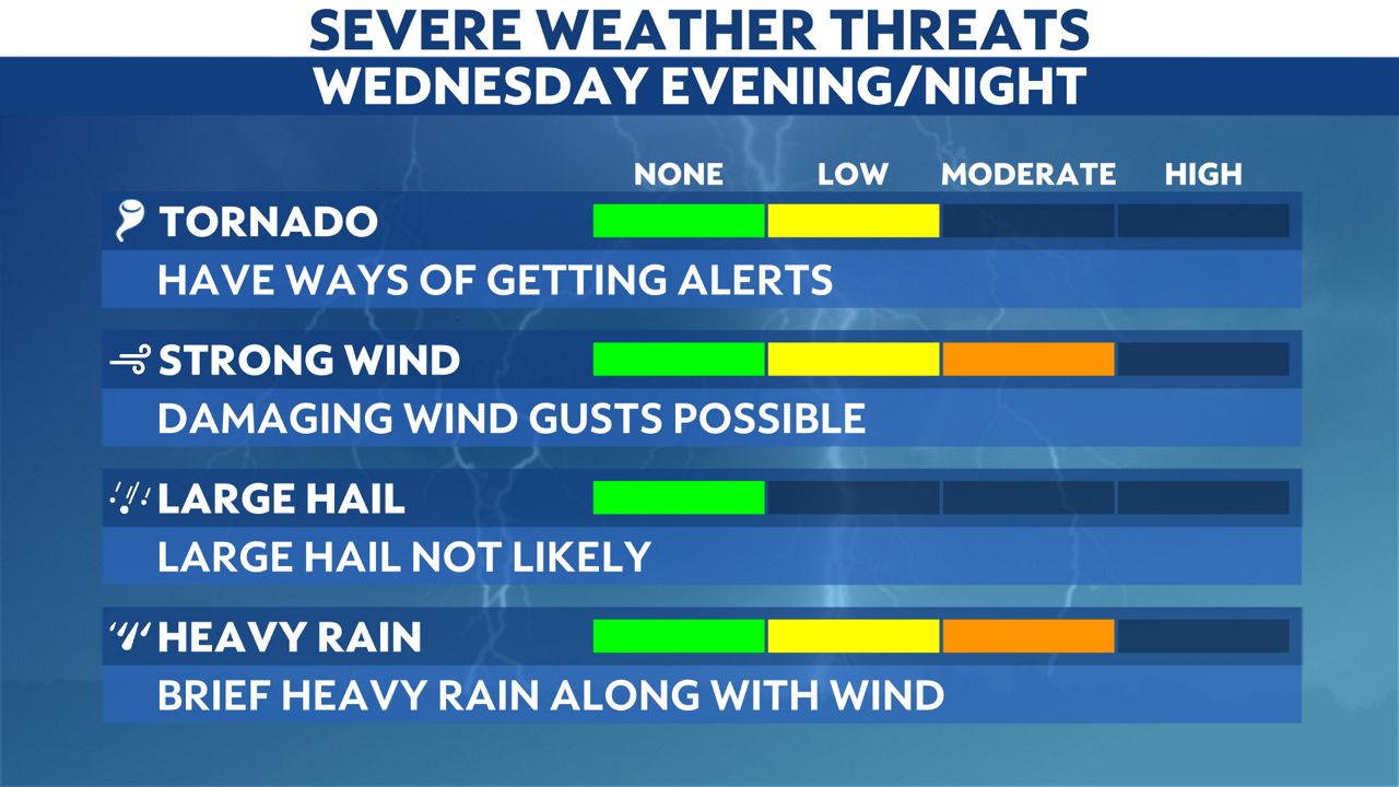
The primary threats, overall, will be torrential rain and strong wind gusts with a line of storms arriving in the evening and moving east through the night.
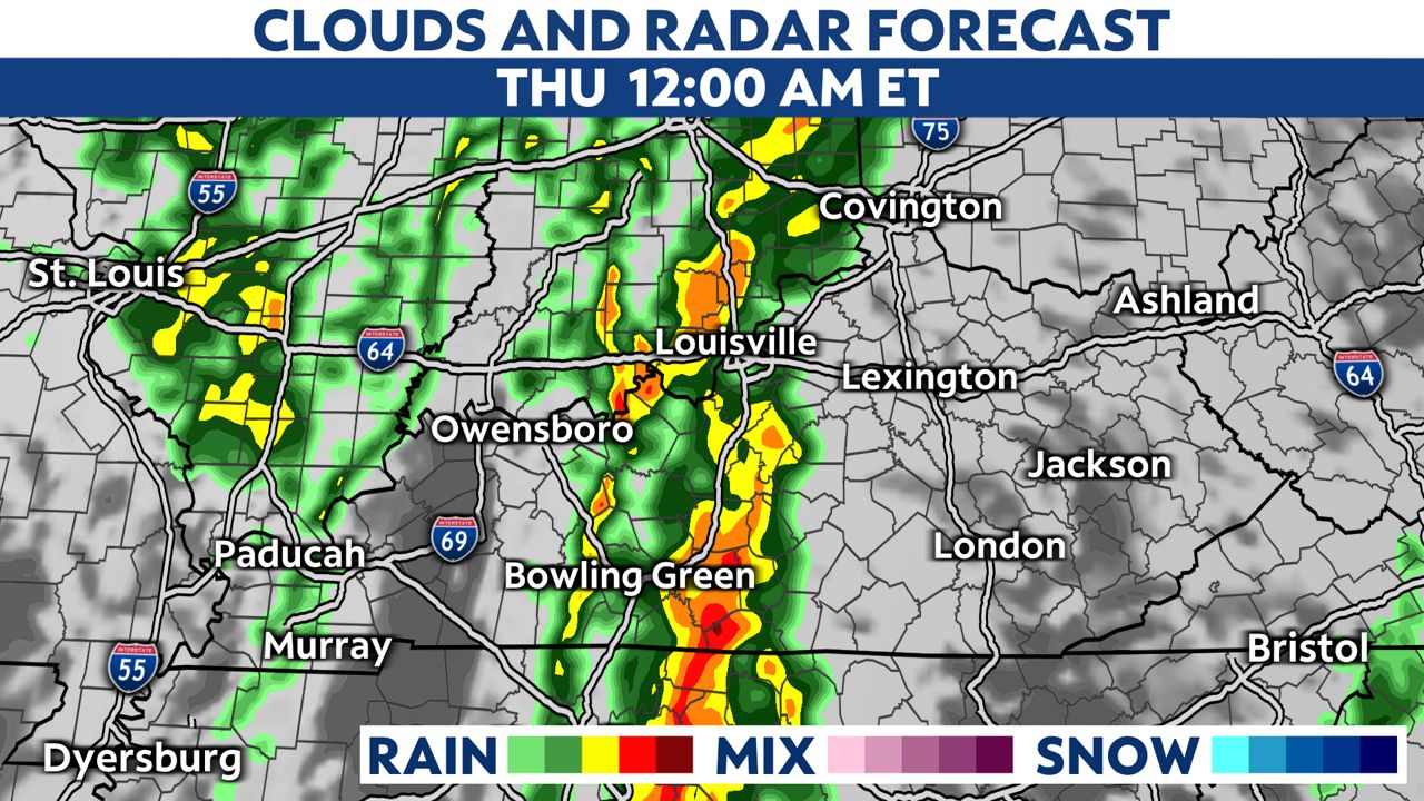
The squall line will push through the I-65 corridor around midnight with gusty winds and heavy rainfall.
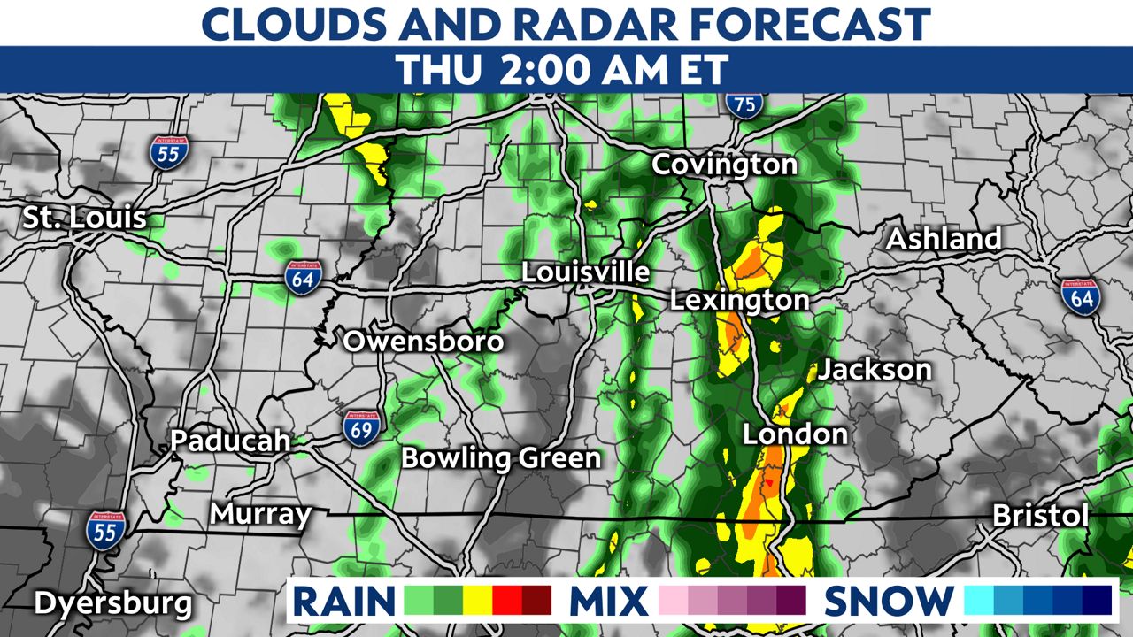
The heavy rain and gusty winds will then move into eastern Kentucky during the overnight hours, but the line will be weakening at that point.
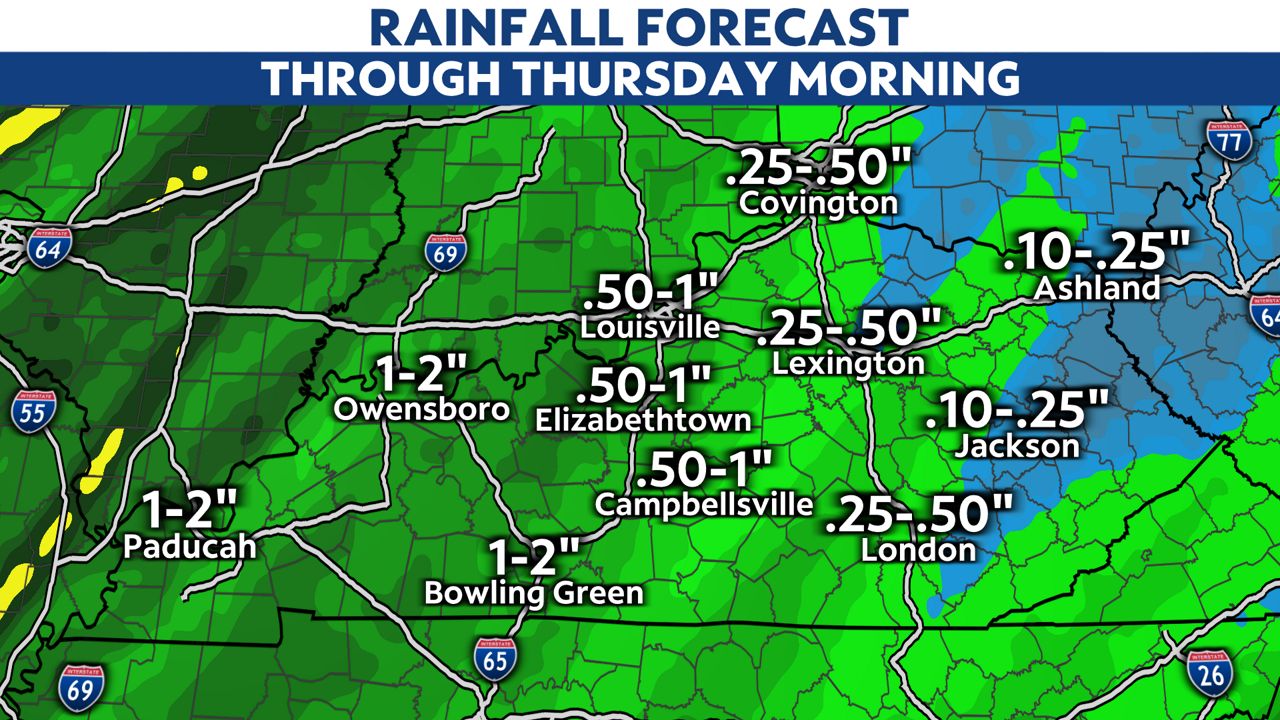
Rainfall totals will be highest in western Kentucky with 1 to 2 inches of rain there. The farther east you go, the lower the rain totals will be.
Make sure you download the Spectrum News app for severe weather alerts so that you and your family are safe in case there are any severe warnings.