


A plume of moisture combining with arctic air will lead to a slick setup of icing across Kentucky into Friday morning.
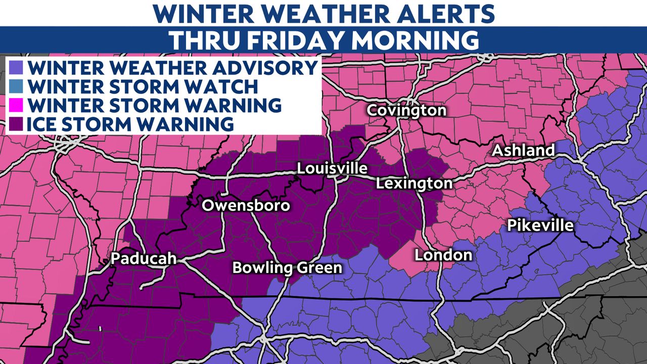
Strong arctic high pressure is situated to our north, sending in cold air. At the same time, a feed of moisture will continue from the southwest along a stalled front.
Dense, cold air will eventually drain in from the north this evening into tonight. The changeover to freezing rain will depend on how fast that front sinks to our south.
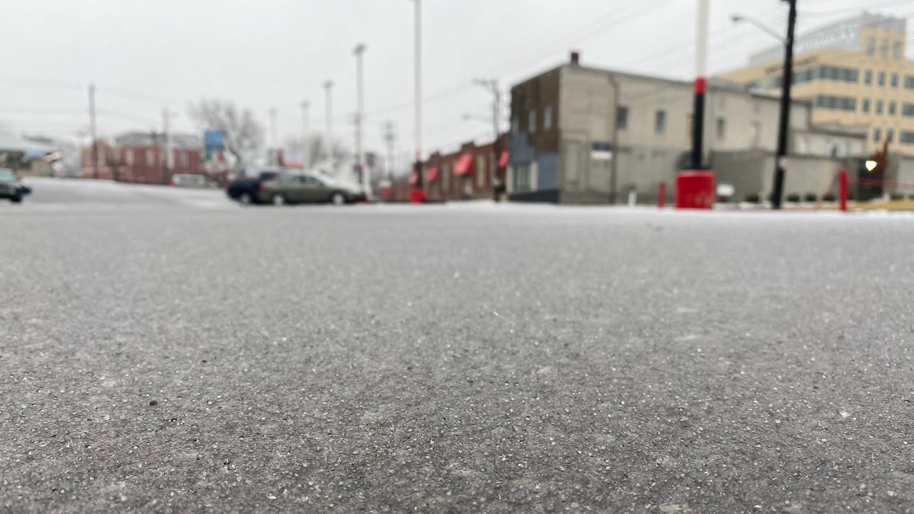
Western and northern Kentucky has already seen freezing rain and sleet. That change will continue to to move south and east through the evening into tonight.
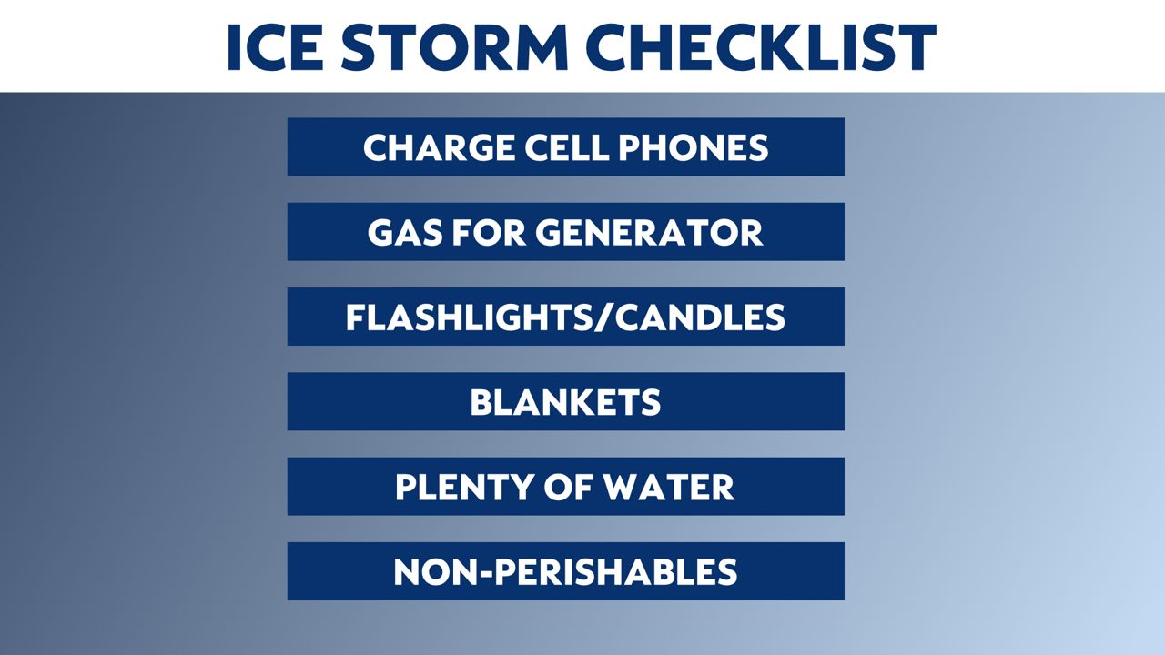
Here are some items you want to have in preparation of the storm.
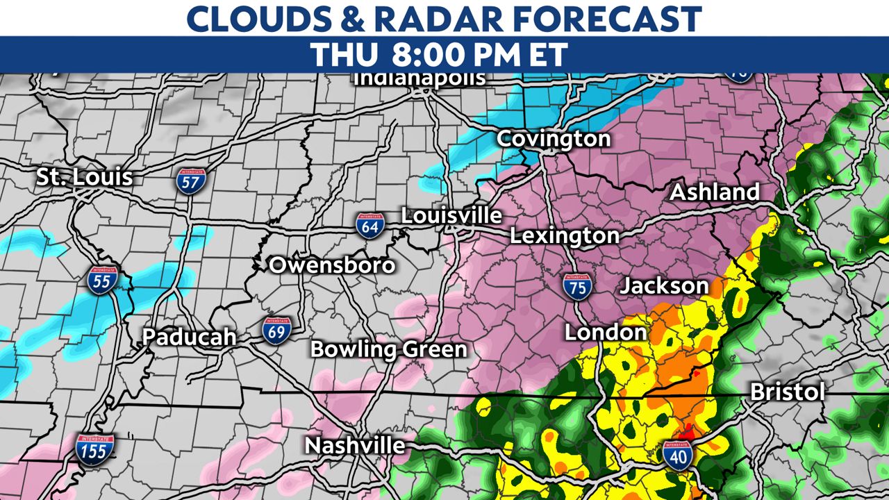
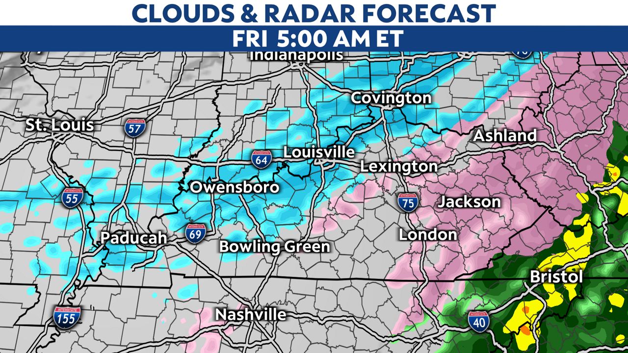
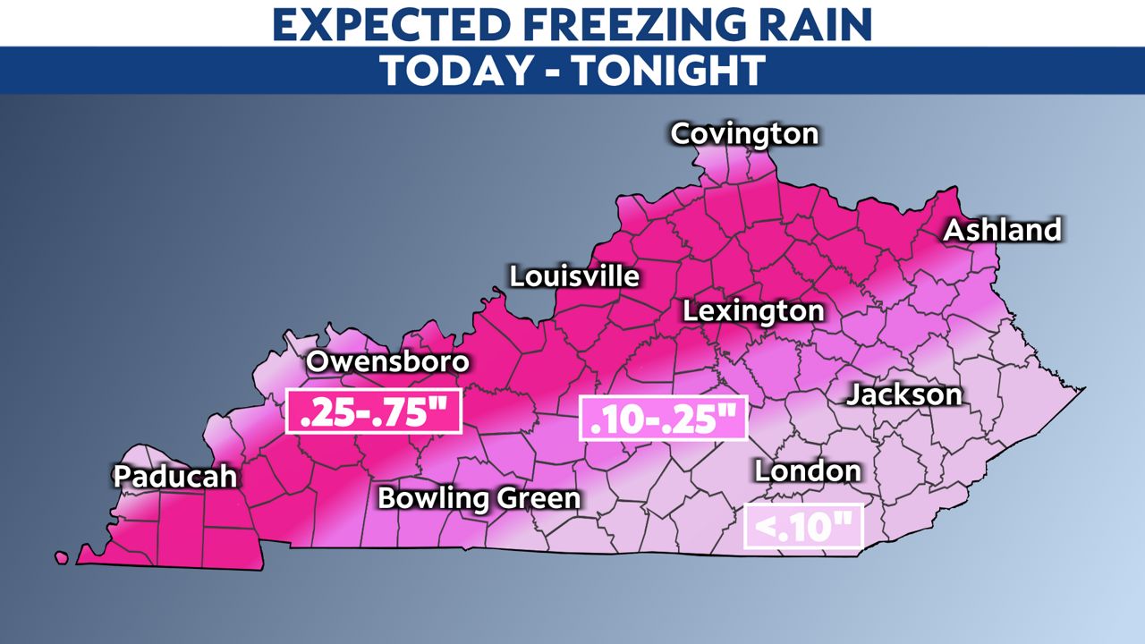
Here is a general look at how the system will develop over the state. Ice accumulation on trees and power lines could create moderate to major impacts across the northern half of Kentucky.
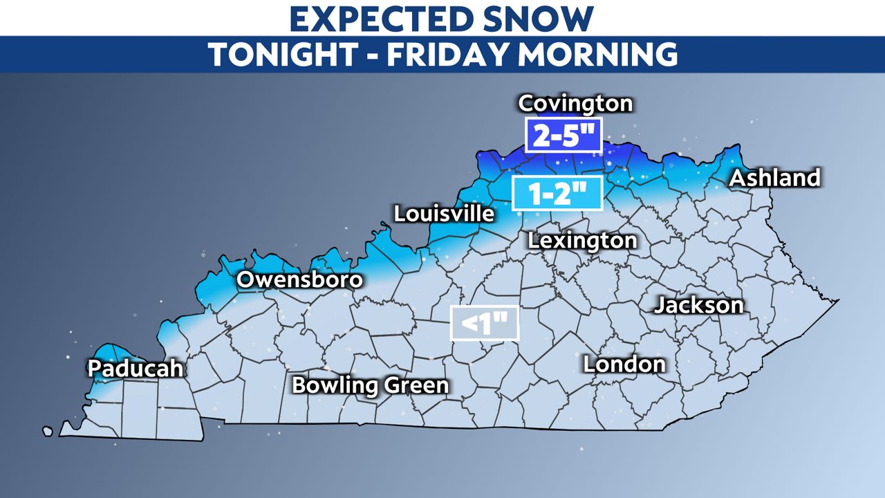
Freezing rain will continue in the evening, with a changeover to sleet and light snow tonight into Friday.
Ice totals will be highest along the Ohio River and points south into central parts of the state, where over a half-inch of ice is possible in a few locations. Generally, ice accumulations will be around 0.25 inches for most areas.
Sleet will change to snow late tonight into Friday and will fall near the Ohio River, making matters worse, with a few inches possible.
Stay tuned to the forecast as the system progresses this evening into tonight.
Go here to sign up for weather-related notifications on your phone from the Spectrum News app.