


Once the calendar switched over to the new year, the snow machine turned on!
The first big snow event took place on Jan. 6, when parts of eastern Kentucky picked up over 10 inches of snow. Lexington saw a new daily record of snow with 9.9 inches. Not as much snow fell along the Ohio River, with amounts ranging from 1 to 3 inches.
The next two snow makers happened on the 16th-17th and the 19th-20th. They didn't produce as much snow, but they certainly helped put locations above their average snowfall for the season to date.
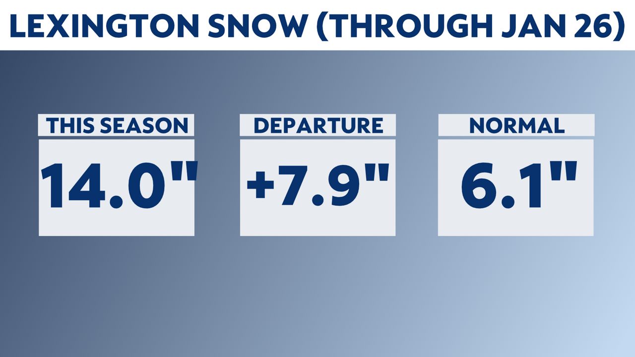
When comparing 30-year average snowfall with current snowfall to-date, Lexington is well above average for snowfall. They're currently sitting at 14 inches of snow as of Jan. 26. That puts them close to eight inches over their average.
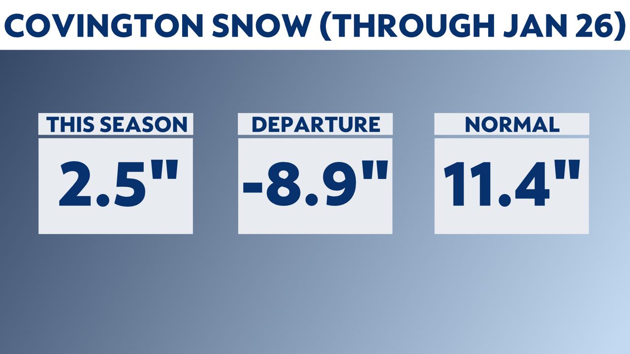
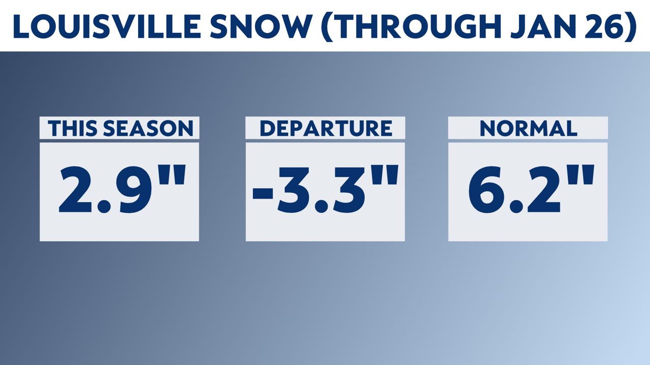
Not everyone is above their average for the season to-date. Covington is currently sitting well below the mark at almost a nine-inch deficit. Louisville is also in a 3.3-inch deficit.
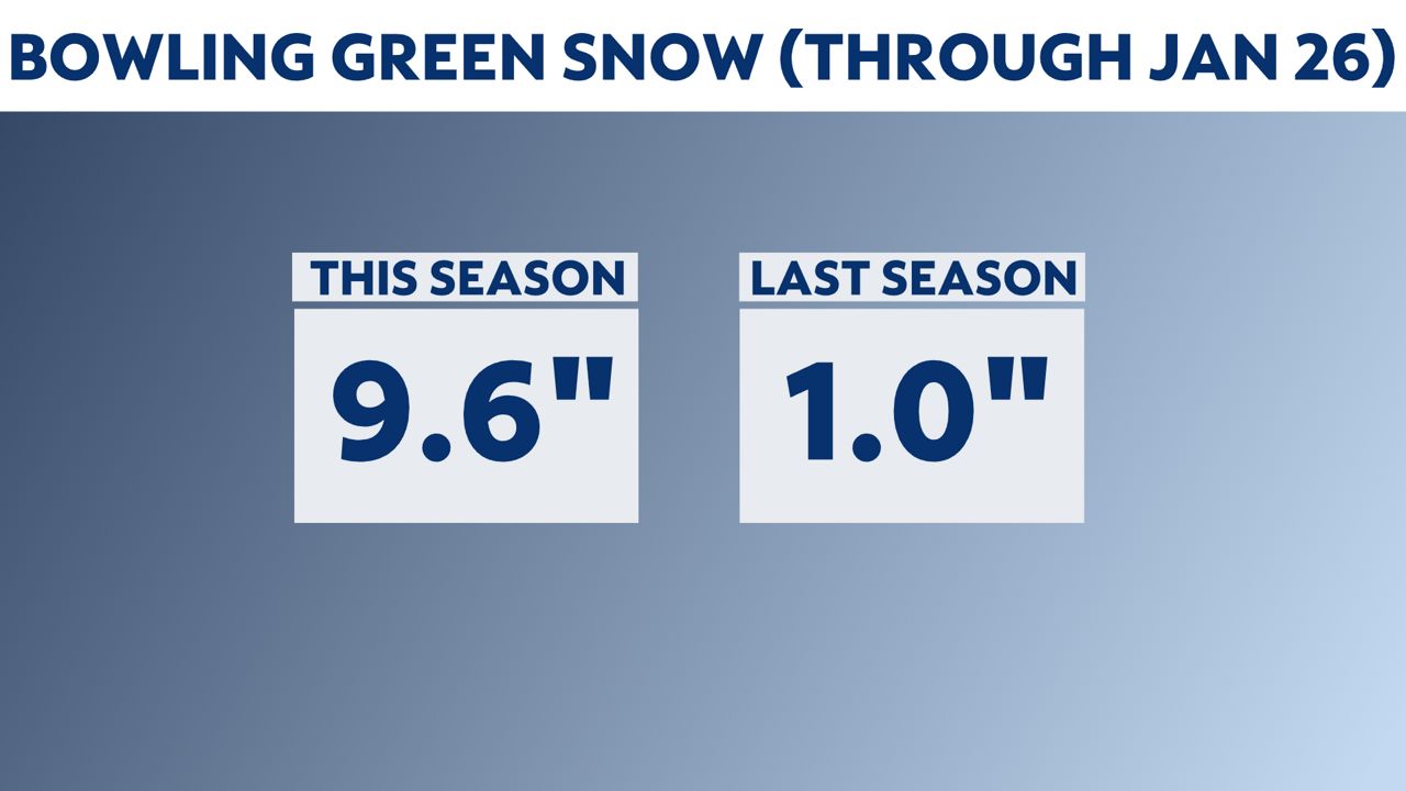
With no new averages yet for Bowling Green, I thought we could compare this year to last year. And look at that difference! They have already picked up 9.6 inches so far. And at this time last year, they were only at one inch of snow.
We have another small snow chance this Thursday night into Friday, so the season-to-date numbers could change. But, it wouldn't be by much with only minor accumulations possible.