Mid-latitude cyclones have several stages of development.
A mid-latitude weather system feeds off the temperature and density differences in the atmosphere.
The first stage of development is known as cyclogenesis.
A stationary front separates warm air from cooler air. The surface winds converge and eventually form a low pressure system. Where the two air masses meet is where you see the highest concentration of precipitation.
This is the second stage of cyclone development.
At this point, a cold and warm front develop as the the low pressure system begins to rotate in a counterclockwise fashion. Warm air moves to the east of the cold front and lifts north. This is also known as the warm conveyor belt.
Precipitation breaks out in this area along the cold front. Meanwhile, cooler air drains in from the north and west of the low pressure system. This air mass is known as the cold conveyor belt.
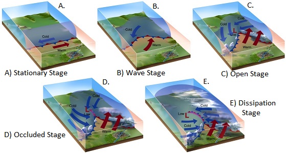
In this stage, the cold air gets pulled in on the backside of the low pressure while the warm air continues to lift north to the east of the cold front.
This is when you begin to see snow on the northwest side of the low pressure with severe weather ahead and east of the low, especially in the transitional seasons of spring and autumn.
In this part of a mid-latitude cyclones lifetime, the air masses begin to take over one another. The cold air from the north meets up with the warm air mass and an occluded front develops.
The point where the cold, warm, and occluded fronts come together is known as the triple point. This area is notoriously known for its severe weather and tornadoes.
For a low pressure to maintain itself, the divergence of air aloft has to be greater than the converging air at the surface.
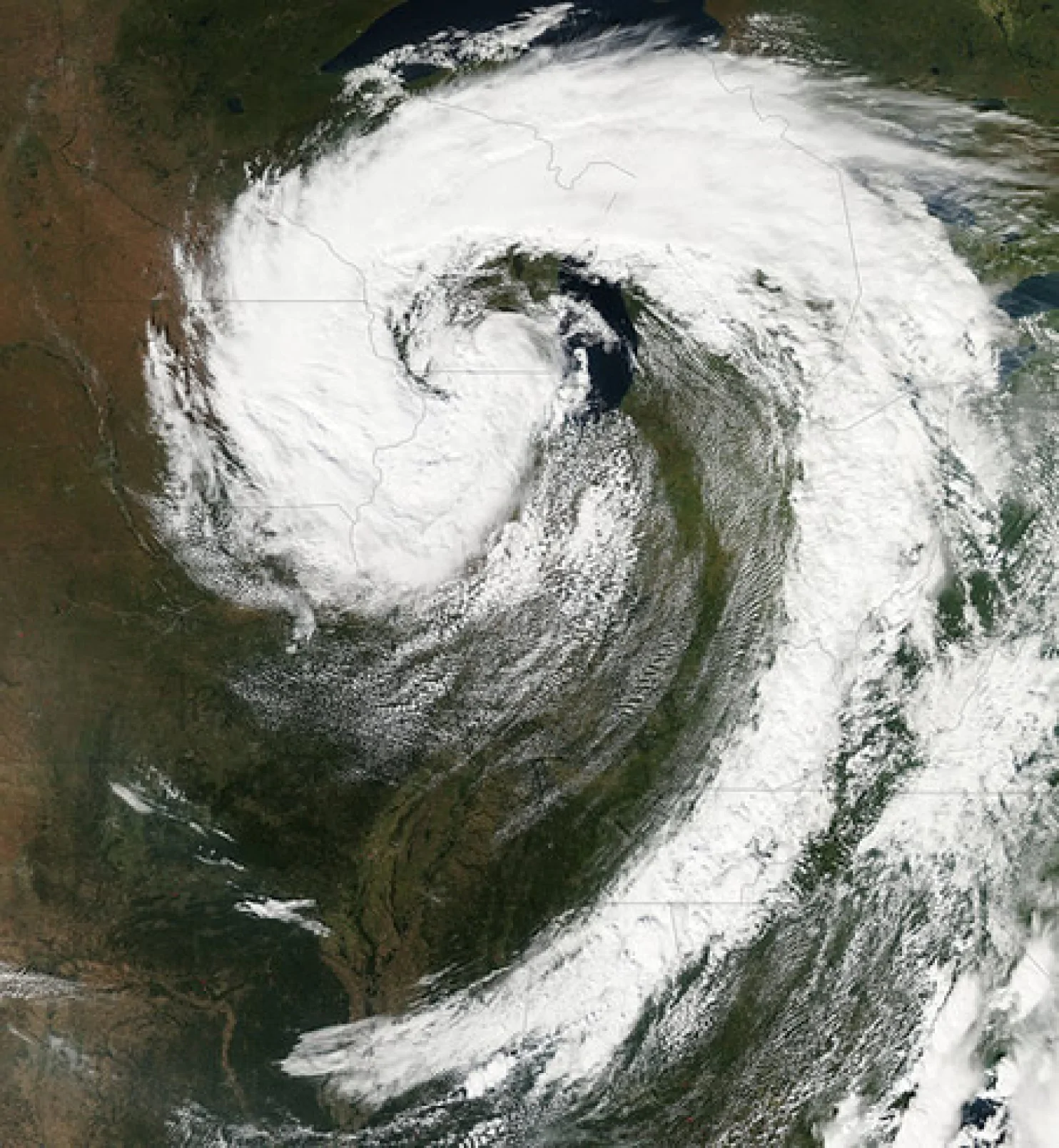
Mature cyclones take on a comma shape like the one you see below.
At this point, the cold air has taken over the storm system and wraps around it.
The supply of warm air is cut off from the low pressure; therefore, the interaction between the cold and warm air masses causes the cyclone to dissolve and collapse.
Common Low Pressure Tracks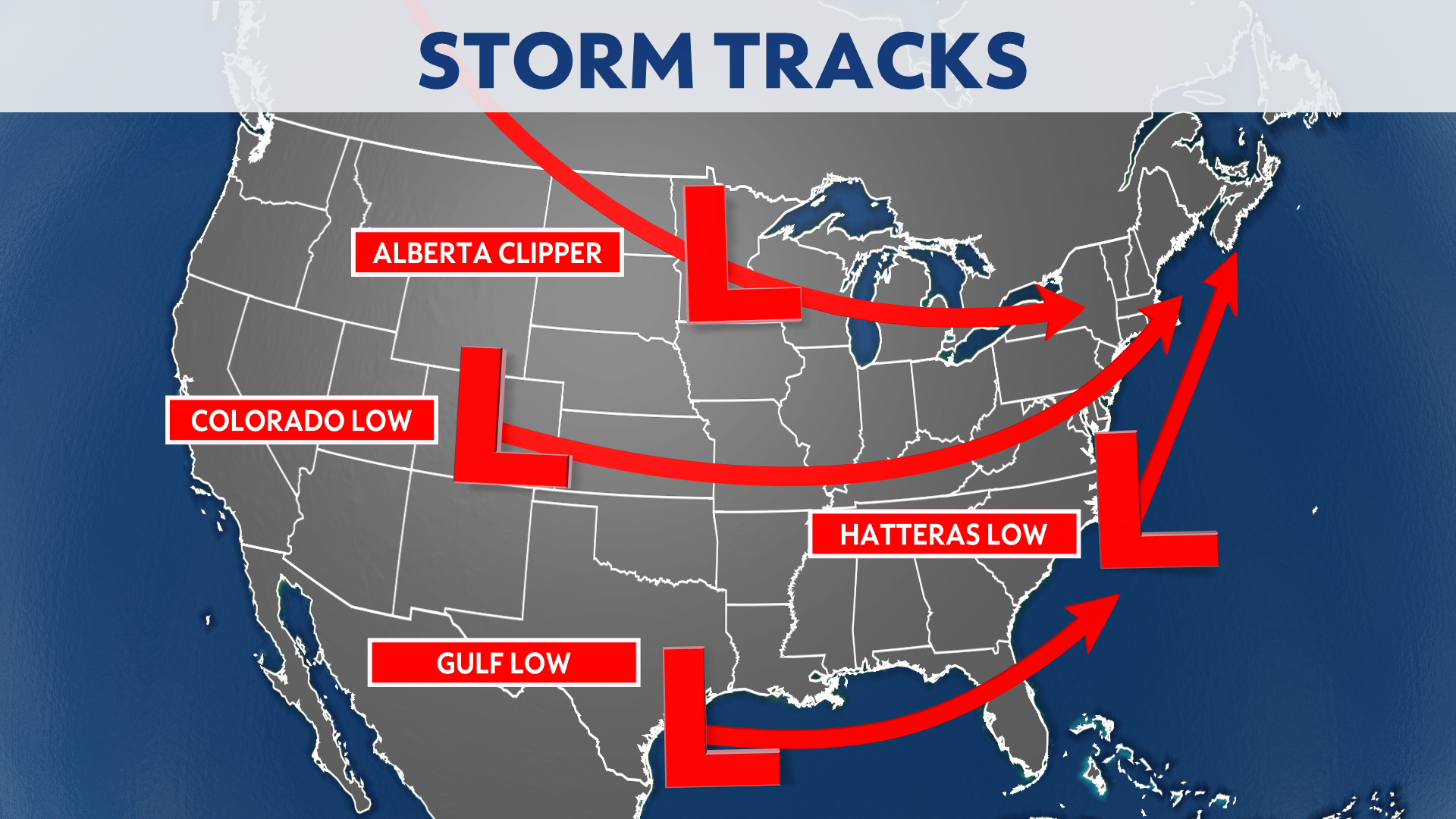
Mid-latitude cyclones typically form off the Rockies.
A low pressure usually dies out in the high terrain of the Rocky Mountains, but then re-energizes as it moves down wind of the mountain range due to the warm, moist, and unstable air mass to the east of the mountains.
Other lows form in the Gulf of Mexico or off the Eastern Seaboard where nor'easters develop. These are the storms that bring a lot of snow in the Northeast.
Alberta clippers are very weak, quick moving, and usually moisture starved. They can bring light amounts of snow through the upper Midwest and Great Lakes region.
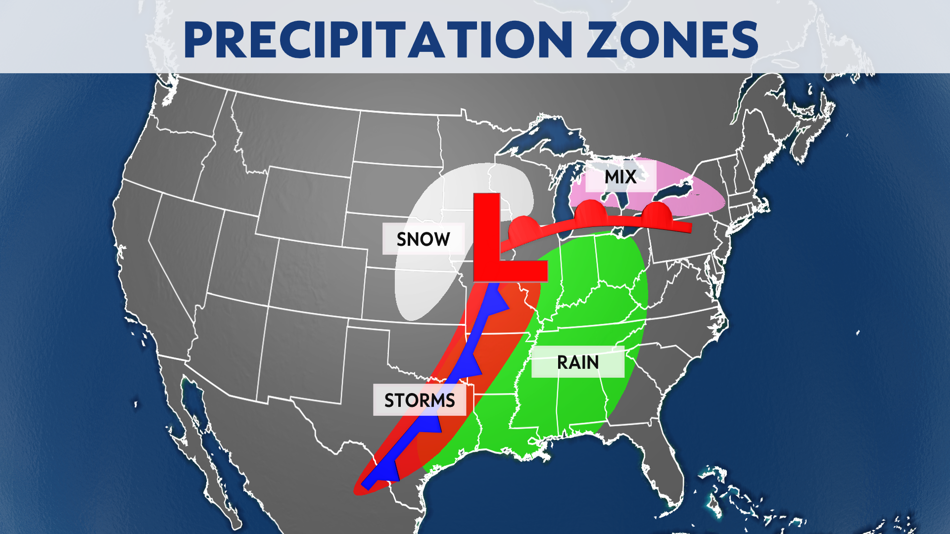
A schematic of a mid-latitude cyclone shows you where you see the typical precipitation types.