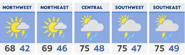


We're already off to a mild start, with breezy southwest winds bringing very warm temperatures back into the forecast this afternoon. Highs top 70 for much of the state, with some areas near 80.
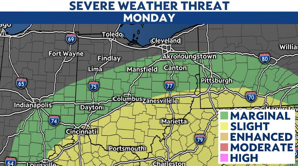
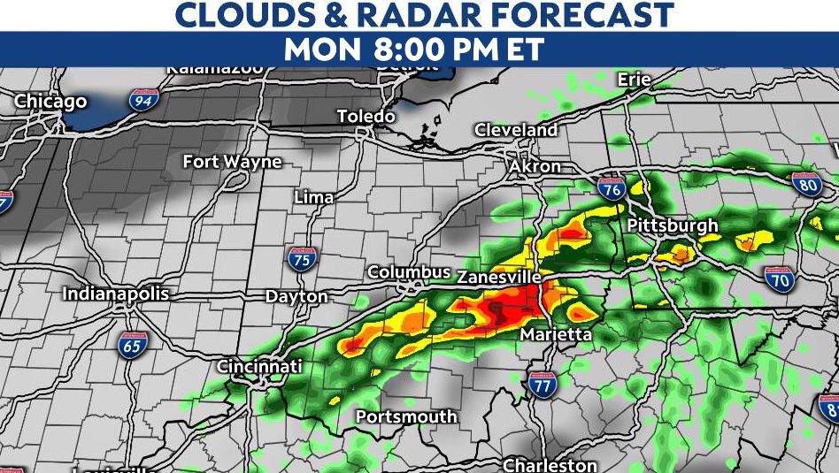
However, as our next cold front moves through, this will fuel strong and severe thunderstorms, mostly SE of I-71 and south of I-70.
Damaging winds and hail will be the primary concerns from about 4 p.m. to 10 p.m.
Behind this line of storms, colder air returns Tuesday, with highs in the 40s to low 50s.