


High pressure dominates tonight into Monday. Expect some patchy fog overnight, especially where you did see rain in central and southwestern Kentucky. Lows will dip into the low to mid 60s.
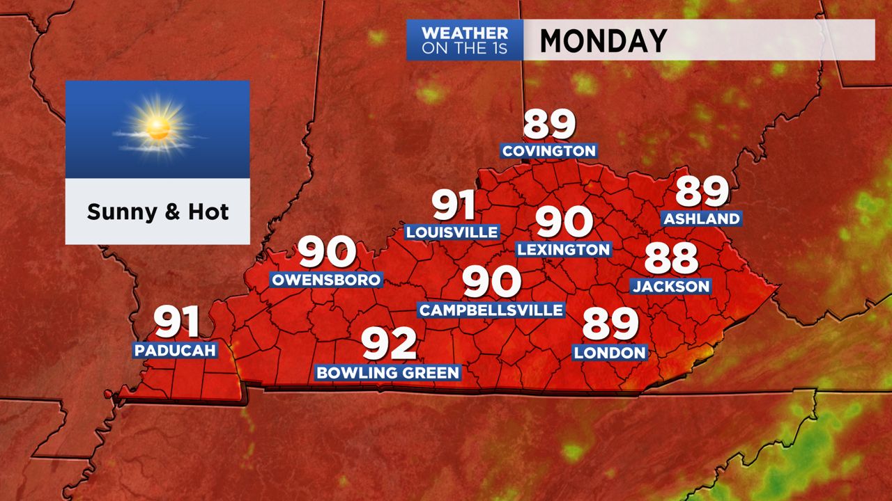
It will be a sunny start to the week and also hot with highs in the upper 80s to low 90s.
A cold front will approach by Tuesday afternoon and evening and that brings the chance for showers and thunderstorms. Highs will top off in the upper 80s to lower 90s.
More of the same can be expected into the rest of the week as well with hit or miss thunderstorms.
The weekend looks a bit cooler with highs back into the mid 80s. We will keep most areas dry for now with a chance of storms mainly for the western half of the state.
-Alan Auglis