Heavy rainfall could lead to flooding across parts of South Carolina later tonight into Thursday. Rain chances will increase beginning Wednesday afternoon with flood potential increasing through tonight as deep tropical moisture spreads across the Southeast.
Flood Watches are in effect across parts of the Midlands and Lowcountry stretching into central Georgia through Thursday evening.

Rain chances begin to increase Wednesday afternoon as widespread showers and storms move in from the southwest. The flood threat will begin in the Midlands tonight and then increase for the Lowcountry as we go into the early Thursday morning hours.
Training storms are expected to last overnight and continue across western South Carolina through early Thursday. Rainfall coverage tapers off Thursday afternoon.
Heavy downpours and excessive rainfall could lead to flash flooding. Excessive runoff could lead to flooding of rivers, creeks and streams and other low-lying and flood-prone areas.

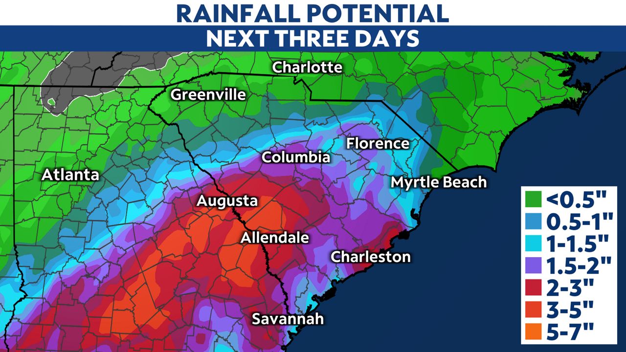
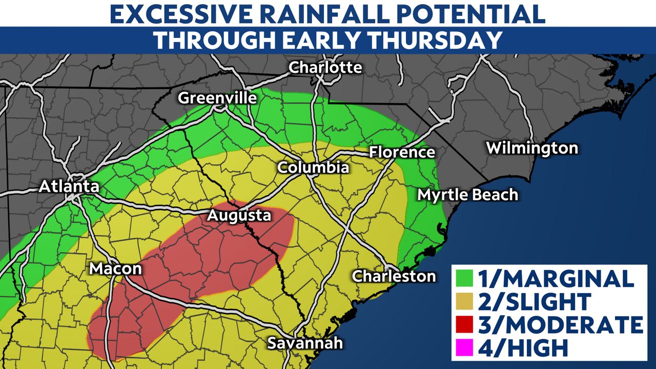
Rainfall totals through the end of the week will be up to 3 to 5 inches across parts of the state, with the highest totals in the Midlands and closer to the Georgia line. Locally higher totals are expected, and that's where flash flooding is most likely.
Some models are showing isolated rainfall totals up to 6 to 12 inches.
There is a level 3/4 threat for excessive rainfall, or a moderate risk.
You can turn on weather notifications and check your interactive radar in the Spectrum News App.
Our team of meteorologists dives deep into the science of weather and breaks down timely weather data and information. To view more weather and climate stories, check out our weather blogs section.