
Tropical storms aren't usually something Californians need to worry about. But, remember, our weather can change drastically if the right mix of elements develop all around us.
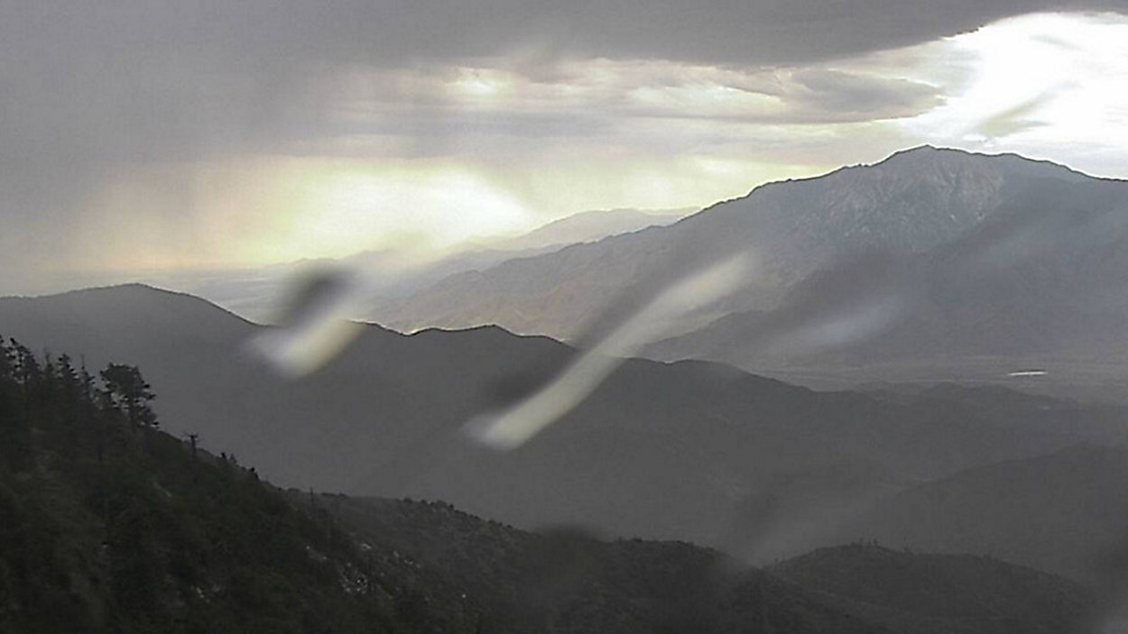
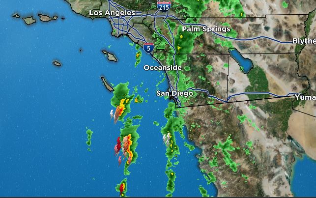
The image below shows the mid to high-level clouds that'll continue to stream across SoCal today, especially over San Diego and Orange counties, as well as the mountains in the Inland Empire and the low deserts.
You can also see the rain shafts and drops of rain on this webcam that is part of the AlertWildfire Network.
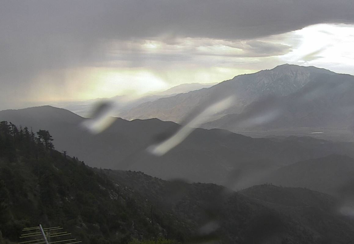
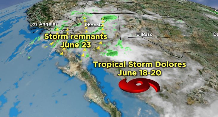
All of the extra spectacular sky art is courtesy of the remnants of Tropical Storm Dolores, which made landfall on June 19 between the Mexican states of Colima and Michoacan.
SoCal's weather isn't always affected by old tropical storms.
Right now, SoCal happens to be sandwiched between a cut-off low off the coast and a ridge of high pressure over the Four Corners. This setup has opened the door to this extra moisture.
With enough instability in the atmosphere, especially due to the heating of the day, thunderstorms are possible, especially over the mountain and deserts.
In my weather segment today on Spectrum News 1, I went a little deeper "Inside the Weather," and explained how tropical systems can affect SoCal's weather.
Click the link in the arrow above to watch my explainer on how tropical systerms affect SoCal's weather.
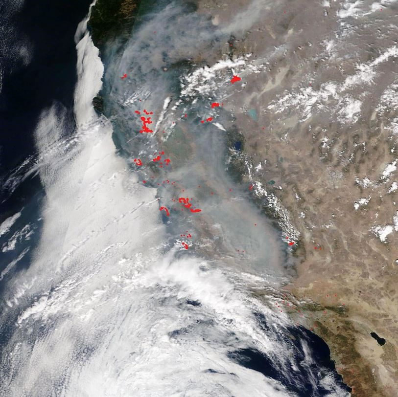
It's rare, but remnants of a tropical system can also affect Northern California, as we witnessed in August 2020.
A plume of moisture from a weakening Tropical Storm Fausto off the Baja California peninsula streamed northward more than 1,000 miles. It interacted with a strong area of high pressure set up over the region, which created excessive atmospheric instability.
The entire region was already dealing with record-breaking high temperatures, strong winds and bone-dry vegetation. This perfect storm of weather elements generated, over a three-day period, more than 12,000 lightning strikes over Central and Northern California.
This siege of lightning, much of it dry lightning, sparked about 650 wildfires.
For a bigger dive "Inside the Weather," check out the blog my colleague Jacqueline Bennett wrote during last year's hurricane season, "Could A Hurricane Hit Southern California."