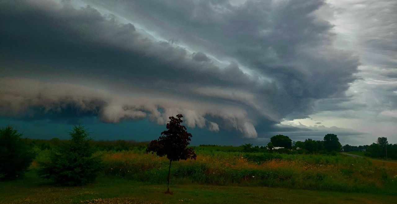
Severe storms are likely across Wisconsin through Tuesday night. Most of the state is under an elevated threat for all types of severe weather.
Rain and storms that move through, especially on Tuesday afternoon and evening, are capable of producing strong tornadoes, damaging winds and large hail.
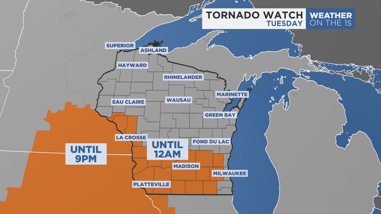
A Tornado Watch has been issued for portions of western and southern Wisconsin.
This watch accounts for thunderstorm development through the night until midnight in parts of southern and southeastern Wisconsin.
A Tornado Watch indicates that conditions are favorable for tornado development, though large hail and significant straight-line wind gusts remain concerns.
It is important to note that areas outside of the Tornado Watch still have a chance to see severe weather.
Stay with Spectrum News 1 and remain weather aware through late Tuesday.
The Storm Prediction Center has issued a level 4/5 risk across southwest Wisconsin. Central and southern Wisconsin, including Milwaukee, Madison and Green Bay, are under a level 3/5 risk.
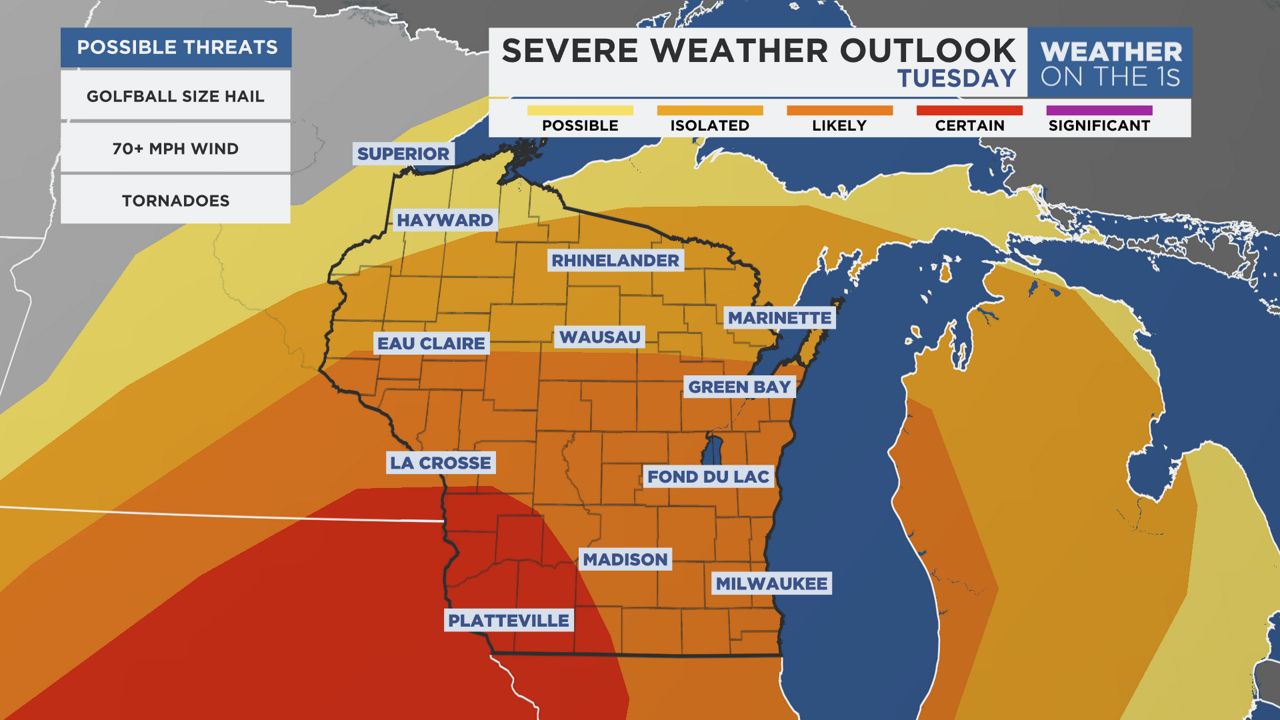
The strong tornado threat will be highest across southwest Wisconsin on Tuesday afternoon.
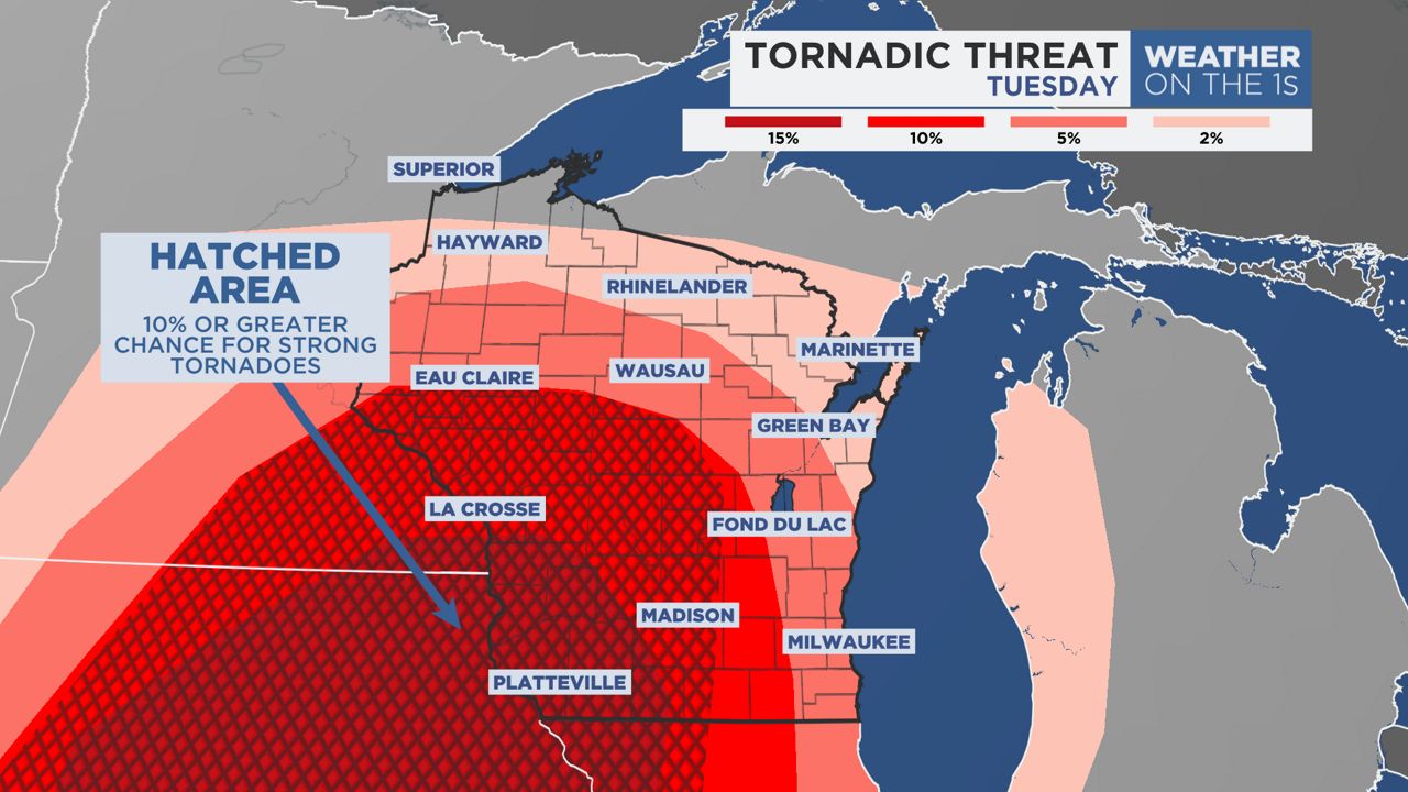
Storms will also be able to produce damaging winds. Southern Wisconsin has the highest threat for destructive winds, where straight-line wind gusts can exceed 70 mph.
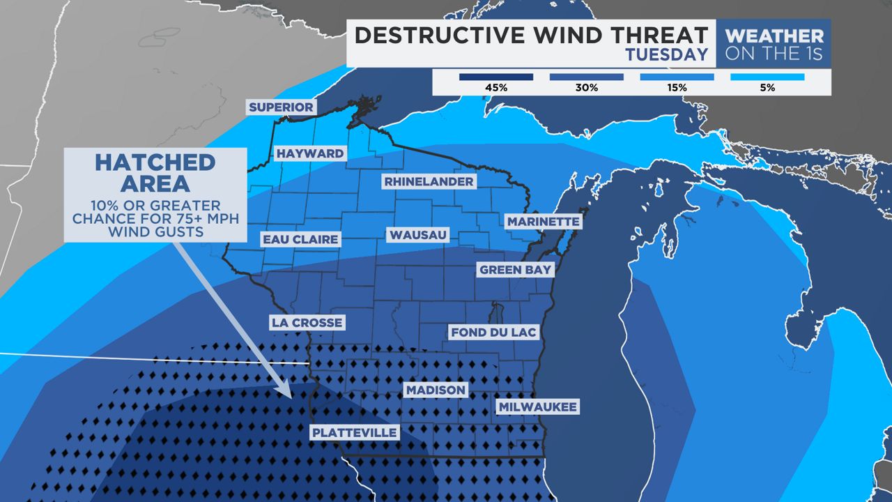
The combination of recent rainfall and any additional rainfall on Tuesday could lead to soggy ground. That could make trees more vulnerable to strong winds, knocking over power poles or trees.
Locally heavy rainfall totals on Tuesday will climb up to 1 to 3 inches across the state.
Large hail up to golf ball size is also possible within storms.

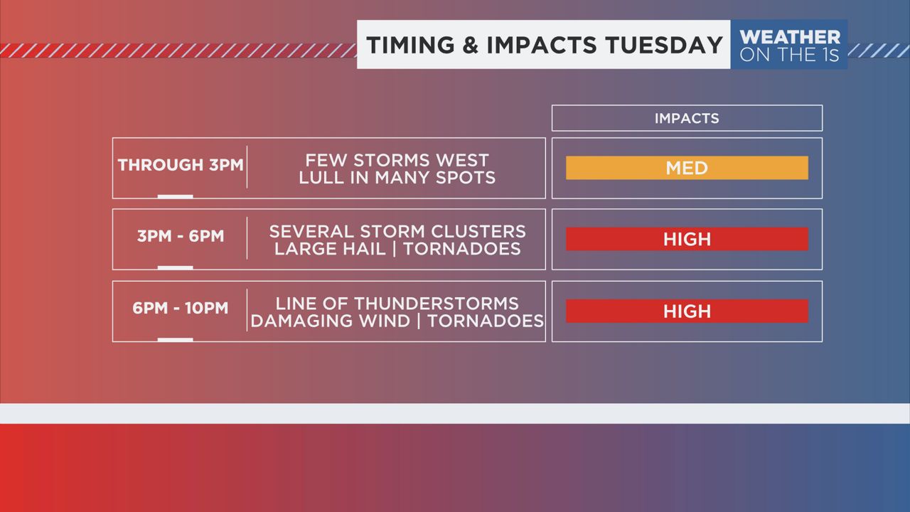
NOW-3 P.M.: Scattered rain and thunderstorms will be likely across parts of western and central Wisconsin. Many other areas around the state will be dry with sunshine possible in some spots. The area at greatest risk for thunderstorms to become severe will be across Central Wisconsin from Baraboo to Waupaca.
3 P.M. - 6 P.M.: More organized clusters of thunderstorms will continue to develop across parts of western Wisconsin as a warm front moves north. These storms will be capable of producing large hail, damaging wind gusts and tornadoes. Areas south of Interstate 90 are at the greatest risk for seeing severe thunderstorms.
6 P.M.-MIDNIGHT: A well-organized line of severe thunderstorms will enter the state ahead of a cold front. Storms will start west and drive east by early evening. The entire state should keep a watchful eye on this system.
La Crosse & Eau Claire: 6 p.m. to 8 p.m.
Madison: 7 p.m. to 10 p.m.
Milwaukee & Green Bay: 8 p.m. to midnight
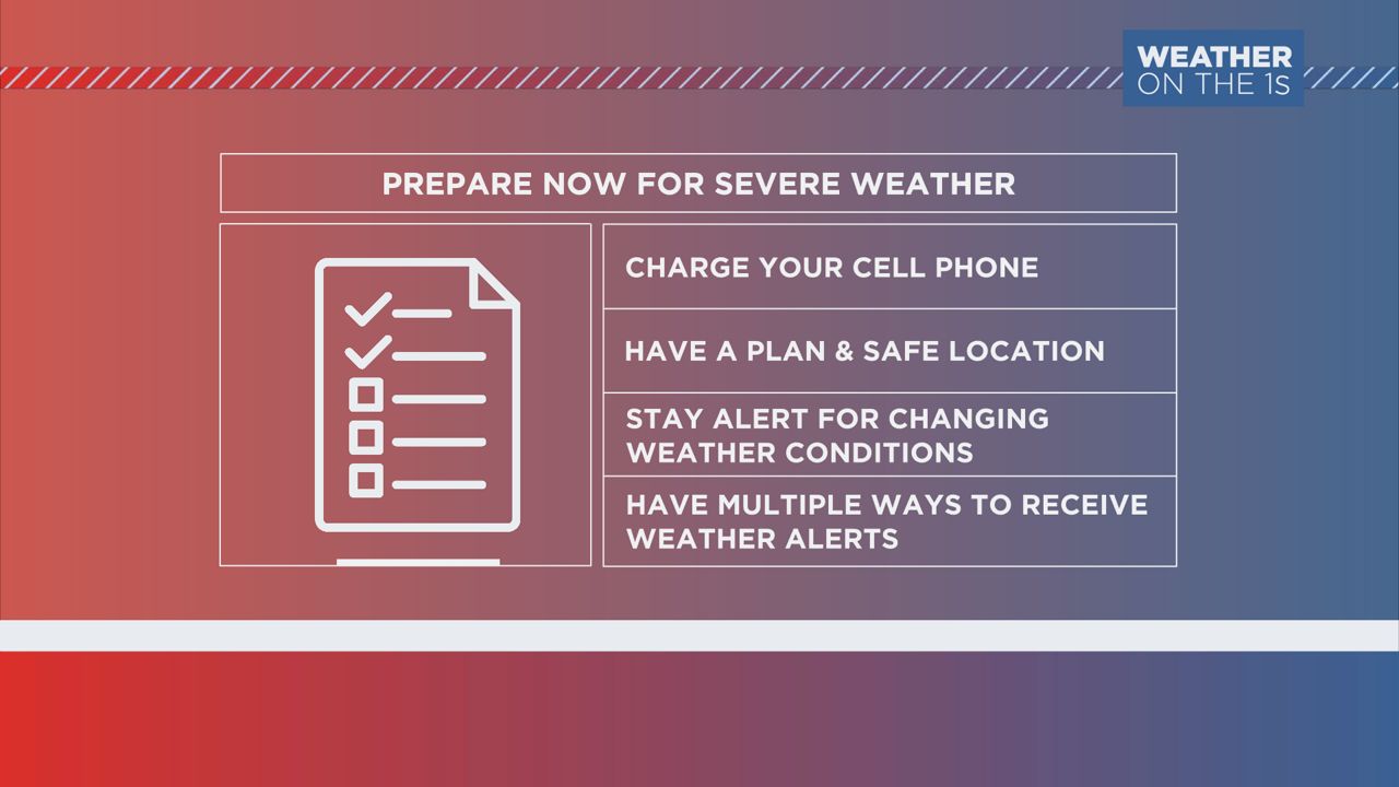
Take some time before the storms arrive to prepare. Make sure your cell phone is charged and you have a plan in the event a warning is issued. Be alert for changing weather conditions and have multiple ways to receive weather alerts.
Our team of meteorologists dives deep into the science of weather and breaks down timely weather data and information. To view more weather and climate stories, check out our weather blogs section.


