The threat for severe weather returns to Wisconsin on Friday. Let's break down what we know.
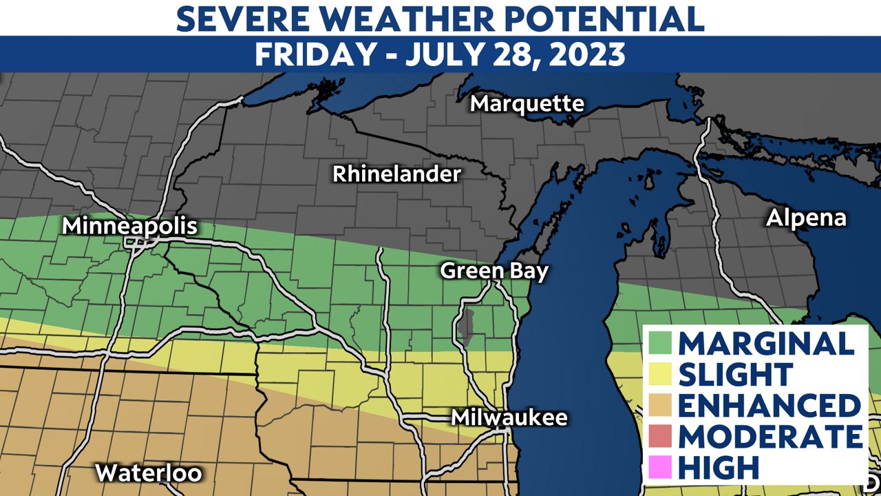
The Storm Prediction Center (SPC) has southern Wisconsin under an enhanced risk (3 out of 5 on our scale) for severe weather.

Damaging wind and large hail will be the primary threats with these storms, but we can't rule out the potential for a tornado, along with flash flooding.

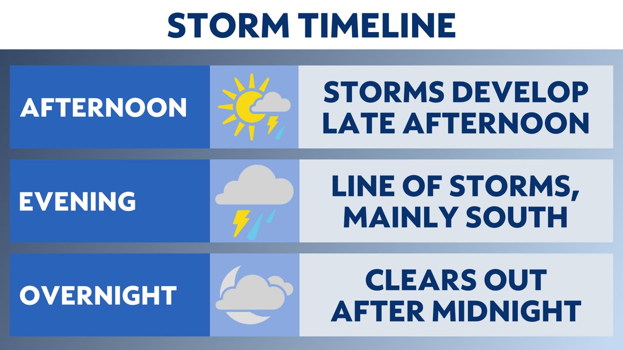
Storms will start to develop around 3 p.m. today.
A line of storms will form around 5 p.m. and move eastward through early Friday night.

The best chance for severe weather will be in southern Wisconsin, especially for those along the Wisconsin/Illinois state line.
Storms should be out of the state by midnight, leaving behind quiet conditions for the rest of the night.

You can now get weather push alerts through your Spectrum News app. These alerts allow you to get advanced notice of various weather conditions in and around your location.
Also, download our app to get up-to-date information on traffic and road conditions, along with potential closures.
Stay alert and weather-aware. Your "Weather On The 1s" team will continue to bring you the latest weather updates on-air and online.
Check your local forecast | Send us your weather photos
Follow the "Weather On the 1s" Team on social media for the latest weather updates:
Chief Meteorologist JD Rudd: Facebook | Twitter
Meteorologist Kristin Ketchell: Facebook | Twitter | Instagram
Meteorologist Brooke Brighton: Facebook | Twitter | Instagram
Meteorologist Jesse Gunkel: Facebook | Twitter | Instagram
Our team of meteorologists dives deep into the science of weather and breaks down timely weather data and information. To view more weather and climate stories, check out our weather blogs section.


