


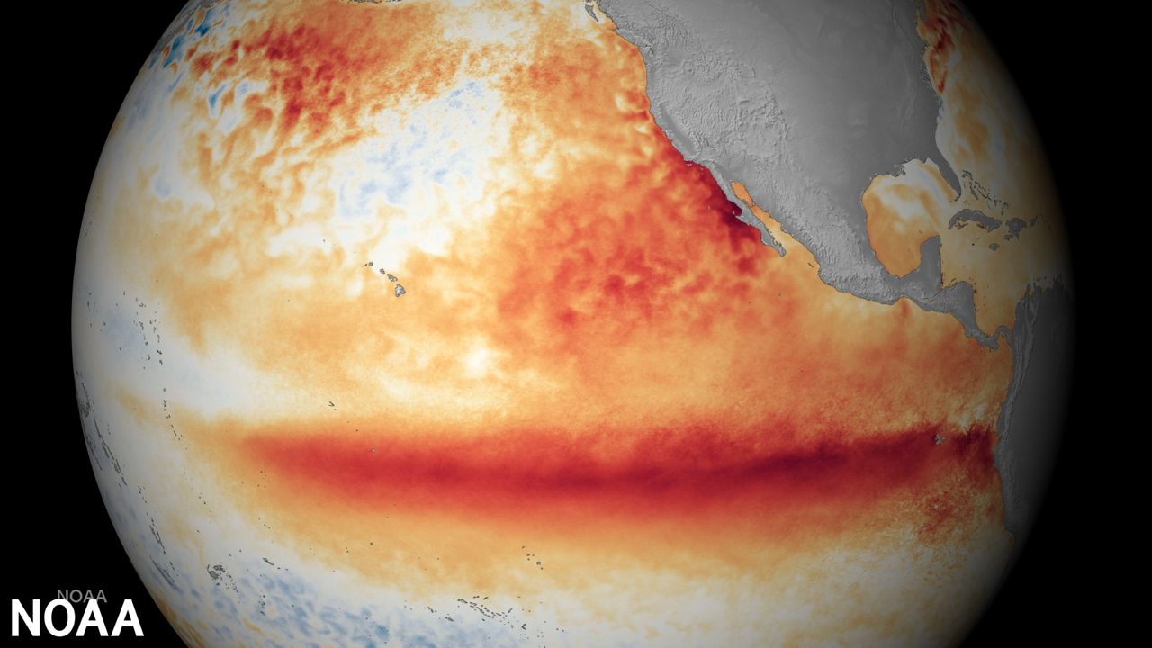
Well, it's official. The National Oceanic and Atmospheric Administration (NOAA) has declared the arrival of El Niño, an event that typically appears every two to seven years.
Recent data shows that El Niño is already present and will likely strengthen well into winter. The likelihood of a strong El Niño is greater than 50%.
Many relate El Niño to reduced hurricane activity in the Atlantic; however, it has some noticeable effects on Wisconsin's weather, especially during the winter months.
In an El Niño season, water near the equator in the central and eastern Pacific turn warmer-than-average for several months. Depending on the strength, many will likely see a sizeable shift in the weather patterns.
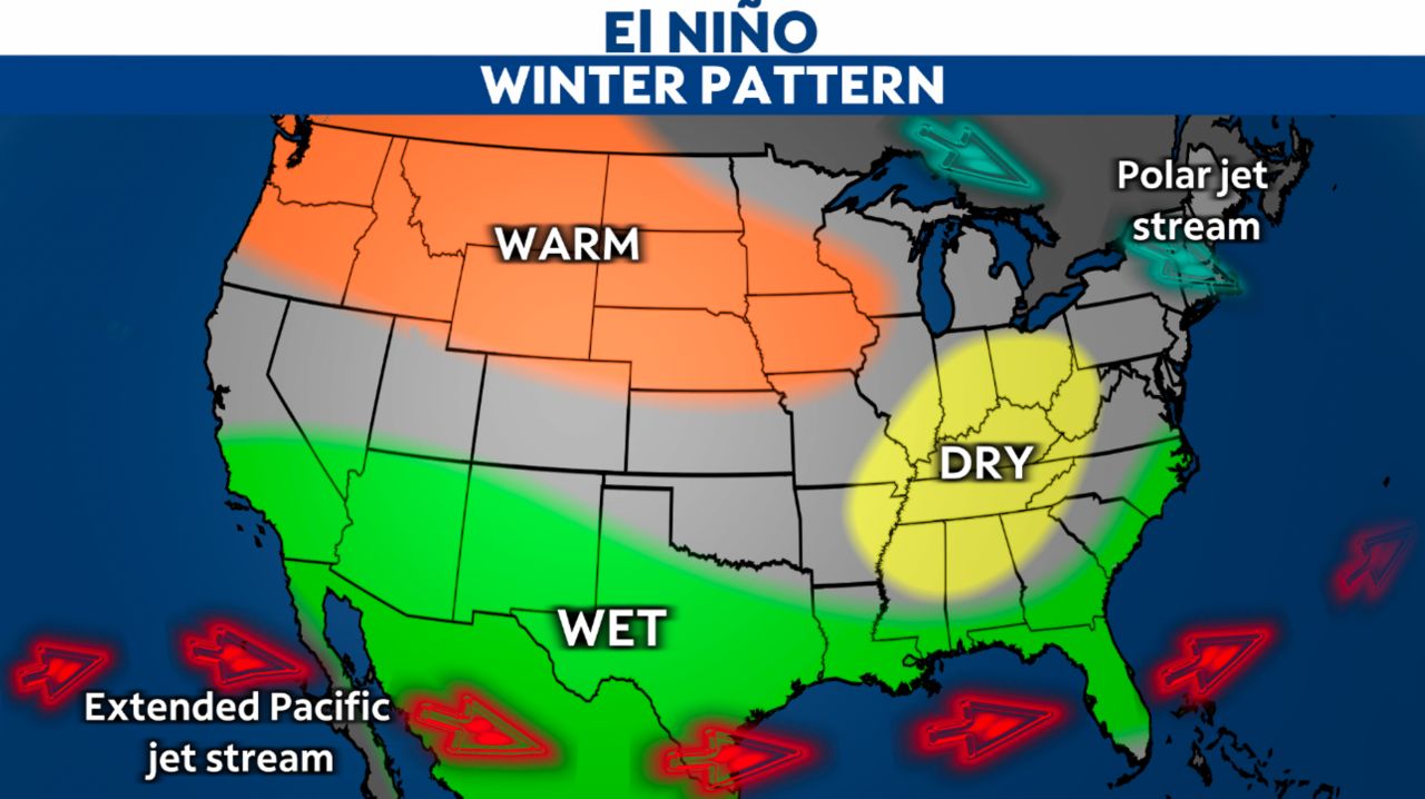
El Niño causes the polar jet stream, which brings in several Arctic intrusions during the winter months, to shift farther north. The northern shift keeps temperatures above normal for much of fall and winter.
Temperatures during a strong El Niño may run about 6 degrees warmer than the typical average.
With the warmer air spreading across the upper Midwest, it also means less snow. A few-degrees bump in temperatures could mean the difference between rain versus snow.
Many may like that news, but several people rely on snowfall for their businesses and well-being. During an El Niño year, precipitation totals will be near or below normal for much of the upper Midwest from late December to March.
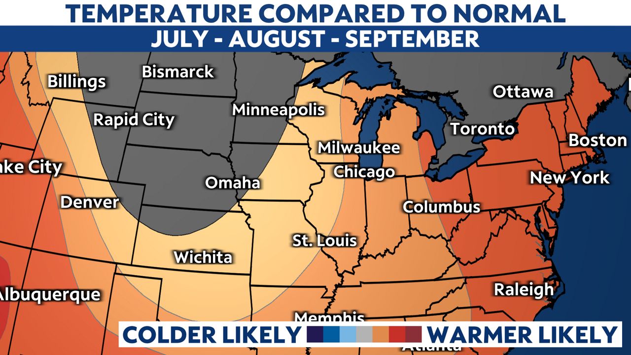
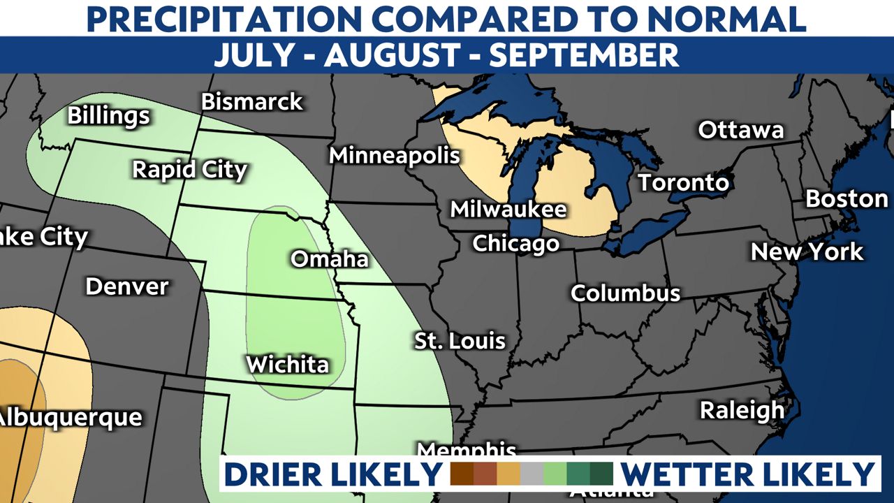
Even though the peak may not arrive until winter, we may already be feeling the effects of El Niño. Heading into fall, temperatures will likely trend above normal with rainfall totals dipping below typical values for the three-month span.
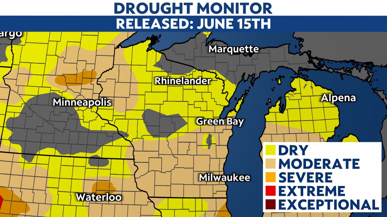
That's not good news. We are already suffering from a drought that will likely expand and worsen as we move into fall and winter.
Diving into the past, the most recent strong El Niño years were 1957-1958, 1965-1966, 1972-1973 and 2009-2010, with the strongest periods happening in 1982-1983 and 1997-1998.
Our team of meteorologists dives deep into the science of weather and breaks down timely weather data and information. To view more weather and climate stories, check out our weather blogs section.