

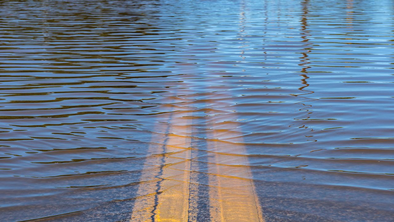
Flooding can happen anywhere at anytime. You never want to underestimate the power of water.
According to the National Weather Service (NWS), "flooding is one of the most frequently occurring natural disasters in Wisconsin and is one of the top causes of weather related fatalities across the U.S."
Unfortunately, this may be a bad year for flooding in portions of the state. All signs lead to a near or above normal risk this upcoming spring season.
Several environmental factors play a pivotal role in deciding the potential risk of flooding. Each local NWS office examines the current snowpack, soil moisture, frost depth, ice levels and current river stages along with the possibility of more precipitation in the forecast.
For now, the greatest risk for flooding will sit along the main stem of the Mississippi River and for portions of the Wisconsin River Basin in southwest Wisconsin.
A thick layer of snow still covers the ground in portions of western and northern Wisconsin. Once the snow melts, all runoff will head downstream to one of the main basins.
Elsewhere, the threat is much lower because of the lower-than-normal snowpack this winter season. With that being said, a typical snowmelt should be manageable. However, a rapid snowmelt or an intense period of rain will exacerbate the overall threat of possible flooding.
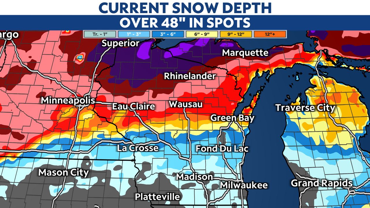
In some respects, we got a little help from Mother Nature. The well-above average temperatures in January and February kept the frost depth much shallower than normal. Typical frost depth is 30 to 50 inches. This year, we ran at 10 to 25 inches.
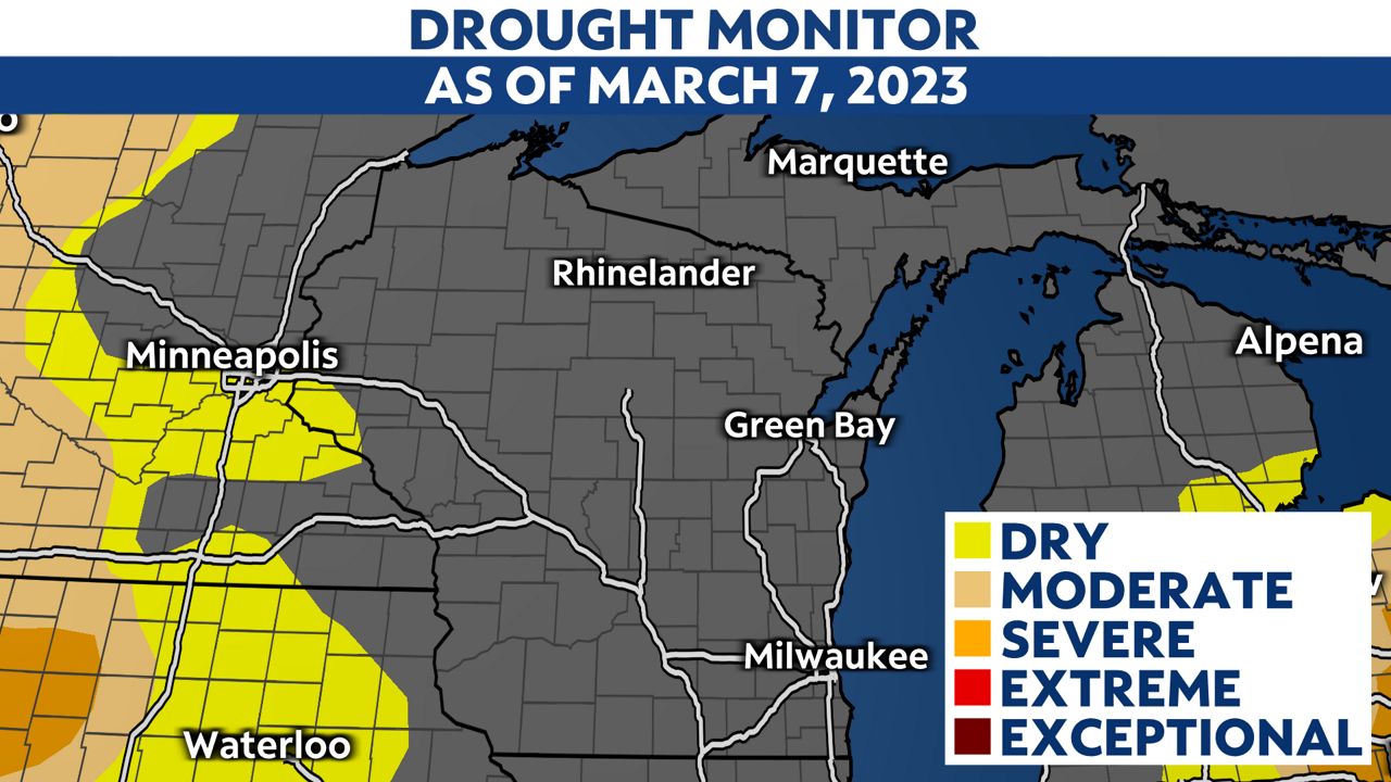
As for soil moisture, most of the state is near normal but elevated slightly in southwestern portions of the state. Because of the saturated soil, areas west of Madison could see an increased threat of flooding.
Much of eastern Wisconsin should be fine once the ground thaws. Absorption of snowmelt and the spring rain should be typical and not slower than usual.
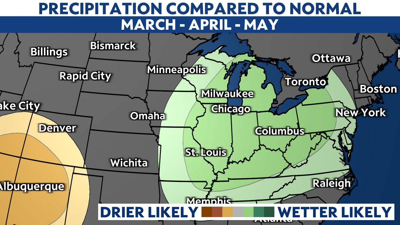
Unfortunately, spring looks wetter than normal. The Climate Prediction Center (CPC) outlook has placed much of Wisconsin under higher than average chances for rain during March, April and May.
The short-term forecast calls for several opportunities for additional snow and rain. If we get significant amounts in a brief window, the risk of flooding will increase.
Have a severe weather plan this season that includes preparations for flooding. Plan for the possibility before it happens.
If you're not sure how, this week is Flood Safety Awareness Week in Wisconsin. The NWS has a complete list of tools and information to keep you safe.
Our team of meteorologists dives deep into the science of weather and breaks down timely weather data and information. To view more weather and climate stories, check out our weather blogs section.