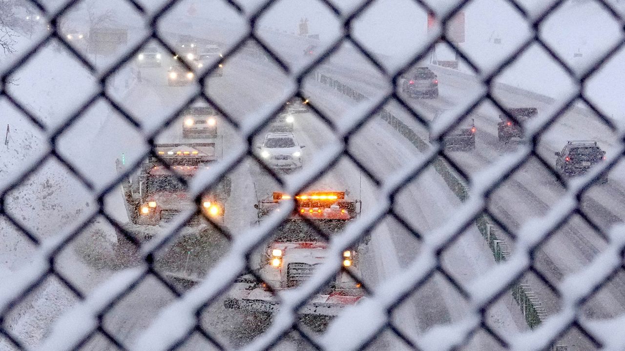
Another round of mixed precipitation continues through Monday. Depending on where you live, the impacts will vary from one corner of the state to the other.
Several winter alerts have been issued for the state until Monday night.
Toward midday Monday, this current weather system pushes farther northeast. Rain slides farther north into portions of central Wisconsin.
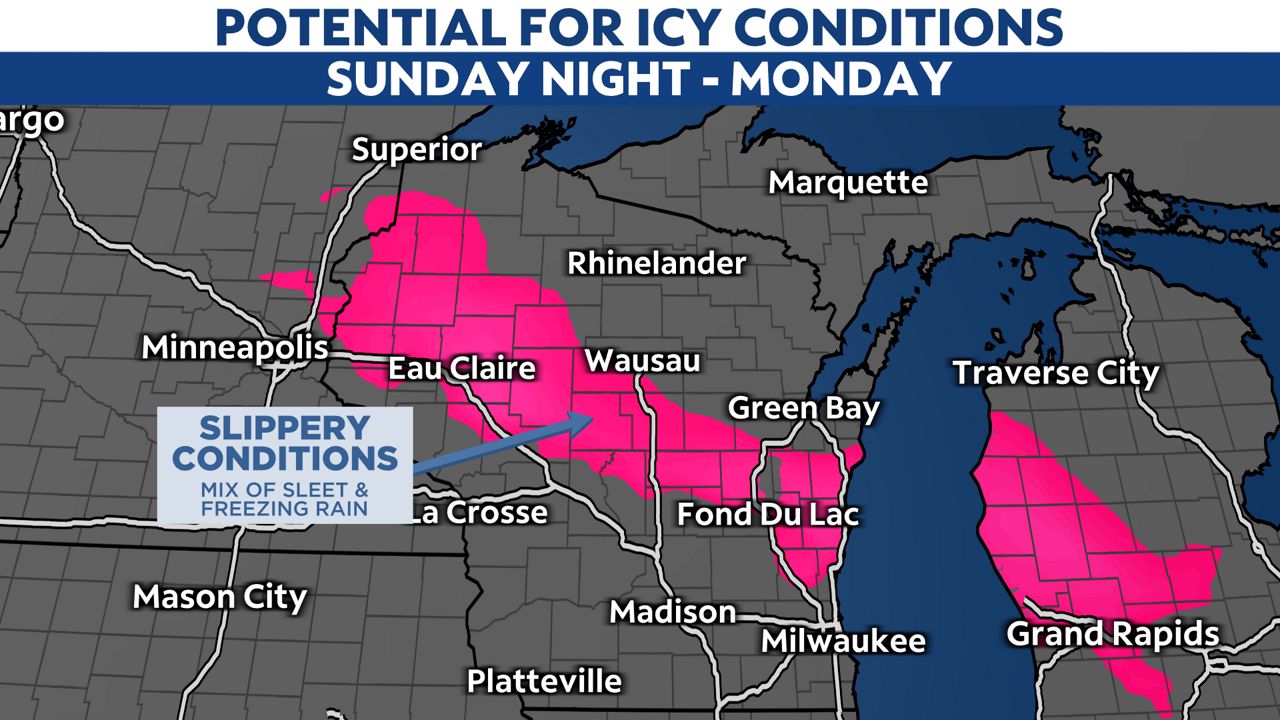
Areas north of the Fox Valley will probably get a mixture of freezing rain, sleet and snow. Portions of extreme northern Wisconsin will gradually transition to snow.
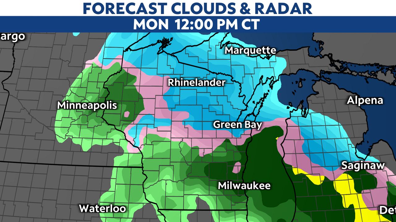
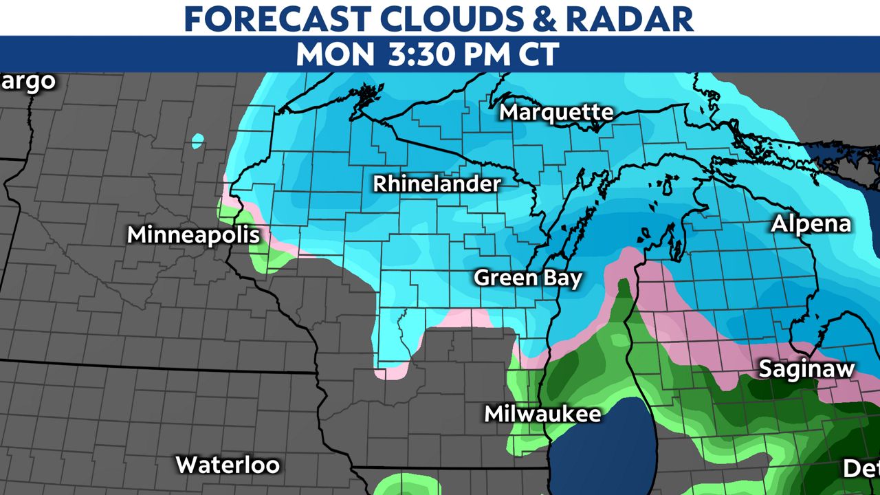
By mid to late afternoon, most will turn to snow. Further south and near Milwaukee, the threat still remains additional rain.
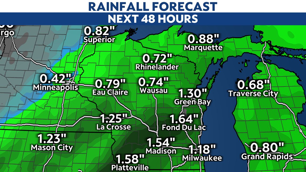
For Madison and Milwaukee, the threat will be heavy rain and localized flooding. On average, most will surpass an inch of rain.
Make sure to clean your storm drains as the risk of street flooding will climb with the heavy rain and melting.
For central Wisconsin, the concern will be icy roads because of freezing rain and sleet. A few inches of sleet may be possible along with a nice glaze of ice.
Scattered power outages may be possible because of the weight of the ice on tree limbs and power lines. A strong wind will exacerbate the risk.
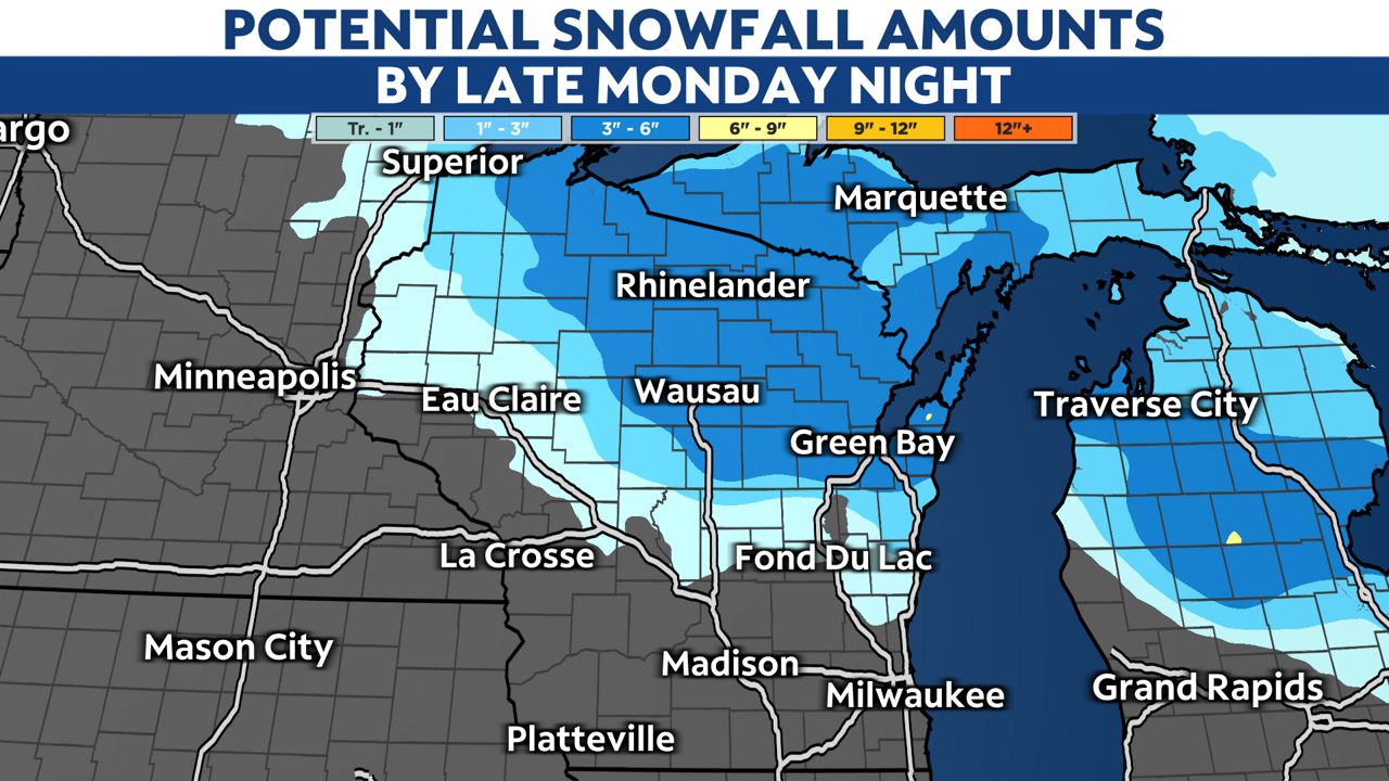
For areas mainly northwest of Green Bay, the hazard will be a healthy heaping of wet snow. In general, most will pick up 3-6 inches of snow.
However, a few isolated spots may exceed that range near the Upper Peninsula.
Our team of meteorologists dives deep into the science of weather and breaks down timely weather data and information. To view more weather and climate stories, check out our weather blogs section.


