


After a warm and sunny start to November, Mother Nature brings some changes to our weather for the first weekend of November.
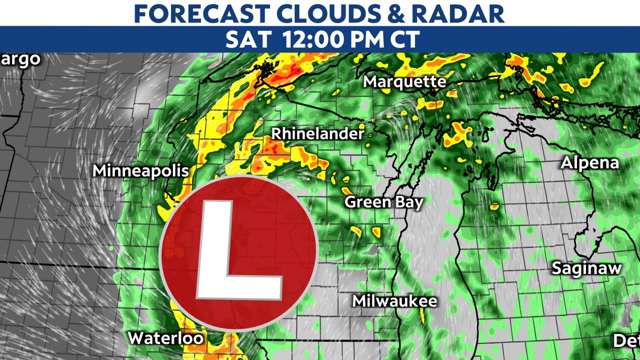
A system continues to push showers and storms through the Badger State on Saturday. The best chance for severe weather will be through early Saturday afternoon.
The threat still remains low for tornadoes. However, there is still a chance for a few weak tornadoes to develop ahead of the advancing cold front.
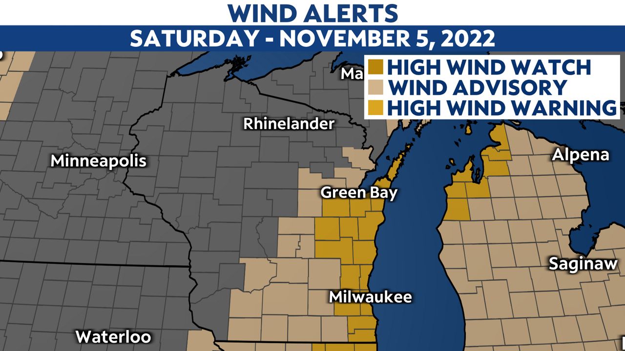
The bigger story will be the wind. For those in eastern Wisconsin, several weather alerts are in effect through Saturday night due to sustained winds between 20 to 30 mph and wind gusts up to 60 mph.
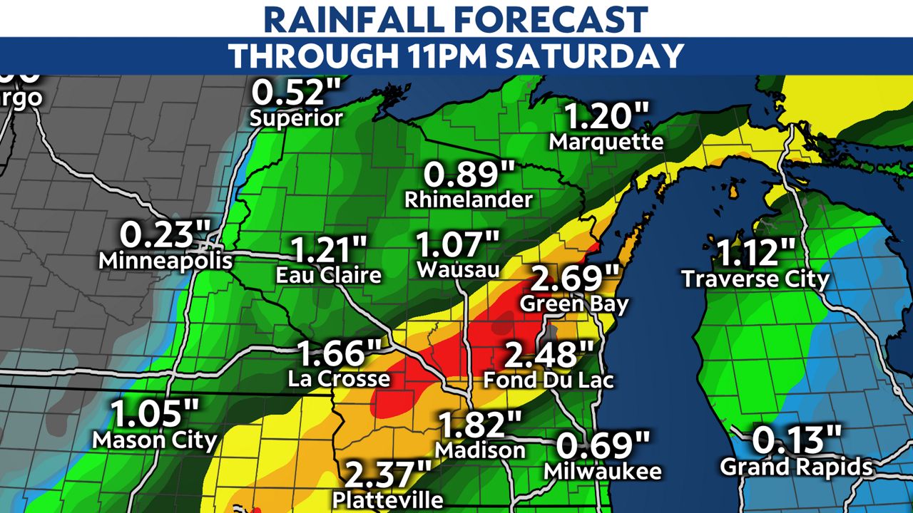
When all is said and done, those in southwestern, central and northeastern Wisconsin could see some impressive rain totals reaching over 3 inches.
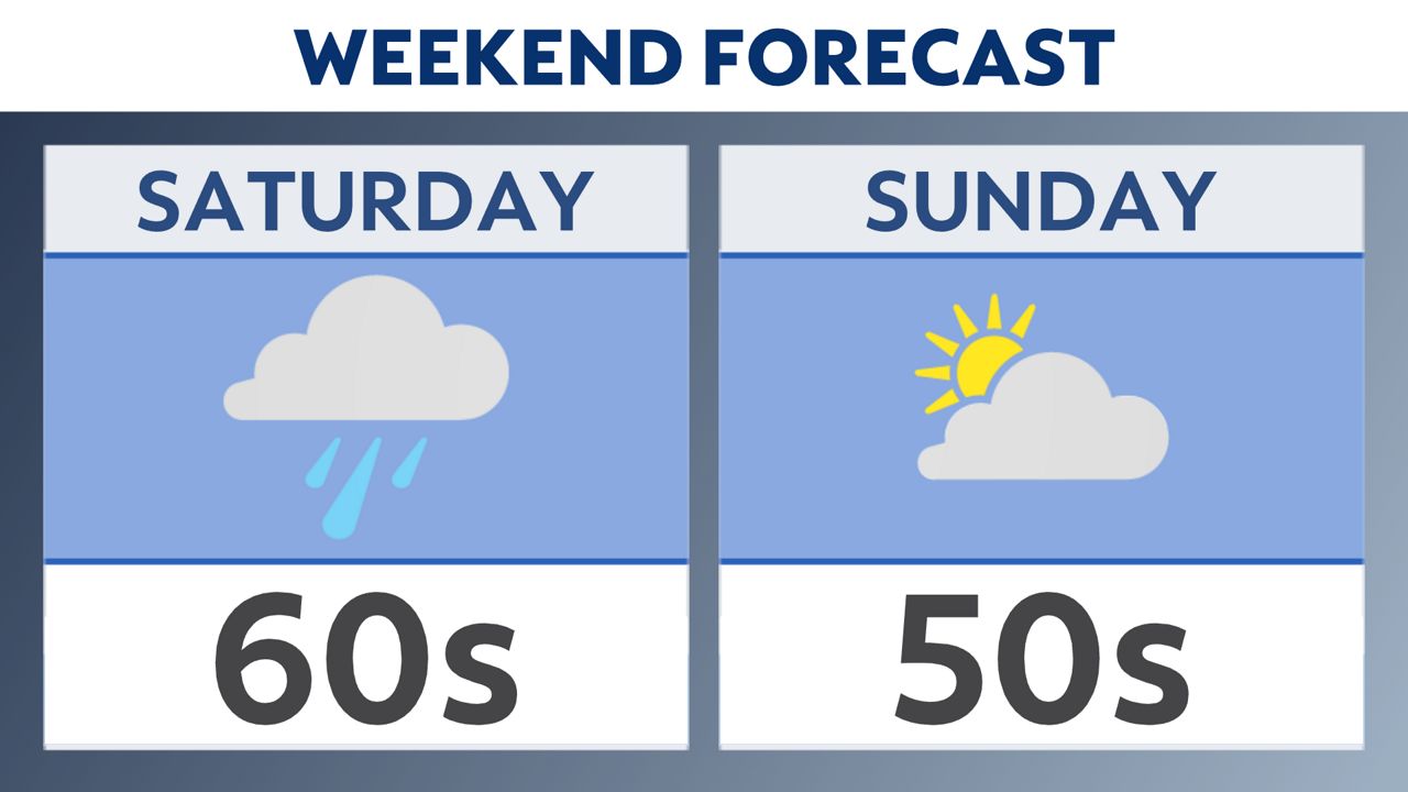
Fortunately, your weekend won’t be a total washout, as sunshine returns on Sunday. However, cooler temperatures are going to stick around through the start of next week.

You can now get weather push alerts through your Spectrum News app. These alerts allow you to get advanced notice of various weather conditions in and around your location.
Also, download our app to get up-to-date information on traffic and road conditions, along with potential closures.
Stay alert and weather-aware. Your "Weather On The 1s" team will continue to bring you the latest weather updates on-air and online.
Check your local forecast | Send us your weather photos
Follow the "Weather On the 1s" Team on social media for the latest weather updates:
Chief Meteorologist JD Rudd: Facebook | Twitter
Meteorologist Kristin Ketchell: Facebook | Twitter | Instagram
Meteorologist Brooke Brighton: Facebook | Twitter | Instagram