


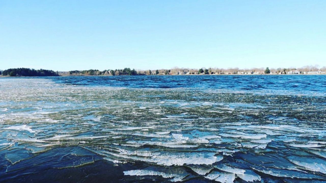
So far, the month of December has been very active across the state. We've had numerous rounds of wintry weather, mainly for northern Wisconsin.
However, the pattern is changing, and now southern Wisconsin is getting its shot at some measurable snow. Madison and Milwaukee officially recorded their first inch of snow this week.
So what is happening for the rest of winter? Is January looking better or worse? Will this winter stretch into May?
We'll look at what the Climate Prediction Center (CPC) predicts for the upcoming winter season.
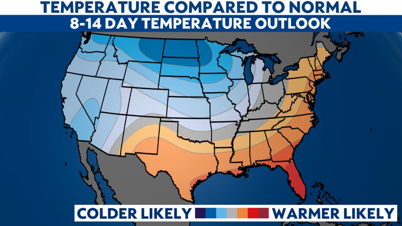
The short-term forecast for early January looks slightly cooler than average for the next 8-14 days. Our long-range guidance agrees on a couple of Arctic cold fronts plunging into the upper Midwest in the coming weeks.
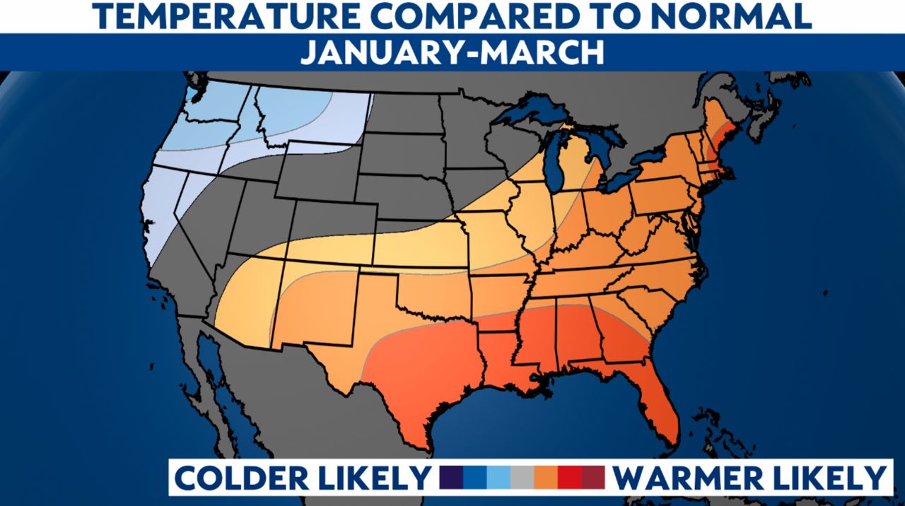
However, the pattern for January, February and March favors an above-normal seasonal mean for temperatures.
The recent ENSO forecast indicates that La Niña conditions will likely persist through the winter and early spring. That means the influence of La Niña will continue to play a major role in the temperature and precipitation outlook for the next three months.
In La Niña years, the Midwest and specifically Wisconsin usually reside in a warmer than average temperature regime.
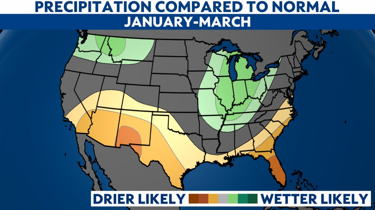
Also, in La Niña years, much of the Great Lakes regions sits under a wetter than usual pattern. That could mean several rounds of snow in the coming months. I guess we'll have to wait and see. Bring on 2022!