We'll continue to see a chance for strong and severe storms to move through Wisconsin for the rest of your workweek.
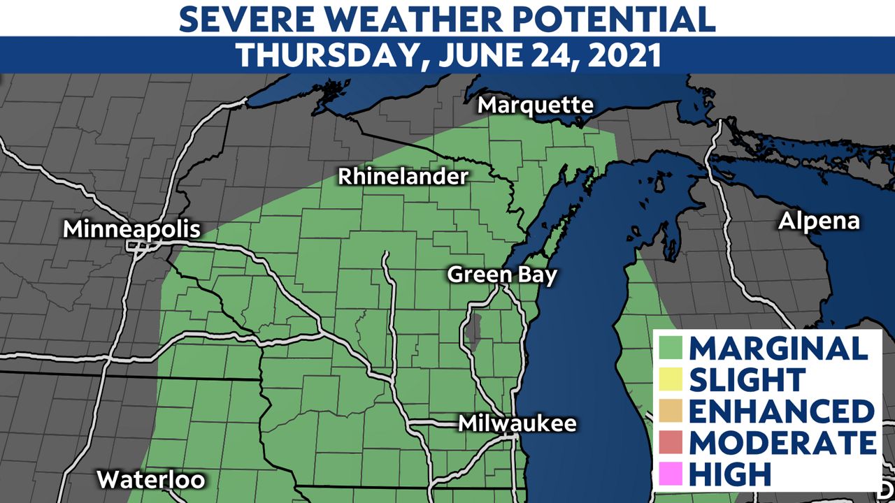
Updated at 3 p.m. Thursday, Wisconsin is now all under a marginal risk for severe weather (1 out of 5 on our severe weather scale). Areas that were under a slight risk earlier were downgraded due to cloudiness and precipitation earlier in the day.
The main threats with these storms still are large hail and damaging winds.
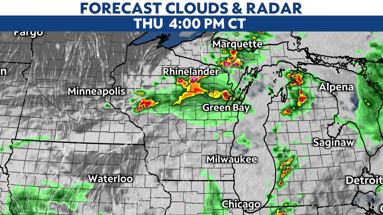
Storms will continue to move through Wisconsin through about midnight. The northern half of the state will see the best chance for stronger storms to move through later Thursday afternoon.
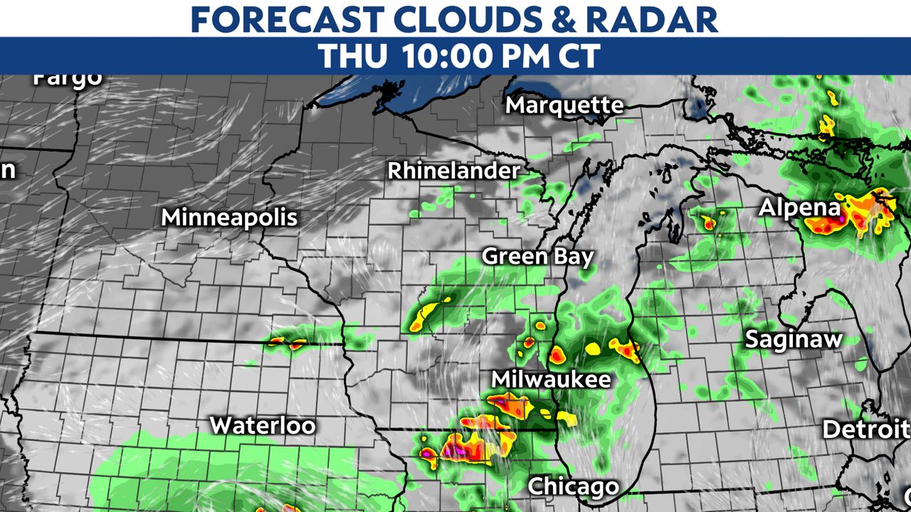
Southern parts of the state will have a better chance to see storms start in the evening and continue through about midnight. All of this will clear our as we head into Friday morning.
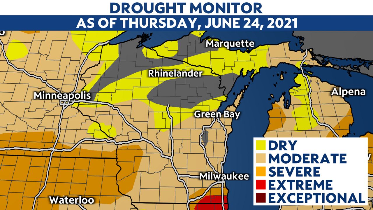
There is some good news with these storms moving through the Badger State.
Seeing as we are still in a moderate to extreme drought across Wisconsin, we should welcome this additional rain. We expect these storms to bring 1-2 inches to much of the state by Friday night.

You can now get severe weather push alerts through your Spectrum News app. These alerts allow you to get advanced notice of various weather conditions in and around your location.
Check your local forecast | Send us your weather photos
Follow the "Weather On the 1s" Team on social media for the latest weather updates:
Chief Meteorologist JD Rudd: Facebook | Twitter
Meteorologist Kristin Ketchell: Facebook | Twitter | Instagram
Meteorologist Brooke Brighton: Facebook | Twitter | Instagram


