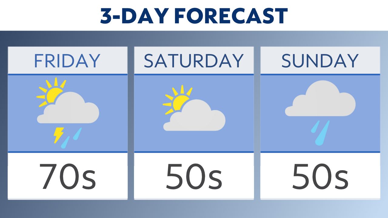
We should be able to squeeze out most of our Easter weekend without rain destroying our plans. However, a few showers could sneak in from the south late Sunday.
What You Need To Know
- Widespread sun on Saturday
- Rain returns late on Easter
- Cooler than normal highs
Temperatures will drop a few degrees heading into Saturday. Expect many with highs in the 50s. Likewise, Sunday will be on the cooler side with daytime highs in the 40s and lower 50s.
Saturday will be breezy and sunny with no hazards. Come Sunday, showers return from the southwest with our next big system. Most of the rain should be held back until Sunday afternoon and evening. All morning activities should be good to go!
Cooler air settles in early Saturday with most of the holiday weekend looking dry until late Easter Sunday.
Remember that you can always share your weather photos with us for your chance to be featured on-air.

Follow the "Weather On the 1s" Team on social media for the latest weather updates:
Meteorologist Brooke Brighton: Facebook | Twitter | Instagram l Threads l Bluesky
Meteorologist Jesse Gunkel: Facebook | Twitter
Meteorologist Kristin Ketchell: Facebook | Twitter | Instagram


