


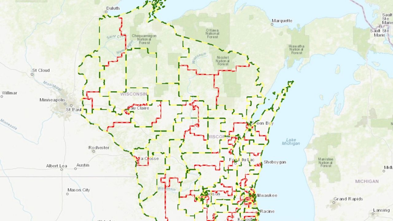
MADISON, Wis. — With 2020 data from the U.S. Census released Thursday afternoon, Wisconsin can now begin the process of drawing new boundaries for legislative and congressional districts.
However, lawmakers will be up against the clock. The timeline for drawing new maps could get pretty chaotic. Census numbers were supposed to be released back in April but were delayed due to COVID-19 and the previous Trump administration.
UW-Madison Political Science Prof. Barry Burden answers some common questions when it comes to the redistricting process in Wisconsin.
Republicans will once again be in charge of drawing new maps in Wisconsin, but unlike in 2011, there is a Democrat in the governor's office who will need to agree with the proposed boundaries. The circumstances tee up a possible veto and subsequent legal battle, which could drag on for months.
Wisconsin's slight population gain isn't enough to pick up another seat in Congress, so there will still be eight districts. However, on top of drawing those boundaries, lawmakers will need to come up with maps for 99 Assembly seats and 33 Senate seats.
“The state is required to draw new congressional district lines, and new lines for the state Assembly and the state Senate, using the data that are coming from the U.S. Census Bureau, but this time around that process is going to be driven by a Republican-led Legislature and a Democratic governor,” Burden said. “They are not likely to see eye-to-eye on almost any aspect of this process. They've been at one another for the last year and a half since Tony Evers was elected, and this one of the most partisan things the Legislature undertakes.”
The short answer: yes. Burden believes a stalemate between the Republican-led Legislature and Gov. Evers could ultimately end with the courts drawing the maps.
“Republicans are hoping to get the cases settled by the Wisconsin Supreme Court, where they think they have a conservative majority that will be friendlier to their goals,” Burden said. “Democrats, I think would prefer probably to be in federal court.”
The Wisconsin Supreme Court has already rejected a request by Republicans to take any redistricting-related lawsuits directly, which means any litigation will have to go through the circuit court process.
Burden said, unfortunately, some of the “guardrails” that had been in place a decade ago no longer exist.
In recent years, there was a U.S. Supreme Court case from Wisconsin in which Democrats alleged they were discriminated against by Republicans who had drawn the boundaries of the 99 Assembly districts. That argument was rejected with the court deciding that the federal government has no role to play when it comes to keeping one party from trying to harm another party.
“This is likely to be an even more partisan process than in the past,” Burden said. “Even the limits that are in place for protecting racial minorities groups, under the Voting Rights Act, those have also been weakened by some recent Supreme Court cases, so it's really only divided government in Wisconsin that's going to keep this from being an entirely partisan process because Gov. Evers has the power of the veto.”
Again, the quick answer here: yes. Just as likely as competing lawsuits are, is the chance for competing maps.
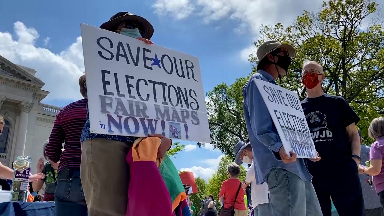
Gov. Evers created an advisory committee of citizens, called the People's Maps Commission, to draw new boundaries in a non-partisan way, but the Legislature is under no obligation to use them.
However, Burden said those maps could be referenced in future court proceedings.
“I think they're hoping that these maps, that are created through a non-partisan process, demonstrate that it's possible, and demonstrate a fairer way that maps may be drawn than when partisan elected officials are doing it for themselves,” Burden said. “So if nothing else, I think it is at least part of the material that will be considered in some of these legal cases.”
Both the Republican-controlled Legislature and the People's Maps Commission called for Wisconsinites to share their input Thursday after the census data was released.
“I’m glad the Biden Administration has finally gotten the data to us after dragging their feet for months,” Assembly Speaker Robin Vos (R-Rochester) said in a statement. “Soon we will begin the robust map-drawing process and I’m confident we will draw a map that the governor will sign.”
Christopher Ford, who is the chair of the People's Maps Commission, said nearly 800 submissions have been received so far, in addition to more than 1,000 Wisconsinites who provided input during the Commission’s hearings this past spring.
“The Commission is eager to begin the final phase of its work, and will work quickly to analyze the updated census data alongside the public input it has received from all over Wisconsin,” Ford said.
Given the slight population changes, Republicans are likely to advocate for limited changes to legislative districts. However, Democrats have argued the current maps are gerrymandered and unfair.
“It's often the case that new districts often end up looking a lot like the old ones,” Burden said. “There's a lot of inertia in the process and there are incumbents who are trying to protect their districts. They are involved in the drawing of the district lines, so they naturally would like to keep the borders somewhat similar from one election cycle to the next, but the truth is the population has moved. It has expanded, and in some parts of the state it has grown faster than in others.”
All of the districts need to have a relatively equal population, but partisan map makers do have a lot of options to manipulate the outcomes, according to Burden.
Maps will need to be in place by late spring, by Burden's estimation, so districts are ready for the August primaries leading into the fall of 2022. The deadline is even sooner for local and municipal boundaries, which also must be redrawn.
“Republicans would like the maps to be in place for one more election cycle if the process wasn't done in time for 2022, it wouldn't be a bad thing from their point of view because the current maps are drawn in a way that favor Republicans and the new maps are likely to be more balanced because you've got a Democratic governor and courts being involved,” Burden said.
Burden said it is possible a court decides to keep the current old maps in place for another year because there isn't enough time to resolve disputes before candidates need to file to run for office, which has happened in other states.