Hurricane Helene was a massive, major hurricane as the storm made landfall overnight in Florida as a Category 4 hurricane.
Now, the remnants of Helene will impact the Ohio valley through Friday with high winds and wet weather.
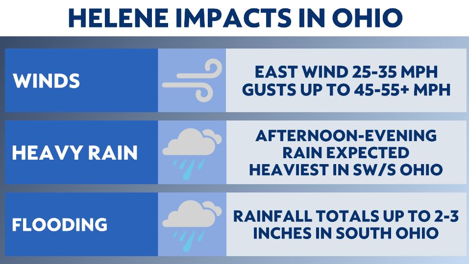
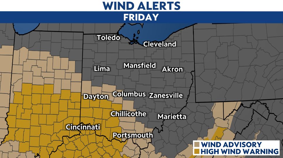
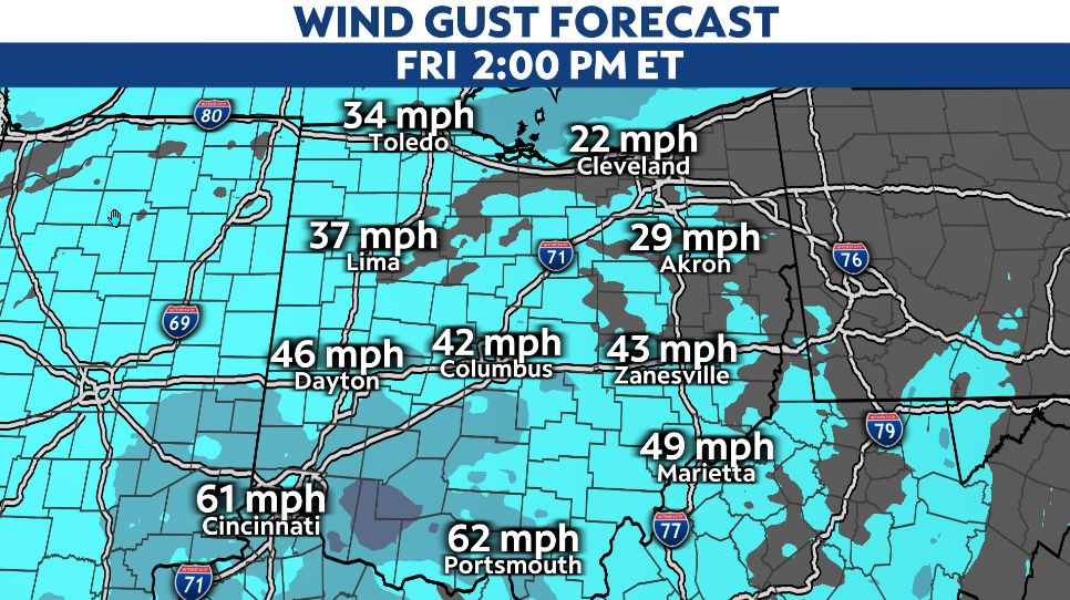
High winds are our main concern especially, in central and southern Ohio. There's wind alerts in place from noon today through 10 p.m. tonight. High wind warnings will be in place in southwest Ohio, where peak wind gusts could be over 50 to 60 mph.
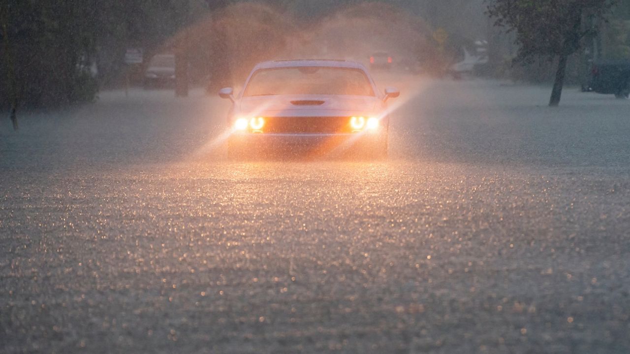
In addition to wind, there's wet weather.
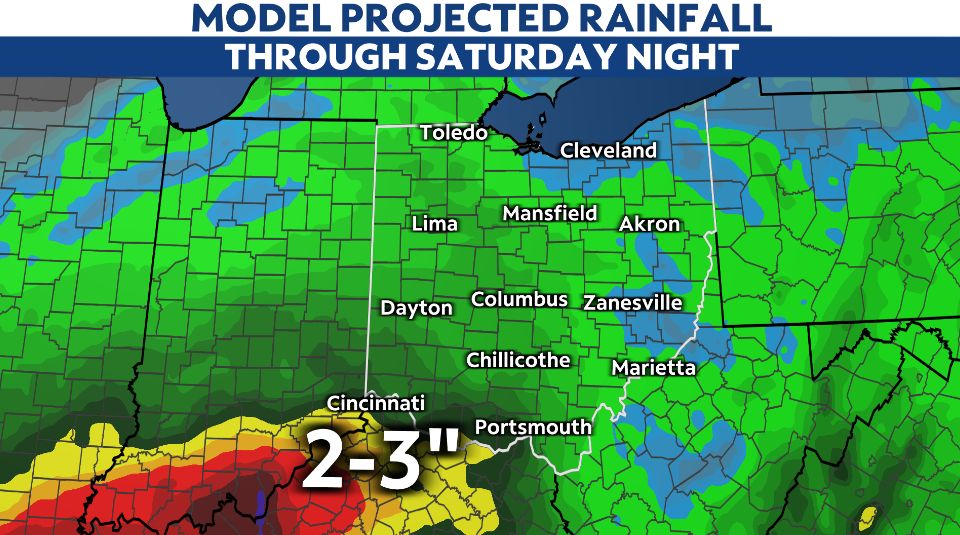
A wave of widespread rain that will be steady/heavy at times is expected. This would bring flooding concerns in southern/SW Ohio. Locally totals up to 2-3 inches for areas along the Ohio river through tonight.
Showers become scattered by this evening as showers continue to move north into northern Ohio later today.
On/off showers through the rest of the weekend, but winds will calm down by Friday night
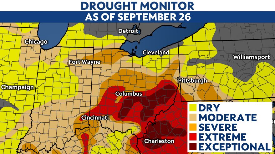
Latest drought concerns through the Ohio valley will improve after this beneficial rain. Below is the latest update — there's extreme drought now in most of the southern half of the state.