


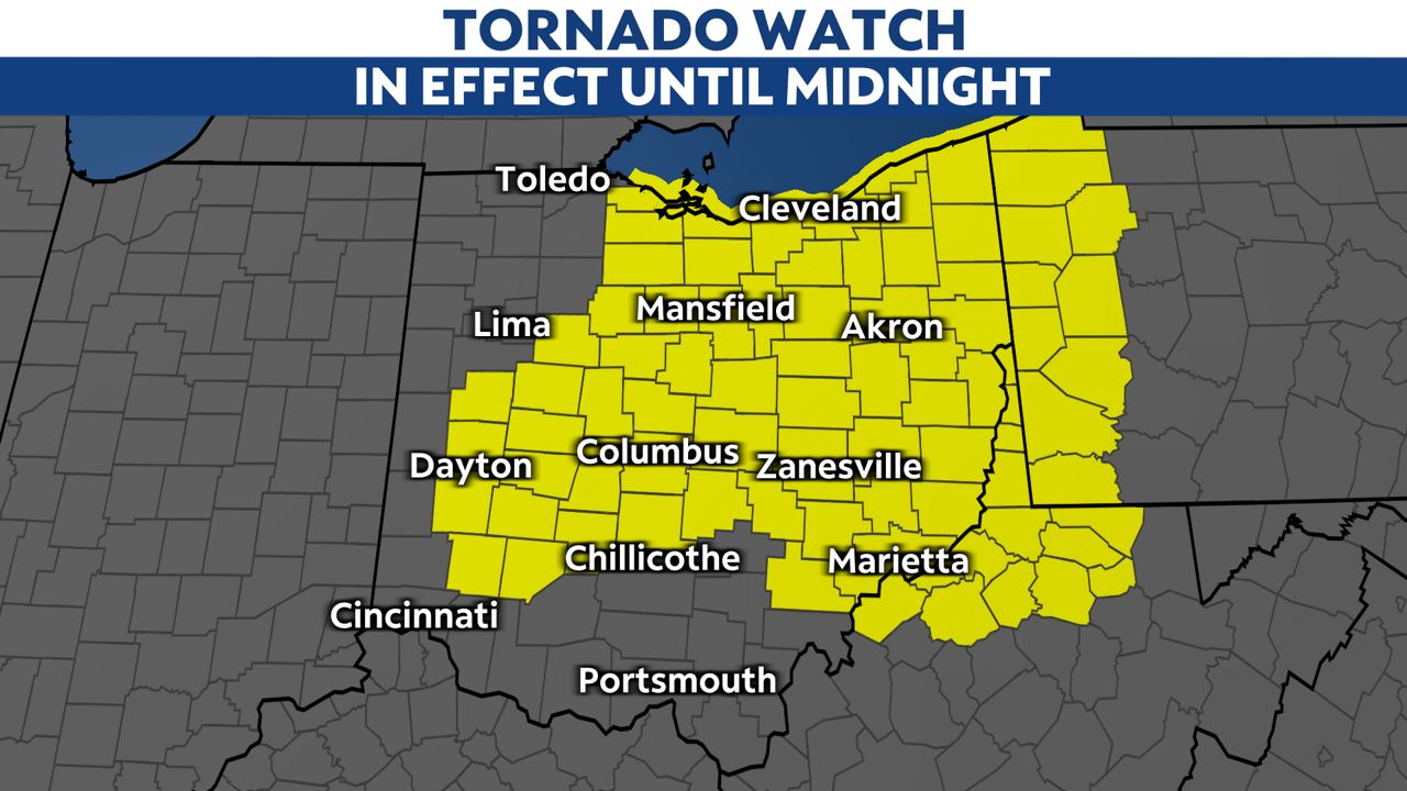
Severe weather storms are moving across the state this afternoon, and a tornado watch is in effect for much of the state.
A tornado watch means conditions have become favorable for severe thunderstorms that could include the development of tornadoes. Those in and around the watch area should remain alert to changing weather conditions and prepare to seek shelter in the event a warning is issued.The threat for severe storms will spread eastward through the day with additional severe weather watches likely.
The threat for severe weather should end by late evening.
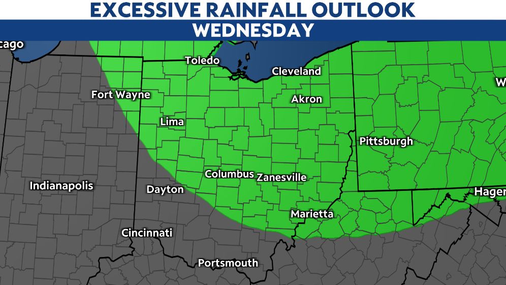
The line of storms is expected to push eastward during the evening hours and quickly exit into Pennsylvania and West Virginia into Wednesday night.
The best chance for severe storms will be in northern and central Ohio.
As is often the case with severe thunderstorms, all modes of severe weather are possible. However, the primary threats will be damaging wind gusts in excess of 60 mph and hail of 1 inch in diameter or larger. A quick spin up tornado cannot be completely ruled out either.
Another concern will be torrential rain. Thunderstorms may bring an inch or two of rain in a very short period, leading to a brief localized flash flooding threat.
Be sure to check back here for more updates, and don't forget to download the Spectrum News App for the latest forecast and radar data.