


We are wrapping up October and heading into a month when the possibility of snowflakes quickly ramps up.
Of course, there have been times we’ve had snow on the ground well before Halloween, but that is highly unusual.
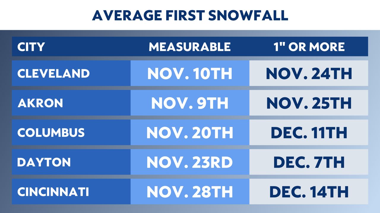
In the southern half of the state, the first snowflakes can vary from year to year. In Columbus, the average first measurable snow is around Nov. 20 with the first inch, not until mid-December.
But there have been several years where Columbus and Cincinnati haven’t gotten any significant snowfall (an inch or more) until well into January.
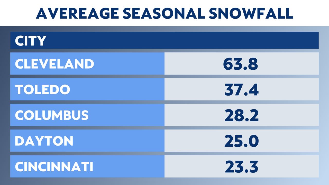
As far as the average snowfall per season, you might think that Cleveland would typically get the most of the bigger cities in Ohio. But it is Youngstown that is the winner, averaging nearly 70 inches per year with Cleveland averaging around 65 inches.
Of course, that doesn’t include the snow belt where average snow amounts can top over 100 inches in a year.
You would expect as you head farther south, the average seasonal snowfall would drop off. Columbus averages just under 30 inches of snow in a winter season, with Cincinnati and Dayton typically picking up between 20 to 30 inches in an average year.
This winter, El Niño is expected to play a big role in the weather pattern across North America. For Ohio, that typically means a warmer and drier winter than average.
However, it doesn’t mean we will escape the harshness winter can bring. A lot will depend on variables that are not yet known. One of those will be the amount of snow cover that builds up in Canada, which can affect how severe the cold air is when it moves into Ohio.
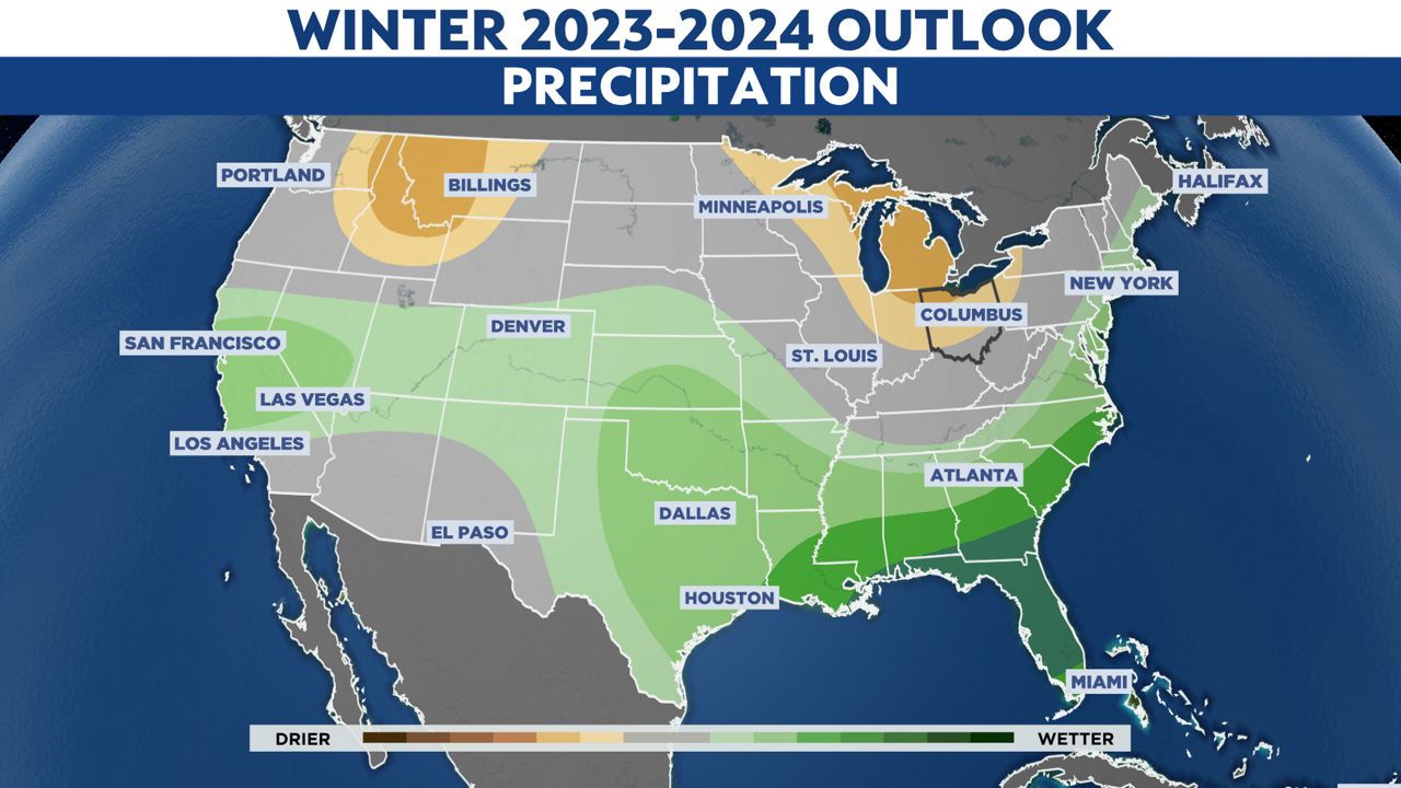
We also monitor sea surface temperatures in the Pacific Ocean, which can affect the jet stream pattern. Of course, we also have to monitor more complicated weather patterns such as the Arctic Oscillation and how the polar vortex reacts over the winter.
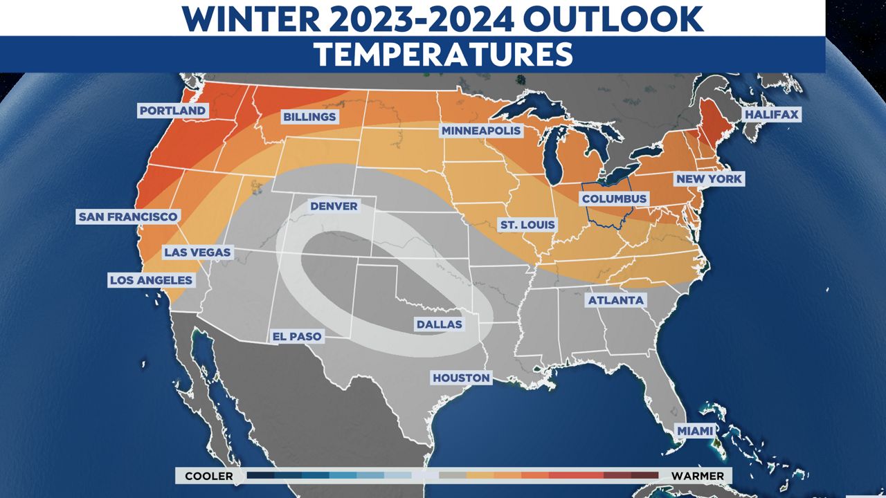
Other than a couple of years in the last decade, winters in Ohio have been averaging warmer and with less than average snowfall. With a strong El Niño expected, it is likely that trend will continue this winter.
Our team of meteorologists dives deep into the science of weather and breaks down timely weather data and information. To view more weather and climate stories, check out our weather blogs section.