


Don’t blink now, but we are over halfway through summer. Since school is starting for many kids, it seems summer is already over.
For the Ohio Valley, it has been somewhat of an unusual season, with numerous rounds of showers and storms. We typically see calmer weather set up by late July into August, but not this year.
Severe weather has also lasted longer into the season, with tornadoes reported as recently as Aug. 14 in Ohio. Our typical severe weather season in Ohio is usually from April through early July, although we’ve had tornadoes reported in every month.
The state typically averages around 19 tornadoes annually, but we’ve already had over 40 reported so far in 2023.
The active weather in our region has allowed Ohio to escape what has been an incredibly hot summer for most of the country. Record heat has baked the Southwest all the way to the Gulf Coast.
Florida recently experienced a heat index nearing 120 degrees, reached all-time records and some had their first-ever Excessive Heat Warnings.
July was the hottest month on record for our planet, according to scientists from NOAA and NASA. The records go all the way back nearly 150 years.
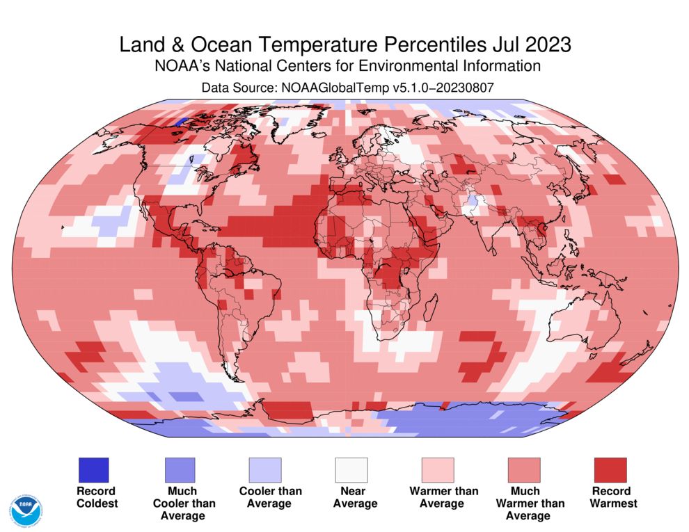
But Ohio has had no record high temperatures so far this summer. In late May, it appeared Ohio may be on track for a hot summer, as temperatures soared and drought conditions quickly developed. But by mid-June, rain returned, ending the drought conditions for most of the state.
The stormy weather also kept temperatures near or below normal for most of the summer days so far.
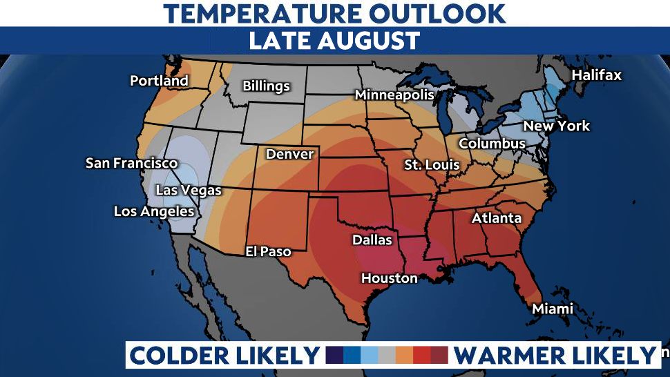
But don’t write off summer just yet. The latest forecasts heading into the third week of August show a return to more typical summer heat in Ohio. High temperatures are forecast to reach the 90s in many areas around the 20th or 21st of the month.
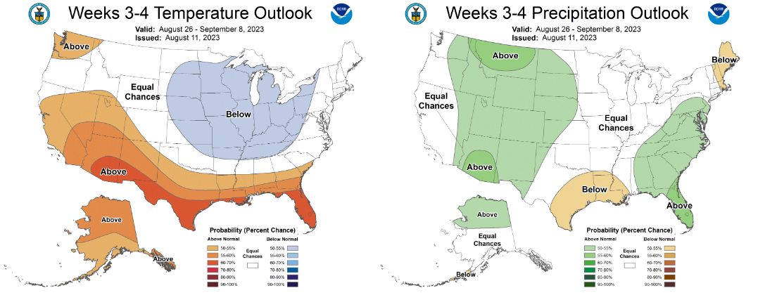
However, long-range outlooks show temperatures in the Ohio Valley once again sliding back down to near normal by the end of the month, where they will likely stay into the start of September.
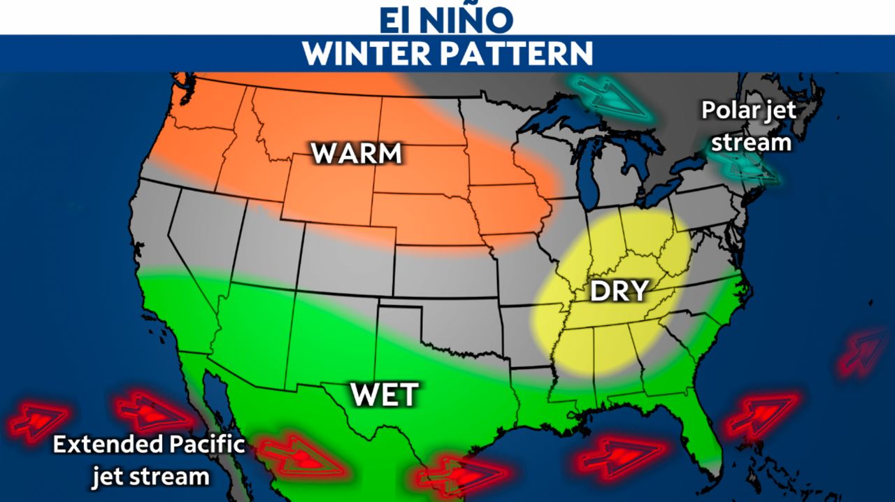
Could this be a sign of things to come this fall and winter? I wouldn’t count on it. The pattern known as El Niño developed earlier this year and is forecast to last through the upcoming winter.
El Niño is a climate pattern that describes the unusual warming of surface waters in the eastern tropical Pacific Ocean. El Niño's warmer waters tend to push the Pacific jet stream south. When that happens, areas in the northern U.S. and Canada, including Ohio, are drier and warmer than usual. But in the U.S. Gulf Coast and Southeast, these periods are wetter than usual and have increased flooding.
So, while we may not have experienced many very hot days this summer–so far–the record warmth could be looming over the coming winter. Stay tuned!
Our team of meteorologists dives deep into the science of weather and breaks down timely weather data and information. To view more weather and climate stories, check out our weather blogs section.